Tag Archives: Landscape

My (Second) Top Five of 2014: The Beach

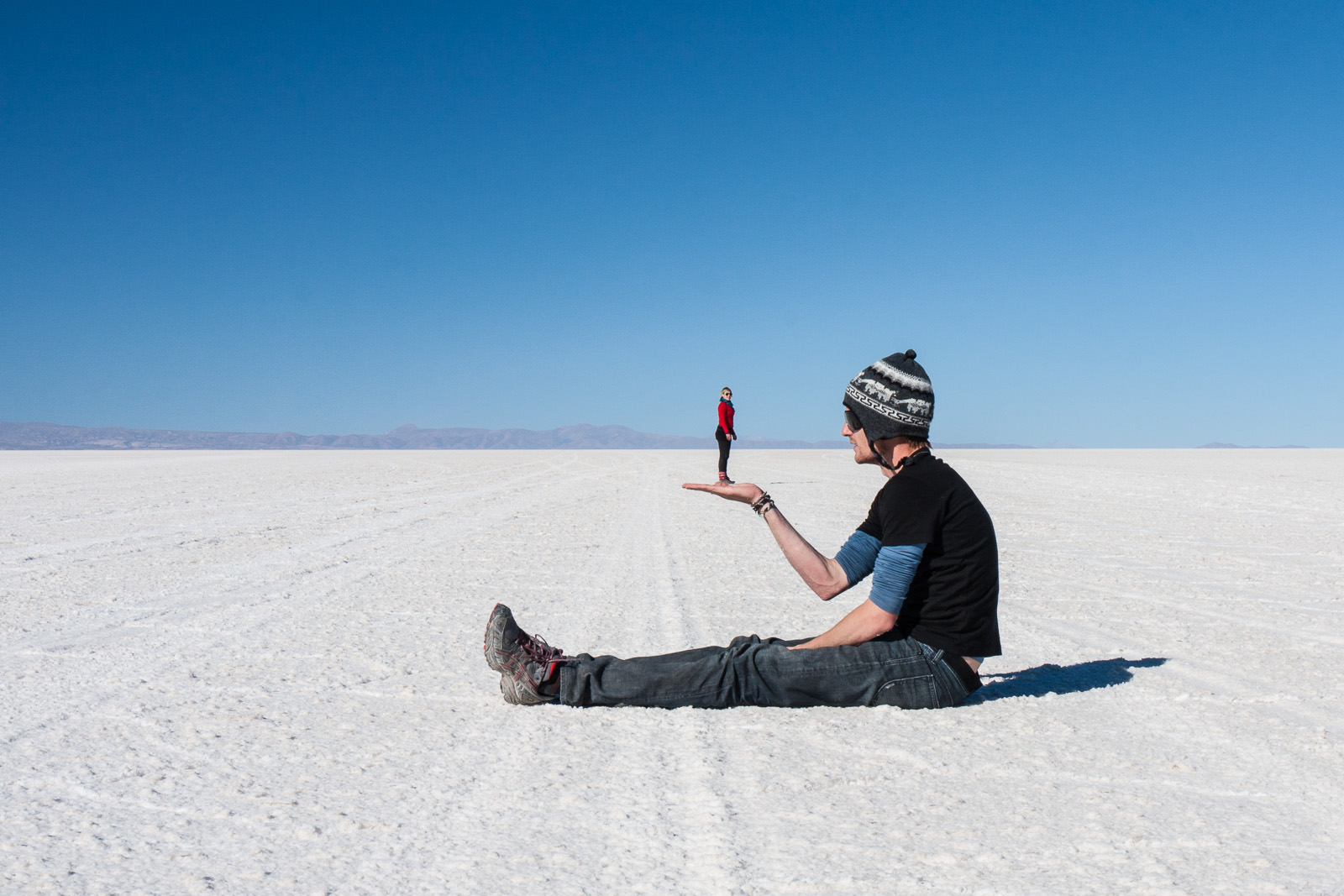
Just because I travel with the specific aim of photography doesn’t mean I don’t have fun And today’s image was definitely involved a lot of fun

Jokulsarlon, Iceland.

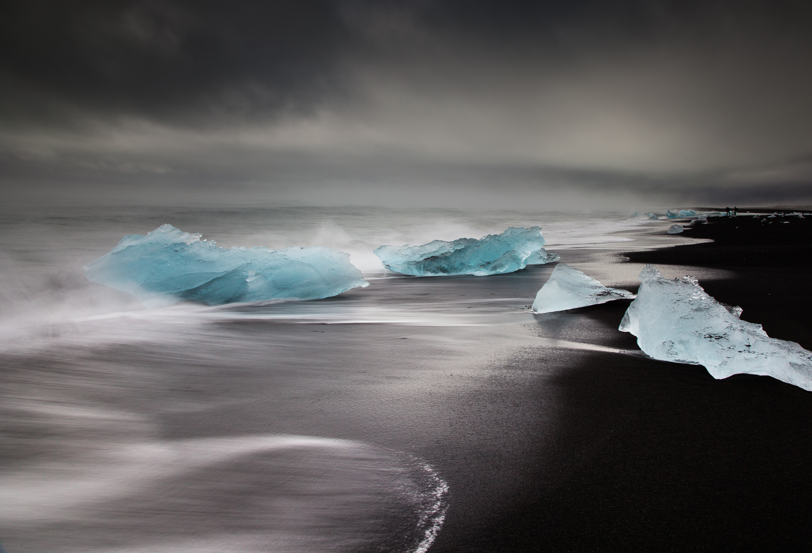
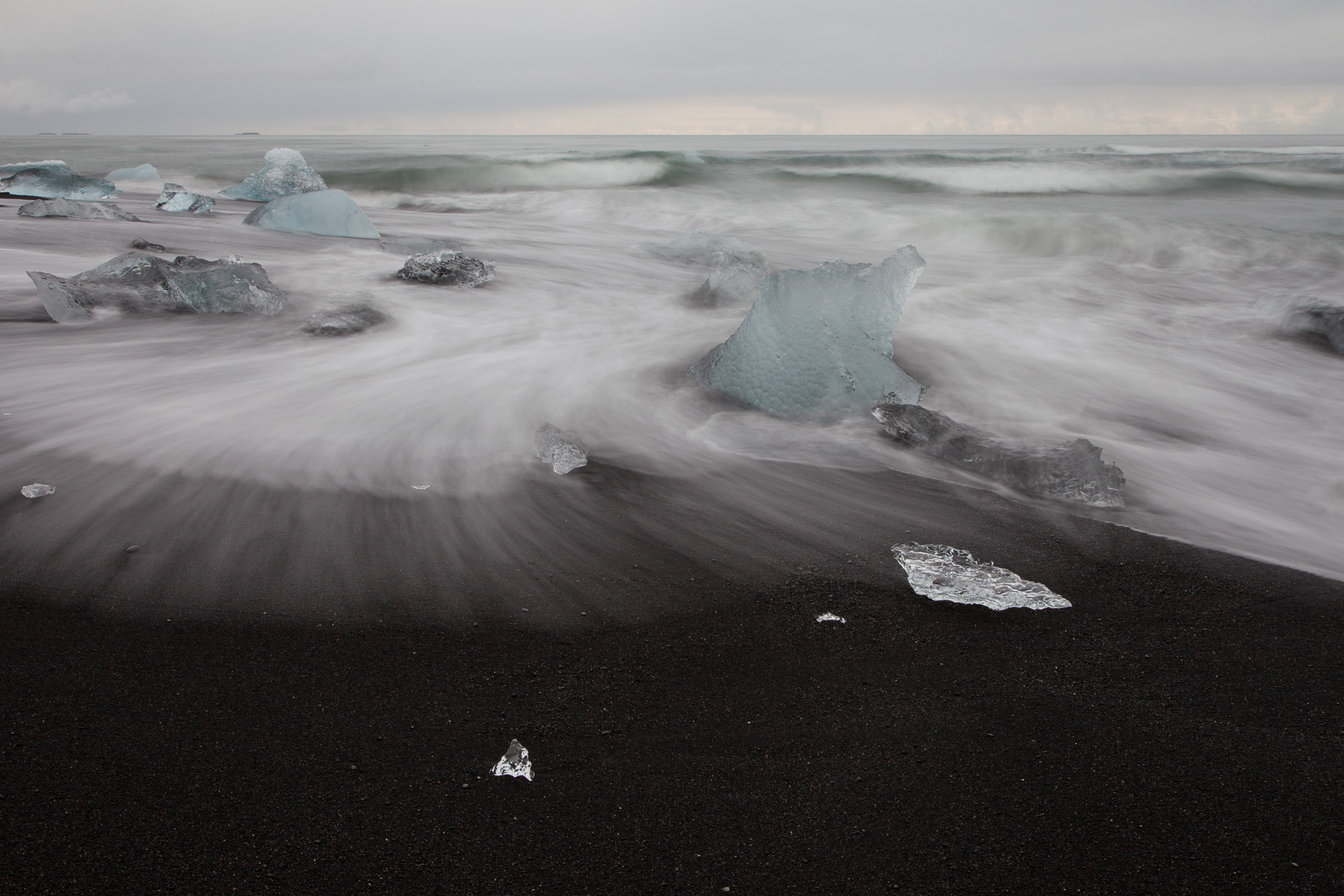
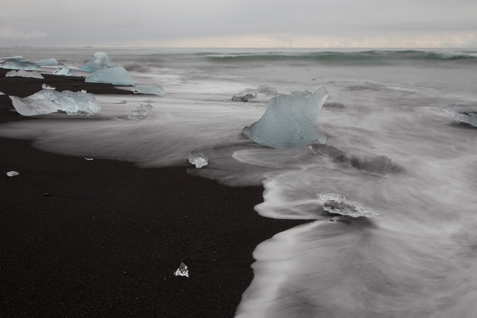
Beware, icebergs can bite back… [Click to enlarge!]

One of the most visited spots along Iceland’s southern coast is the glacial lagoon of Jökulsárlón. Indeed, even at almost 400km from Reykjavik, there is a steady stream of tourists making the arduous coach trip out here and back in a single day which usually ends up as 9 hours in a coach and two to three hours at the lagoon. But despite what little time they get to spend around the lagoon they invariably leave impressed at what they have witnessed.

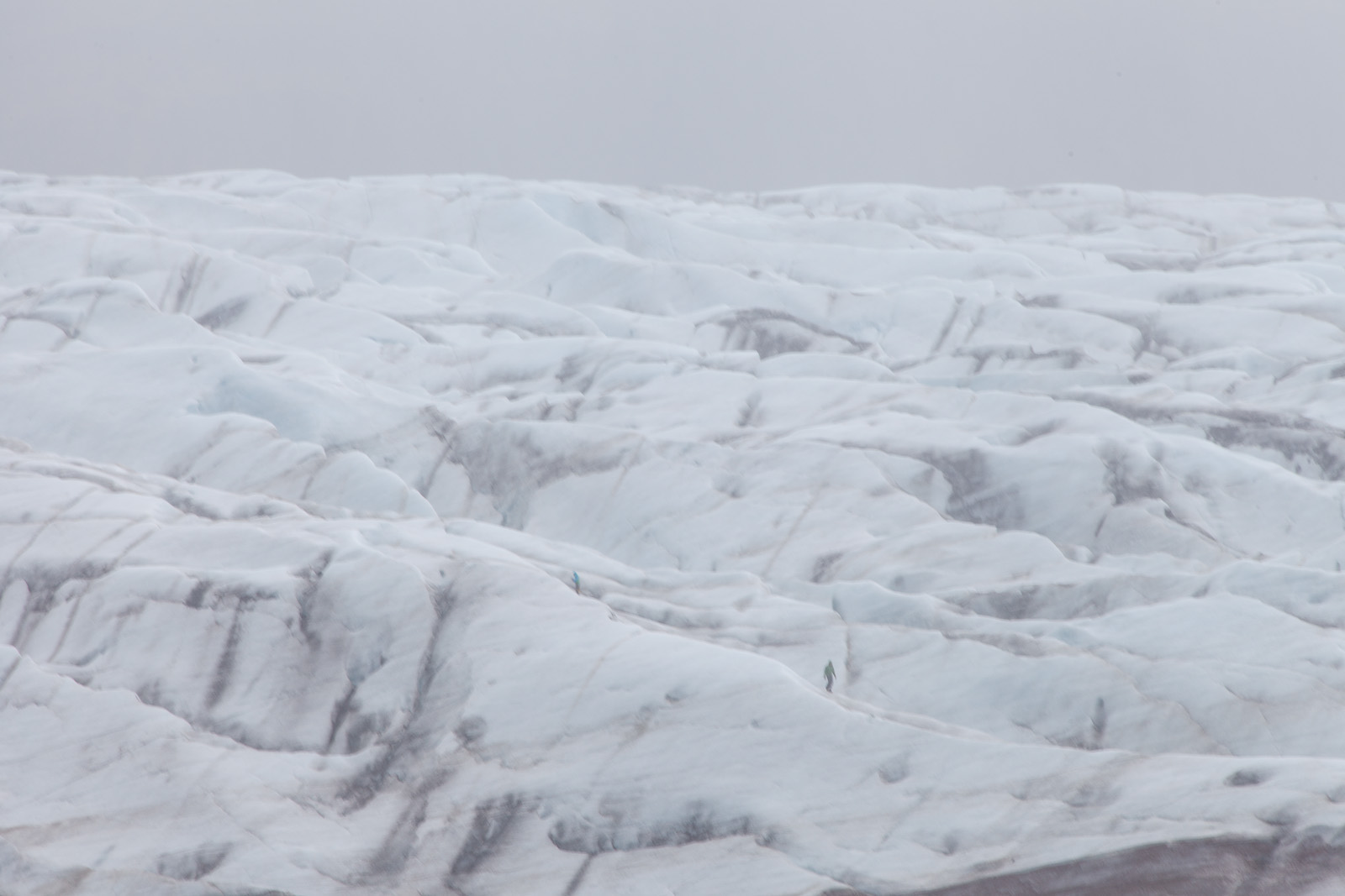
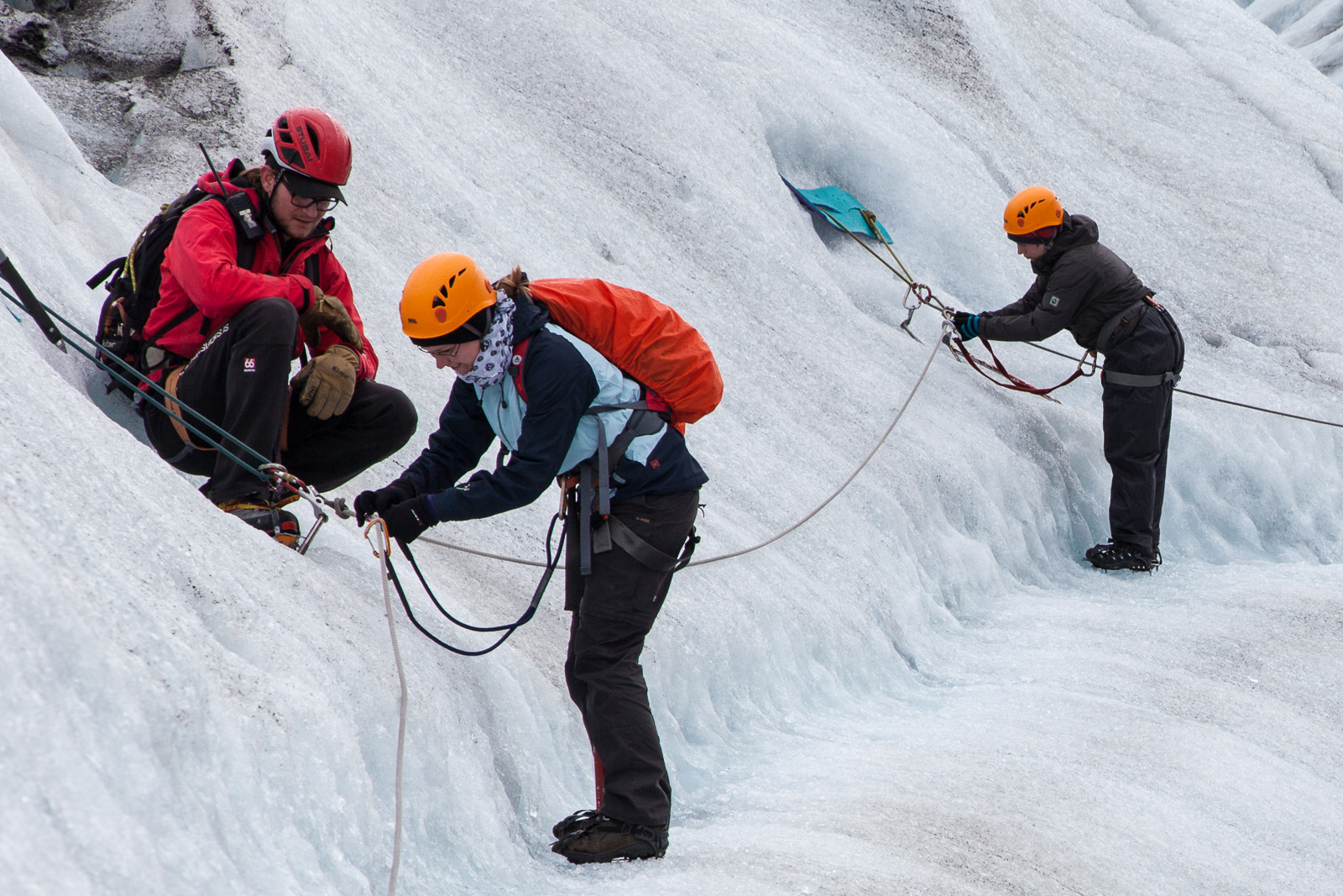
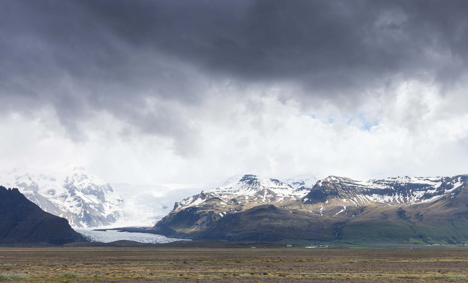
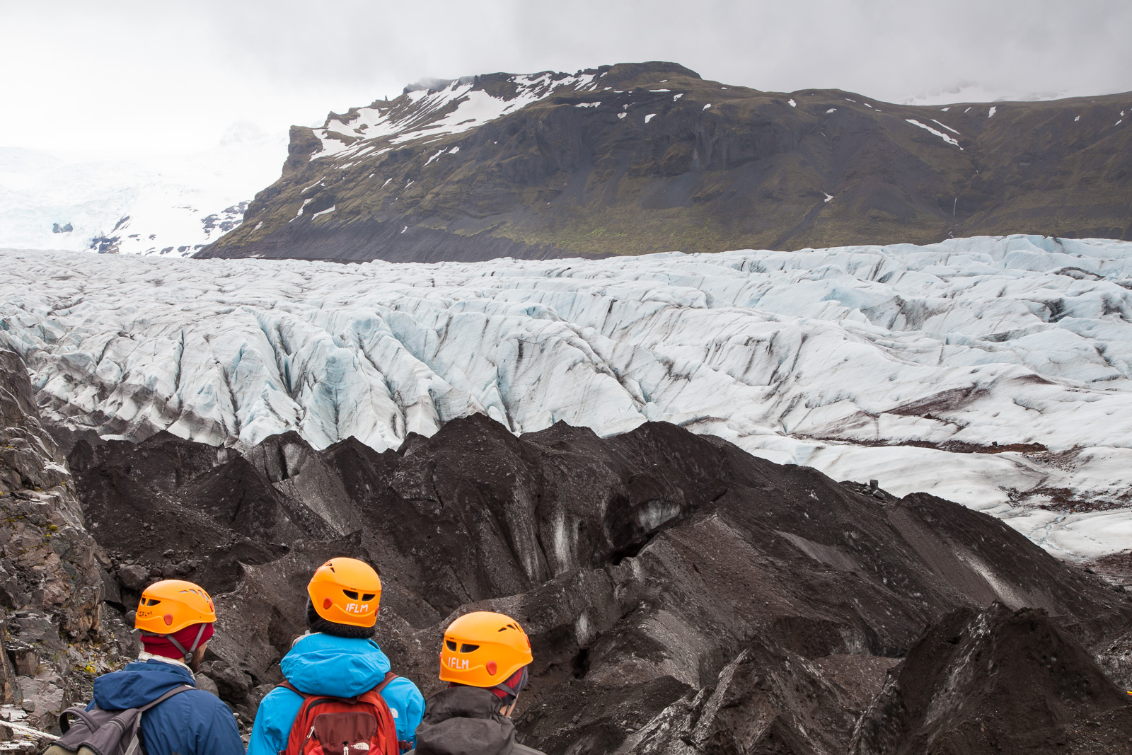
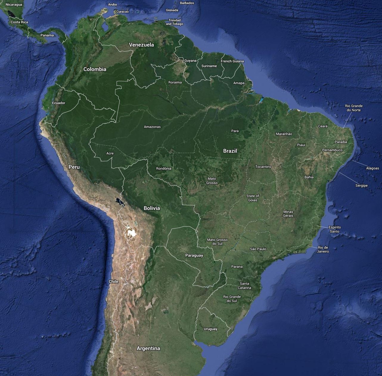
As mentioned Jökulsárlón is a lake that has formed at the base of Vatnajökull – Europe’s largest glacier – and more specifically at the base of Breiðamerkurjökull, an outlet glacier. There are many complex processes linking these three entities but in essence Vatnajökull is highland ice cap where erosion, glacial motion, snow fall and gravity result in the edges of the ice cap spilling downhill forming what are known as outlet glaciers or glacial tongues. Eventually the outlet glacier meets warm air, ground, or both and collapse under their own immense weight into icebergs – a process referred to as calving.  But words and the science behind them are definitely nothing compared to the sight itself.

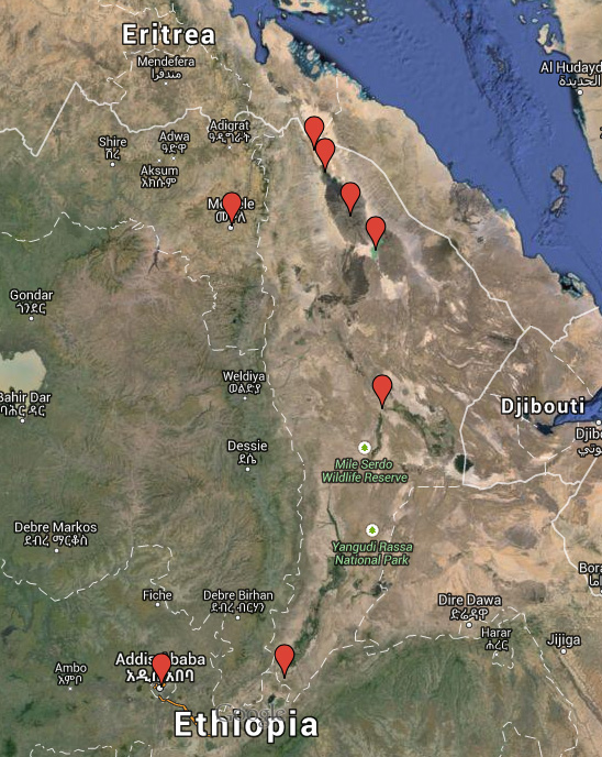
I can understand why Jökulsárlón is so popular – thousands of icebergs at the foot of an awe-inspiring glacier – I would have been awestruck too had I not been to Antarctica. Alas however, I have been and so, as impressive as the lagoon is, it left me a little, well, cold.

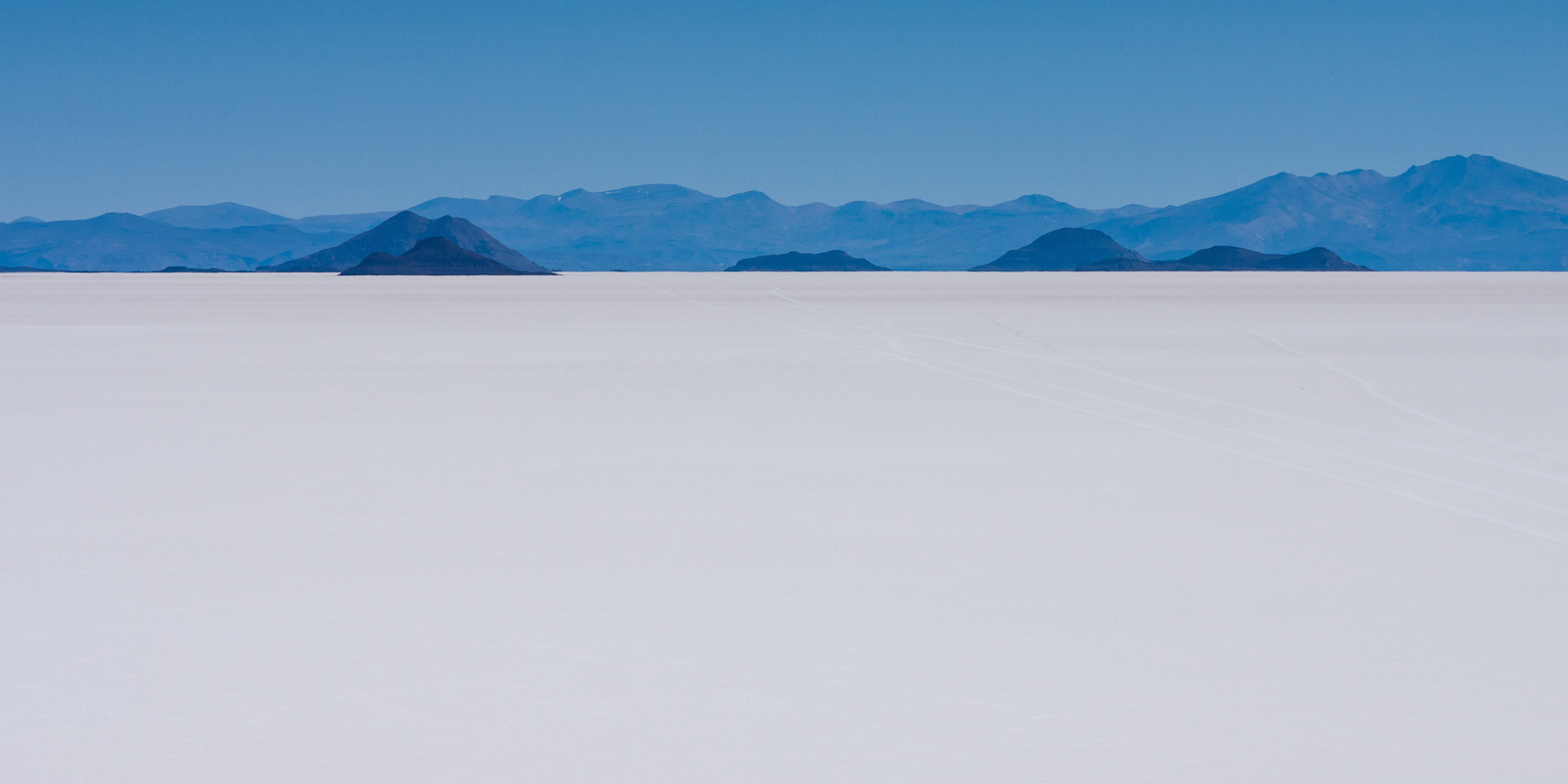
One of the interesting things about Jökulsárlón is that it vents out via a narrow estuary on to the very top of the North Atlantic and because of this there is a natural tide that pulls the icebergs out to sea. Get there early in the morning after low tide and you’ll be greeted with a sea full of icebergs. It is not a time to go for a swim – some of the larger icebergs can weigh upwards of a 100 tonnes but the power of the North Atlantic tosses them around as if they weighed nothing. The incoming tide also pushes some of the icebergs back onto the beach, grounding them on the black sand. It is truly stunning: A landscape of only black, blue and white. Alas, if you are taking a coach trip out of the capital, you won’t get to see this marvel of nature – as the waves beat rhythmically against the beach and the temperature rises, the mighty icebergs melt and by evening only small lumps remain, the largest the size of a pet dog.

I found myself on Jökulsárlón beach several times trying to do justice to what nature had designed. As can be seen from this image – and the rest in the gallery – the best angles are side on to the sea shooting along the beach. All well and good and I had even bought Wellington boots for this very purpose, which were 1100 miles away back in the UK as I couldn’t get everything into the suitcase! So I ended up playing chicken with the Atlantic: Set up the tripod just out of reach of the waves and begin the task of trying to capture the right shape of wave on the beach at the right time (which is tricky with multi-second exposures), all the while keeping an eye open on the waves coming in to the side of me. Of course, just as soon as I would get in to the swing of things, a rogue wave would come hurtling in and it would be a mad dash out of its path, often having to leave the camera behind perched on the tripod and hoping that there would be camera to return to. Over the course of my visits I discovered a list of handy tips, the hard way.

First, don’t set up the tripod with a thigh-high iceberg right behind you and between you and safety as, when an incoming wave means it time to make a dash for it, the iceberg is somewhat less bothered. You learn a lot about momentum, high centre of gravity, pivot points and just how big a bruise a iceberg can make by crashing full speed into one.

Second, just because you find a nice, solid feeling iceberg you can stand on to raise yourself above the level of the incoming wave, don’t get smug. Given a big enough wave that solid feeling iceberg suddenly becomes far less solid and the thing about ice is that it isn’t exactly a high friction surface.

Third, no matter how far up on the beach you leave your camera backpack out of harm’s way, it won’t be enough. The tide is coming in and you’re engrossed in trying to capture the perfect moment. You end up relying on the goodwill of others to either shout a warning that your backpack is about to get a good wash, or to move it for you.

Fourth, no matter how much you rinse the sand off your tripod after a session you’ll still take half the beach home with you. By the end of the trip my lovely carbon fibre Feisol was making alarming grating noises. Luckily John over at Feisol’s UK distributor was brilliant and had the tripod serviced and back in my hands within a week.

But the biggest thing I learned on my days to the beach was that, despite the bruises and the soaking wet feet, I was having more fun than I’d had in years.

Oh, and not to leave my wellingtons at home again…


Posted in Frame by Frame Also tagged , |

Ethiopia: Dreaming of a White (and Black and Red) Christmas

Well, with just twelve days until I leave for Ethiopia and after spending the bulk of yesterday picking and ordering the last of the clothing and equipment, most of the shopping is now complete. All that remains is the medical kit, a plastic funnel for transferring water between containers, some coloured pens and pencils and a few inflatable globes. So with all of that now done I have finally started thinking about the thing that made me want to travel to the remote Danakil Depression in the first place: Landscape photography. 

Starting in Addis Ababa we’ll head east to Awash National Park before heading north and entering “No Man’s Land”

Starting in Addis Ababa we’ll head east to Awash National Park before heading north and entering “No Man’s Land”

It is going to be a packed two weeks as we travel northwards from the capital of Addis Ababa up to the very top of the country and then back again along a loosely counter-clockwise route. As we travel everything will change around us: the landscape, the climate, the wildlife, the people, even the predominant religion will alter as we descend from Addis Ababa at an altitude of 2300 meters to Dallol with an altitude of -130 meters, one of the lowest points on the Earth’s surface.

For me the highlights of the expedition are the three days spent at the Erta Ale shield volcano and the time spent at Dallol. There are many descriptions of Dallol but Wikipedia probably best describes it:

Dallol features an extreme version of hot desert climate (Köppen climate classification BWh) typical of the Danakil Desert. Dallol is the hottest place year-round on the planet and currently holds the record high average temperature for an inhabited location on Earth, where an average annual temperature of 34.5 °C (94.1 °F) was recorded between the years 1960 and 1966. The annual average high temperature is 41 °C (105 °F) and the hottest month has an average high of 46.7 °C (116.1 °F). Dallol is also one of the most remote places on Earth. In addition to be extremely hot, the climate of the lowlands of the Danakil Depression is also extremely dry and hyper-arid in terms of annual average rainy days as only a few days record measurable precipitation. The hot desert climate of Dallol is particular due to the proximity with the equator, the very low seasonality impact, the constance of the heat and the lack of efficient nighttime cooling.

For someone who is as fond of cold weather climates as I am, it will be interesting to see how well I cope with such opposite conditions. The temperature will be further exacerbated by the heat coming off the lava lake at Erte Ale whose surface temperature is a mere 1200 °C

Whilst we spend three days at Erta Ale it is, for all intents and purposes, a single environment. At an altitude of 600 metres there is little else other than the lava lake itself and the black balsaltic lava ground. Getting a good series of photographs here is likely to be as much luck as skill as we will be at the mercy of just how active the volcano is at the time, but I have a series of photographs in my head that I want to try and capture in the limited colour palette of volcanic black and lava red.

Once we descend from Erta Ale and head towards Dallol the pace will pick up dramatically and photography is going to be more of a challenge as the area offers several different landscapes with only approximately two days to capture something decent. One of the big landscapes is a salt flat much like the Salar de Uyuni in Bolivia although much smaller at only approximately 200 square kilometres. Here I’ll hopefully have a number of opportunities – from the wide vistas of the salt flats themselves to the Afar miners who extract the salt with picks, to the camel trains that take the salt to market. I may even get a chance to try my hand at salt mining in what can only be described as intensely harsh conditions.

Salar de Uyuni, Bolivia.

The Salar de Uyuni salt flat in Bolivia. A similar white Christmas awaits me in Ethiopia.

The volcanic area of Dallol is a sight that still causes me wonder at just how such a place can exist. It is a landscape that would look at home in an old science fiction movie where they have pumped the colours to the maximum and day-glo blues, greens, pinks and yellows all mix together. Lighting here will be a key factor – it has to be right first time as there will be no chance for a revisit.

Another thing that I want to try whilst in the Afar region, and particularly the Danakil Depression itself, is astrophotography. It is not a style of photography I have any experience of and involves its own set of rules and techniques that I know very little about. But the one thing that every astrophotography web site and blog I have visited agree upon is that astrophotography works best when there is no light pollution to obscure the incredibly faint light from distant stars.


Yellow is light pollution and blue is darkness: Jazan on the top border is typical of towns and cities. In the northwest of Ethiopia we’ll have no problems with light. The only light sources are from lava.

Yellow is light pollution and blue is darkness: Jazan on the top border is typical of towns and cities. In the northeast of Ethiopia we’ll have no problems with light. The only light sources are from lava.

Looking at the above image from blue-marble.de – a web site that shows satellite imagery of light pollution across the planet – it is easy to see why the one thing I can guarantee is that – in what Wikipedia and National Geographic call one of the most remote places on Earth – light pollution will not be a problem.

So I have given myself a crash course in astrophotography which in turn has led to having to learn the basics of how to locate and identify the constellations and navigation by the stars. I am hopelessly under-prepared but there is not much I can do now other than make use of the location and hope that what little I have learned will help me produce something I like. Unfortunately however, whilst I would love to take a photograph showing the Milky Way galaxy in the night sky, I believe I’ll be there at the wrong time of year. On the plus side however, to capture some really rich star field images, even the moon can be a problem and most recommendations suggest shooting on nights leading up to and immediately after a new moon. As I start the expedition on the 21st December – the day of the new moon, I’ll have ideal conditions to shoot the night sky – assuming it is not cloudy, that is.

Posted in Destinations, Trip Planning Also tagged , , , |

The Iceland Gallery

Finally, I have uploaded the Iceland gallery. The images chosen reflect the broad range of landscape I experienced as I drove along the south coast and back.

Each image follows the 90 second rule: if more than 90 seconds of post processing is needed, it probably is not worth the effort. Consequently each image only has clarity (a more gentle form of contrast), vibrance and sharpening added. No colours were boosted – they are all natural. I feel the need to state this as a the volcanic minerals make for some otherworldly colours. The only images where more time was taken was when dust spots were just too distracting.

I loved Iceland and it is definitely on the short list of places to return to. I hope the photographs put Iceland on your list too.

Iceland Gallery


Posted in Destinations, Landscape Also tagged , |

Ethiopia: The Danakil Depression

With the Iceland gallery in its final stages of preparation meaning that I no longer have to worry about it, it does free up some much needed time to plan the next trip: The Danakil Depression in Northern Ethiopia. And this trip really does represent my biggest challenge to date.

Looking at some of my recent trips (Iceland, Antarctica and the Bolivian Andes being examples in point) and you probably come to the conclusion that I’m a cold weather kind of guy. And I am. So the thought of spending time in a place whose average daily temperature – in Winter – doesn’t drift much below 40 °C doesn’t really make me want to rush and pack my suitcase. To be fair, I’ve survived 40 °C plus temperatures before, in Egypt, but that was insanely low humidity and I spent much of the midday hours under cover. In the Danakil Depression, the lowest point in Africa and the second lowest land point on the planet, the humidity is to put it mildly, horrific.


The Danakil Depression - Dalol on the map - isn't exactly recommended.

The Danakil Depression – Dalol on the map – isn’t exactly recommended.


The second aspect that would raise an element of concern for most is its location about eight kilometres from the border with Eritrea. A hotly disputed border. The Foreign & Commonwealth Office (or FCO) – the UK’s governmental department responsible for issues travel guidelines and assisting UK nationals around the World via regional embassies – is the go-to site when assessing the safety of travelling to various countries. The travel advice for Danakil is “Advise against all travel”. Digging a little deeper however and, aside from an unfortunate episode in 2012, there have been no real problems in the past few years. That said, however, without FCO approval, no normal travel insurance policy will cover you. So I’ve had to look into specialist insurance.  I don’t know if I should be comforted or concerned that they all include kidnap and torture cover.

The third issue is that the area is the home to the Afar tribe, a nomadic people who live off the land by mining salt from the region’s salt flats and transporting it back to civilisation via  camel train. My experience of African people (in Africa) is that they are a proud race but apparently the Afar take that pride up a few notches. So, I’ve got to read up on Afar (and tribal) societies, lest I do something that offends. Not that I’ll come to any harm, but it could well mark the end of my being allowed in what is their homeland.

But despite all of this it is the fourth point that, for many, would be the most problematic. The Danakil Depression is regarded as one of the most remote and inhospitable places on the planet. It is a barren, unending desert scrubland. There is no running water here, surface lakes being either extremely poisonous or highly acidic. There is no gas or electricity supply, no medical facilities, in fact there are, well, no facilities at all. Including toilets. If you are the least bit conscious about bodily functions then this is not the place for you. It is not so much you go and squat behind a bush – there are no bushes. No, when you need to go it is a case of grab the paper, walk two hundred metres out on the flat expanse and hope no-one heads your way. And, given that, you can safely assume that there are no washing or bathing facilities at all – a highlight of day eight on the expedition I’m taking is that we get to have a makeshift shower in a river.

So, why on earth would anyone want to put themselves through all of this?

The first reason is that the Danakil Depression hosts the second of five known lava lakes on the planet – the first being up a mountain in the Democratic Republic of the Congo and currently inaccessible after recent civil war. It may be deemed the second best, but it is the oldest lake and still hugely impressive.

The second is that the Danakil region itself hosts some of the most insanely coloured and textured landscapes ever. They look like they’re from another world, or a game designers imagination.

And, as a budding landscape photographer, what more could I ask?

Posted in Travel, Trip Planning Also tagged , , , , , |

Reynisfjara Beach, Iceland.

This is one of my favourite photographs from Iceland.

I had based myself just outside the village of Vik for six days – which is a convenient stopping point as many areas of interest are within easy driving distance – and so had the opportunity to visit most of the places on my list a couple of times. One place I revisited a number of times was Reynisfjara beach with its view of the striking rock spires of Reynisdrangar.

Reynisfjara doesn’t crop up on many ‘Top Beaches of the World’ lists, although I suspect that is because most lists focus on beaches with golden sands, warm breezes and azure seas gently kissing the sands. There are some absolutely stunning beaches out there that fit these criteria, but in no shape or form can Reynisfjara be considered one of them. The sandy beach is jet black volcanic sand. The breeze is the relentless gust of cold North Atlantic air and the ocean doesn’t so much kiss the beach as beat it.

My goal for the beach was to capture the white surf on the black sands and the spires of Reynisdrangar were going to form an interesting backdrop. As a shot it looks good too but once I had captured the image in my head it felt a little, well, incomplete.

Being close it is to route 1 and having an accessible car park right next to it makes it a popular beach. Coach parties make regular stops here and so, as was to be my rhythm whilst in Iceland, I had to shoot in the gaps between one coach party leaving and the next arriving. Of course, independent travellers were there too and this couple caught my eye. Most people were turning up, walking along the beach long enough for the chill wind to suck the heat out of them and then beat a hasty retreat to their cars. But not this couple. They, well, stayed.

Somehow the moment I saw them I had an idea for a shot; silhouettes of them against the milky white of the sea. But there were problems. First the shot would only work if it were just the two of them, so the shot had to be taken between coach parties and other visitors who would get in the frame. Second, the silhouette would only work if they were contrasted against the sea – a dark silhouette on a black ash beach doesn’t really work, after all. And third, for the water to be a milky white, I had to take a long exposure, during which they couldn’t move.

It took 20 or 30 shots and well over an hour to finally get the image I was happy with and, unsurprisingly, in that hour they realised that they were being, err, photo-stalked. So we got talking and I discovered that they were a young couple from Singapore who were travelling around Iceland. I apologised but explained that they had just helped make the photograph I was after and luckily when I showed them the shot they liked it too.

Persistence pays off...

Persistence pays off…


For me this image has a couple of attractions. The first is the simplicity. As I have developed I have begun to discover my ‘style’ of photography. I favour the images where there is a bare minimum of distraction – the kind of photograph where, if just one more thing were to be removed, then the whole image would lose meaning. I think the artistic turn of phrase would be “the use of negative space to draw the viewer’s attention to the subject”. Some people don’t like negative space , some do, but I find that the photographs that I keep coming back to – that I continue to enjoy looking at, follow this minimalist approach.

The second thing I like is the silhouette of the couple. As mentioned in a previous post (http://davehoggan.com/finding-tel-avivs-heart/) when you can’t distinguish people’s features, they become less an individual and more a representation of people in general; they could even be you. I also liked the fact that, when they stood still long enough for the six second exposure, it was pretty much exactly where I wanted them to be – on the right of the frame.

Posted in Landscape Also tagged , , |

Iceland: The Selfie

I defy you to find anyone who travels who hasn’t once taken a selfie. For years I resisted, but in Iceland I finally cracked.

This is Skogafoss, one of the more impressive waterfalls in a county known for impressive waterfalls. It is also typical of many of Iceland’s sights – when the coach parties disappear, you have it pretty much to yourself.

And yes, it was very, very wet…

My first, and hopefully my last, selfie...

My first, and hopefully my last, selfie…

Posted in Landscape Also tagged , |

Svínafellsjökull: Walking on Water

A long time ago I had a couple of bad experiences with organised trips, bad enough to tarnish the experience in fact. After the second I resolved that I would never go on an organised trip again. Never.

The problem is that, if you are interested in travel photography there are only two options: You rely on someone else to plan the trip or do it yourself and because my obstinance on the matter had precluded the former option I have had, over the years, to become quite adept at the latter. To be honest, I’ve even come to actually enjoy the process and wholeheartedly believe in the old axiom: If something is worth doing, do it yourself – or something along those lines…

But there are some things that you can’t, or shouldn’t, attempt alone.

Destinations such as Antarctica firmly fall into the can’t category. Just getting there is a challenge: The Drake Passage is not a body of water that you would want to cross in a fishing boat and nor would you want a fishing boat captain, and specialist vessels and specialist staff require specialist organisations.

As for the shouldn’t category, well, that’s a bigger list. However here’s one example from Iceland.

Of the three organised trips I booked in Iceland the first was a glacier walk on Vatnajökull, Europe’s largest glacier. Walking on glaciers is not only fun, but presents great photographic opportunities too. But walking on a glacier can also be dangerous – after all, you’re essentially walking on a gigantic skating rink, albeit one with man-eating crevasses, soft spots and, of course, gravity-affirming slopes. Walking out onto a glacier when you do not know what you are doing or are ill-equipped usually puts you one step closer to asking your maker – personally – as to why such wonders of nature exist in the first place.

There are several operators who offer glacier hiking but I went with Icelandic Mountain Guides, aka MountainGuides.is, for a couple of reasons. The first was the number of options they offered for glacier hiking. I was on a tight time schedule and having various options available meant that I could plan my limited time effectively whilst still getting the experience into my itinerary. I initially opted for the full-day hike, but ended up taking the half-day for the reasons discussed below. They also included all the safety kit – so I didn’t have to worry about last minute costs or hassle. Probably the thing that ‘sealed the deal’ however, was that they responded quickly to my emails – when I am planning something I want to get it organised quickly and out of the way. I want people to move at my speed.

It was only a few weeks after booking that I saw the BBC documentary “Julia Bradbury’s Icelandic Walk” and Icelandic Mountain Guides were the local guides involved. If they’re good enough for the BBC, they were good enough for me!

Even after paying my money, they were very responsive and, when they had to cancel the full-day trip I had booked as I was the only person, they gave me an option to have a full refund, move to the half-day trip (and refund the difference) or move to another day. They really could not have done much more.


_MG_7484

The day before the start of the season and operators are out checking safety conditions.


So what are the benefits of going on an organised glacier hike?

The first is, quite simply, safety. Certain activities carry a significantly higher risk of serious or fatal injury for those who are badly equipped and  glacier hiking is one of them. I only have to cast my mind back to last winter here in the UK when a bit of ice resulted in the endless news spots showing  people slipping and falling over.  Ice is nice, but there more of it there is, usually the more dangerous it can be. With an organised hike all the necessary safety equipment is provided and all you have to do is use it. Perhaps more importantly, there’s someone watching to make sure you use it properly. Of course, you could walk past a crevasse without using guide ropes and 99 times out of 100 you would be perfectly fine. But that one time out of 100 will really ruin your day.

Going with the experts has a number of benefits. Not falling into a crevasse being one.

Going with the experts has a number of benefits. Not falling into a crevasse being one.

The next benefit it is educational. Do you know what an ablation zone is? Do you know that the ice at the front of the Svínafellsjökull tongue moves at 1.5 metres per year whereas the ice at the rear moves at 50 metres per year? Do you know why? Do you know why crevasses form at different angles? I didn’t. But after a few hours with Árni, our guide, I did, along with a whole bunch of other interesting facts. At some point you’re going to be telling the folks at home about your trip and it is going to be so much more interesting to them if you can explain why the patterns in the ice are the way they are. Yes, you’ll learn that too.

300 year old art: Icelandic glaciers mix pure ice and volcanic ash to create some truly stunning abstract art. It is possible that the catalyst of the French Revolution is in this very photograph…

300 year old art: Icelandic glaciers mix pure ice and volcanic ash to create some truly stunning abstract art. It is possible that the catalyst of the French Revolution is in this very photograph…

The third is that you meet new people. That is always a reward.

So, maybe I am slowly recovering from my earlier experiences with tour operators and that my adamant refusal to consider them in the past is exactly that – in the past. As the saying goes, never say never…


Disclaimer: If this post sounds like a bit of an advert for Icelandic Mountain Guides, I guess it is. One of the problems I’ve always had in planning a trip is finding recommendations for excursion operators that are photographer-friendly. Whilst this trip is not a photographic hike – and I was the only photographer on this particular hike – two things make me recommend it. The first is that I felt like I had plenty of time for photography. Whilst I spent a lot of time shooting on the move, there were plenty of stops. The second is that I was pretty much allowed to move at my own pace – I frequently drifted behind the group to get them in the ‘sense of scale’ shots as well as look around at other things that caught my eye. Other than keeping a watchful eye on me, Árni let me drift behind and catch up as I needed. It was only as I approached something potentially dangerous that he intervened.

Some more shots from the hike…

From a distance you get a real sense of the scale of Vatnajökull - Svinafellsjokull is a relatively small glacial tongue.

From a distance you get a real sense of the scale of Vatnajökull – Svinafellsjokull is a relatively small glacial tongue.


At the foot of the glacial tongue. Up close the black rocks in front of us turned out to be ash-covered ice.

At the foot of the glacial tongue. Up close the black rocks in front of us turned out to be ash-covered ice.


Close to the mountainside friction causes the glacier to twist and buckle.

Close to the mountainside friction causes the glacier to twist and buckle.


Having an experienced guide like Arni meant that I could concentrate on photography safe in the knowledge that I wasn't going to kill myself.

Having an experienced guide like Árni meant that I could concentrate on photography safe in the knowledge that I wasn’t going to kill myself.


If you've never tried hiking on a glacier, you should add it to your list - it is great fun!

If you’ve never tried hiking on a glacier, you should add it to your list – it is great fun!

Posted in Destinations Also tagged , , , , |

A Photographer’s Voldemort: The Self-Critique

In the two week period I spent travelling along the southern coast of Iceland I took 3136 photographs. This includes 200-300 individual images for stitching together in various panoramas, a number of bracketed shots for HDR images as well as the inevitable ‘click it and hope’ shots. There are also countless shots from the ice along Jokulsarlon beach – getting the sea and ice to form interesting patterns was more an exercise in patience and luck than skill. My task is to distil these 3136 down to 25 photographs for the website: More than that and the gallery would likely feel too big and any less may cause me many a sleepless night about the shots I left out.

It all starts simply enough. The photographs are loaded into Adobe’s Lightroom software and all are given a rating of three stars. As I walk through each image the out-of-focus and otherwise unsalvageable shots get reduce to one star; good images and those with promise get four stars.

Over the past few weeks, between travelling for work and, of course, going to Israel I have managed to get the first pick – the four stars – down to 180 photographs. Yesterday, after 11 hours, I have managed to get second pick to 68. Those 11 hours were also spent processing the photographs and stitching together the panorama shots, some of which have worked out well and some of which not so much. And so on to third pick. The critical analysis of those 68 images. The moment I dread.

No one talks about this aspect of the photographic workflow which is a surprise as it is arguably the hardest. I once asked wildlife photographer Daisy Gilardini about how long she spent processing photographs to which she replied between 60 and 90 seconds. It isn’t much time, but then I suspect that is the point: if an image is good, it won’t need much time to ‘tidy up’. But I feel I asked the wrong question. I should have asked “How do you select those photographs?”

Now, what makes a good image is always going to be an emotive topic and a question with no real answer. Humanitarian photographer David duChemin has long written about the importance of creative ‘vision’ and storytelling in photography and he should know – humanitarian photography has to generate a reaction in the viewer otherwise it has failed. By contrast even if a landscape shot fails to make you immediately pack your bags and get on a plane, at least it can still be pretty.

Many of the photography-related magazines include regular features that interview a notable photographer and ask the usual questions such as how they got involved in the industry. But none, that I have seen at least, ask the photographer to pick an image or two from their portfolio and explain why that selected that image and not one of the others from the same shoot. What was it that drew them to an image above all others? I once brought the idea up on a forum for a well-known UK magazine and was greeted by a wall of silence from both fellow readers and staff alike. But I can’t believe that I am the only one to struggle with self-critiquing work. Perhaps every photographer struggles with self-critique more than they would like to admit and, like Harry Potter’s nemesis, find it easier not to openly discuss the topic in the hope that it will not look their way.

Here is a classic case in point from the second pick of Iceland. Two images from one of my trips to the beach at Jokulsarlon. Can you choose which you prefer?


Jokulsarlon Ice #1

Jokulsarlon Ice #1


Jokulsarlon Ice #2

Jokulsarlon Ice #2

The problem is I cannot. What I wanted to capture was the essence of the beach: the striking black volcanic sand, the motion of the sea wrapping itself around the icebergs and the limited palette of grey, blue, black and white. Both images do just that. But what now? Where do I go from here?

I am sure that too will learn the art of self-critiquing my work. But, if anyone knows of a site, a magazine or any other resource where photographers show examples of how they self-critique, please let me know.

Oh, and I just realised that my Voldemort analogy may paint photographers as wizards and non-photographers as Muggles. But more worryingly, it implies that I’m Harry Potter. I do not believe this, of course, and I don’t want to live in Harry Potter’s world. For the time being, at least…


Posted in Process Also tagged , |

The Day I Realised That I Would Outlive the World.

In a recent post on Facebook announcing my beginning to plan the 2015 photography expedition to Erta Ale, a friend replied and questioned, somewhat jokingly (at least I think it was jokingly) as to whether my shift away from architectural photography to landscape photography was the result of an early midlife crisis. I can categorically state that this is not the case, based on three facts. And here they are…

First, any midlife crisis I suffer now would not be an early one.

Second, I think I already had my midlife crisis when I was around 27, which at least got that out of the way, although it wasn’t a particularly impressive one as, like most 27 year-olds, there isn’t much at that age to have a crisis about. It was probably more a long sulk than an actual crisis.

Third, and the real reason for my shift to landscapes can, very definitely, be attributed to one particular experience in 2010 when I visited a place that is probably the most strikingly beautiful place I have ever seen. That place is Southwest Bolivia.

Now, the whole of southwest Bolivia is stunning and a single post wouldn’t really do it justice, so this time I want to reminisce about one particular part: The Salar de Uyuni.

The Salar de Uyuni is hard to miss - you can even see it from the moon. (Hint: Not that you need help but it is the white bit!)

The Salar de Uyuni is hard to miss – you can even see it from the moon. (Hint: Not that you need help but it is the white bit!)


There is an urban myth about being able to see the Great Wall of China from space, but when Neil Armstrong and Buzz Aldrin set foot on the moon for the first time in 1969 they definitely spotted the Salar de Uyuni, apparently mistaking it for a glacier.

For anything to be seen, unaided, from the moon it has to be big. And at 4,100 square miles (10,500 square km) the salar certainly is big. Neil and Buzz can be forgiven for thinking that it was a glacier as there aren’t really many alternatives for geologic features that are pure white. But there is one: Salt. The Salar de Uyuni is not only the World’s largest salt flats, but at an altitude of 3,650 metres it is the highest too. The salar’s existence can be traced back to the very formation of the Andes when the Nazca tectonic plate subducted below the South American continental plate forcing the latter, in places five kilometres skywards. During this (geologically speaking) abrupt process, a vast amount of sea water was scoped up and when the area settled down a rather bizarre sea was created at around 3,650 metres. Over the millennia evaporation has reduced the sea to nothing but its constituent minerals and being nestled in the northern Andes – referred to as the ‘Dry Andes’ being close to the equator – with an monthly rainfall of approximately 1 mm there is little danger of the sea returning.

This is what a sea looks like after several million years of evaporation.

This is what a sea looks like after millennia of evaporation.


Now, the most obvious aspect of the salar is that it is so dazzlingly white although this is perhaps a little unsurprising given that there is an estimated ten billion tonnes of salt contained within. The next thing to notice is that it is also very, very flat. So flat, in fact, that orbiting satellites use the salar to calibrate their altimeters as they pass overhead. The high altitude, near perfectly clear blue skies and high reflectivity of the surface makes the salar an ideal calibration tool.


The evaporating waters from the ‘rainy’ season leave a flat surface with a curious pattern.

The evaporating waters from the ‘rainy’ season leave a flat surface with a curious pattern.


The reason the salar is so flat is that during the rainy season (‘rainy’ being a relative term in a desert) the rain water dissolves the salt at the surface. When the rain water evaporates, a uniformly flat surface is left, albeit one with a geometric pattern. There is a bunch of science as to why the pattern emerges that I once understood, but has long since been lost…

When researching the salar, it was difficult to find a widely agreed figure for the depth of the salt, but in the end I found the Mineral Corporation of Bolivia’s website. It appears that a 1989 study by a French research institute drilled a borehole down 120 metres while a 2004 study by American Duke University drilled a similar borehole down 214 metres. In both cases they found alternating layers of salt crust and clay – in the latter study a total 170 metres of salt – without touching the bottom of the salar. Of course, it’s not that deep over the entire salar, but even so, it’s impressive. Photographs really do not do justice to the area and to really appreciate the beauty of the salar you have to go and experience it yourself. And that leads me on to the pivotal moment when I changed from architecture to landscape photography.

Bolivia is one of the poorest countries on Earth and one that derives a lot of its income from tourism and a limited mineral and metal export industry. The export industry is limited due to the radical left government’s unwillingness to form trade partnerships with US and European companies. The lack of large scale trade partnerships makes tourism all the more important to the income of your average Bolivian and the salar is a major tourist draw. So, what I learnt next was the catalyst to my change.

Aside from the 10 billion tonnes of salt covering the salar, there is a far more precious element beneath the surface and one that you, and everyone you know, depends on every day. It is an element that has, in the last twenty years, become a globally sought resource and one that, for the foreseeable future will shape your daily existence.

Under all that salt is lithium. The element is found in every single piece of modern portable consumer electronics. Phones, tablets, battery-powered watches, GPS units, laptops and increasingly hybrid and electric vehicles.  Your reliance on any of these is a reliance on the underlying power source. And that, right now, is lithium. The problem for Bolivia and for the salar is that there is an estimated 9 million tonnes of lithium under the surface or, to put that in a global context, approximately 35% of the World’s total lithium deposits, based on the most conservative of estimates.

Now, that doesn’t seem to be so much of a problem. You’re a desperately poor nation, but you just happen to have a significant proportion of one of the most sought after elements in the World as a natural resource. But just like winning a rollover lottery, all this good fortune will come at a price.

The first is political: To date billions of dollars of investment have been offered to the Bolivian government and all offers have been declined. But with the increase in public interest in hybrid and electric vehicles, which require far larger batteries, now seeing the car industry showing interest in lithium the drive to find resources will only see Bolivia under more pressure to develop trade partnerships.

The second is logistical: The lithium is 3,650 metres up on the altiplano with no infrastructure. No roads, no electricity, no gas, no water. Getting to the lithium will require developing all these infrastructures as well as the mining facilities and that is a lot of time and expense.

But, for me, it was that third impact that made me reconsider my views. In order to mine the lithium, the salar – as a stunning piece of natural beauty – must go. You cannot have a mining operation and an area of natural beauty side-by-side. Even if you start with a small mining operation, it will grow as time, and demand, increases. And as I discovered whilst reading an article earlier this year that is exactly what is happening.

So, at the time, whilst standing atop Isla Incawasi I realised that by 2020 the beauty of Salar de Uyuni may be forever lost. This may be my last chance to experience it. And what of the other places I had idly wanted to visit: the Arctic, the Antarctic, Peru, Jordan and Cambodia? How long before they too are irrecoverably altered? So that is when I changed to landscape photography: The day that I realised that I’ll outlive parts of the World around me.

Whilst the salt may be unusually flat, this is still high up in the Andes. Volcanoes and other mountains can soar up to 2,000 metres higher. Here I’m a mere 100 metres higher.

Whilst the salt may be unusually flat, this is still high up in the Andes. Volcanoes and other mountains can soar up to 2,000 metres higher. Here I’m a mere 100 metres higher.


The dark tracks that can be seen crossing the surface are unofficial 4WD paths. Whether this is to preserve as much of the beauty as possible or simply to avoid getting lost is one of many questions I have no answer to.

The dark tracks that can be seen crossing the surface are 4WD paths. Whether they stick to the same route to preserve as much of the beauty as possible or simply to avoid getting lost is one of many questions I have no answer to.


This is Isla Incawasi, a refuge for cacti that, despite the high salt content and lack of water continue to grow at a rate of 2.5 cm per year.

This is Isla Incawasi, a refuge for cacti that, despite the high salt content and lack of water continue to grow at a rate of 2.5 cm per year.


At 3,650m there day/night temperature variance is not to be ignored. Walking across the salar would be suicide unless properly prepared. And pack your sun block too. UV radiation is three times stronger at this altitude than at sea level.

At 3,650m there day/night temperature variance is not to be ignored. Walking across the salar would be suicide unless properly prepared. And pack your sun block too. UV radiation is three times stronger at this altitude than at sea level.


The near perfect flatness and vast size of the salar gives the brain a hard time when interpreting perspective, a fact tourists have loved for years.

The near perfect flatness and vast size of the salar gives the brain a hard time when interpreting perspective, a fact tourists have loved for years.


A salt hotel is no idle title – The building is made of salt, the table and chairs are made of salt, the beds are even made of salt.

A salt hotel is no idle title – The building is made of salt, the table and chairs are made of salt, the beds are even made of salt.


Posted in Destinations Also tagged , , , |

The Waiting Game

The other day I was talking to someone just getting started in photography and later got thinking about what I have discovered over the past few years and if there was any advice that I could give other than the usual – and obvious – “know how your camera works” or “practice, practice, practice” advice. And there is: Good photographs rarely just happen.

Part of the joy of solo travel is that I can afford to spend lots of time waiting. And waiting. Usually it is for inspiration, or thinking about how to shoot a scene, or the light. But often it waiting for people to get out of the way. Iceland is a great case in point. One of the popular tourist spots along the southern coast is Dyrholaey. It is especially popular with bird watchers as several species, including puffins choose it as their nesting grounds. So, leave it to me to visit during nesting season when, what felt like every bird watcher on the planet, was out on the cliffs keeping a lookout. If that were not enough there is a fantastic black volcanic sand beach there with a cave at the far end and I can understand why people were keen to walk along to the cave and back. I would, usually. But I had this image in my head and it did not include people on cliffs. Or beaches. Or even, as cute as they are, a passing puffin. It just had the landscape.

So I set up the tripod, framed the shot, ran a few test shots to check focus, exposure and the creative look and then waited. For a few hours. The cliff line would clear, but people were still on the beach, or vice versa. Or both were clear, but the clouds had moved in. There was always something not right. I waited so long that the tide came in, changing the images, luckily in a way I liked.

Then it happened: No people, no birds, no grim clouds and an, as if to reward me, an incoming wave. Lovely.

Don't tell her but my mother was right: Patience is a virtue. 4secs, f/13 ISO 100

Don’t tell her but my mother was right: Patience is a virtue.
4secs, f/13 ISO 100

Now yes, I could have cloned people out in post production, but I shoot to print at a metre plus in size and unless you’re really very good, Photoshopping can be spotted. Anyway, you really can’t remove clouds or add waves in Photoshop so getting it right in camera is usually the best course of action. So, my advice is simply that. Good shots don’t just happen – you make them happen.

By changing your viewpoint, or removing the waste bin sitting next to the rustic door, or by picking up rubbish seen in frame. Or simply by waiting.

Posted in Hints and Tips, Landscape Also tagged , , , , |