Category Archives: Trip Planning

Feeling the Heat

The ever-changing surface of the lava lake at Erta Ale guarantees that you'll never take the same shot twice. But be warned; staring at the lake's surface can become almost hypnotic.

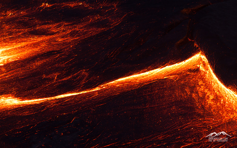
The ever-changing surface of the lava lake at Erta Ale guarantees that you’ll never take the same shot twice. But be warned; staring at the lake’s surface can become almost hypnotic.

It has been very quiet around here for a few weeks simply because work has been insanely busy. I’m an IT security professional by day and right now I’m currently managing two projects that are well underway and all my time is split between them with the thousand different technical and operational queries that clients raise during the deployment phase. All my other work therefore has to fit into the gaps and the evenings.

Of course there is always a benefit to being so busy and one is that I have been working on one client’s site or another over the past few weekends and the travel fund has slowly been growing! So, despite feeling a little weary right now I do have something to look forward to: the next photography trip!

As mentioned in a previous post, Siberia is planned for 2017. The photographer running that – Alexey Trofimov – has suggested dates around the end of February and so whilst I’m really excited about working alongside him I need something a bit sooner.

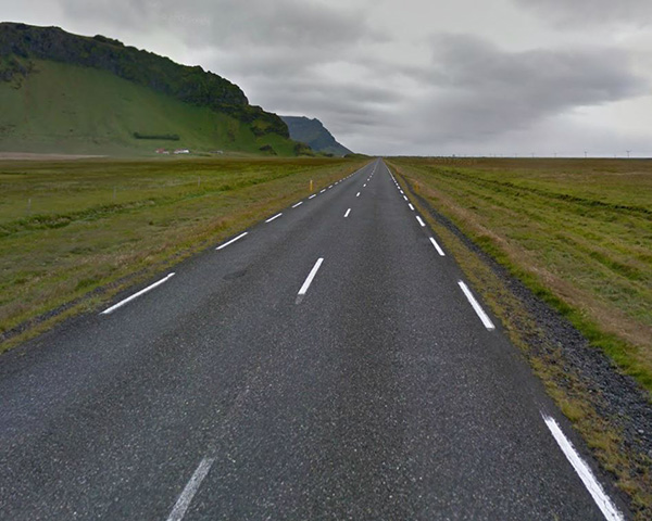
The next option is to return to Iceland. I have an image in my head that I can’t get rid of and so I can see a week or two spent driving along the southern coast. Iceland is an easy trip; one I really do not have to think about but again, I want to go late in the year, when it is colder – perhaps November or early December. Again, I can’t wait.

So, the current plan is 18 days travelling through Java on a volcano hunt. The people who organised the trip to Ethiopia, Volcano Discovery, have a photographer-centric trip in September and over the past few weeks I’ve been talking to them about adding a custom extension. If all goes well I should be climbing Krakatoa in just under 80 days!

After the heat of Java's volcanoes Iceland will be a nice halfway-house before the -25°C expected in Siberia.

After the heat of Java’s volcanoes Iceland will be a nice halfway-house before the -25°C expected in Siberia.
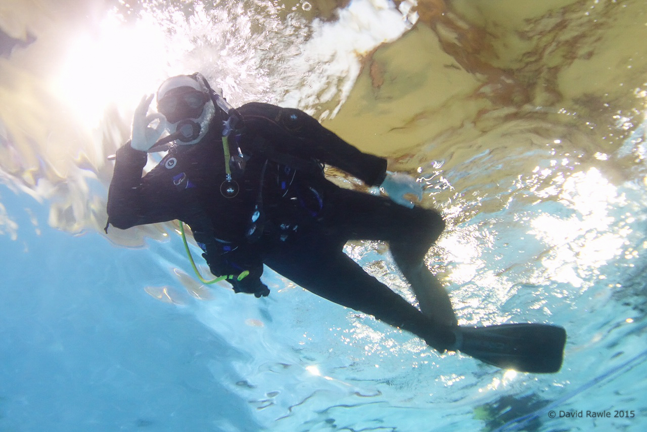
Also posted in Uncategorized Tagged , , , , , |

Siberia’s Lake Baikal: 2017

The World is full of wonder and this map is my reminder to not waste the one thing we all have in short supply: Time.

The map responsible for many of my trips. I’m sure my bank manager would prefer me to have wallpaper instead…

Here in the UK we are on the last day of the four-day Easter weekend and whist for many it is a busy time for me it is a time to rest and catch up with all those “I really must do that someday” jobs.

One such job was to clean fingerprints off the glass cover of the map in my study, fingerprints that covered most of Indonesia, China and well into Mongolia – so in the end I just decided to clean the whole map. A particularly stubborn mark over Mongolia had me scrubbing away and I was caught by the striking gash of blue in the otherwise orange expanse of Russia. Although not really obvious in the picture of the map above, you cannot miss it when looking at Google Earth, a deep blue against the green.

GoogleMaps - Russia 1600px

Anything that piques my interest is worth a quick Google, especially if it may lead me somewhere new and so the rest of the day became an increasingly interesting search about Lake Baikal.

Lake Baikal has a lot of ‘firsts’ to its name. It is considered the oldest lake at approx. 25 million years, the deepest at just over 1600 metres, the largest freshwater lake in the World by volume of water and one of the clearest. If you took all the water from the five Great Lakes in the USA, Lake Baikal still has more.

However, it was when I looked at some example images taken of the lake in winter that idle curiosity became a “What would be involved in getting there” train of thought. The best images range from stunning landscapes through to downright other-Worldly and it is an area relatively untouched by mankind. Siberia has long been on my list of extreme environments and now Lake Baikal has given me a focus.

So, as Easter comes to an end, I have narrowed the photographic expeditions down to three possibilities and some have already replied to my email. There is one expedition that stands out although all three represent the best on offer that I could find. The only thing is that I’m too late for 2016 as all the expeditions are in the February/March timeframe and so it means a long wait until the 2017 season.

But, it is always nice to have something to look forward to…


Tagged , , |

The Iceland Trip’s “Worst Case Scenario”

With the trip to Iceland being tomorrow and packing essentially complete I’m now at the point where I’m actually beginning to get excited. In fact there are only a few items left to deal with, including buying a few of those “meals in a bag” for the middle of the trip when I’m up in the Icelandic highlands and nowhere near a supermarket. That’s the double-edged nature of Iceland: It’s a truly breath-taking country but it favours the prepared.

Now, I do consider myself a reasonably prepared traveller, including the steps I take to stay out of trouble. But a recent post by a regular contributor over on the Trip Advisor Iceland forum did stop me in my tracks. In it she suggested that the profile for those travellers to Iceland that end up never leaving (alive) is male, a solo traveller, hiking and often with some experience. I fit 100% into that profile and whatever the source of this statistic I found myself double-checking my preparations for a “worst-case scenario”.

Risk analysts with tell you that there are three ways to deal with risk: Accept it and carry on (assume the risk), take steps to reduce the risk (mitigate the risk) or get someone else to handle the risk (transfer the risk). Depending upon the situation each option can be a valid approach, but in the case of my time in Iceland’s highland interior as the predictably unpredictable weather continues to worsen, option one would be plain, flat-out, stupid and option three (in this case meaning going on an organised trip) would be too expensive – if possible at all – and so inflexible as to render the reason for being there not worthwhile. So it was time to take the middle ground.

It is worth pointing out that there are usually three potential sources of danger in a given environment: From other humans, from animals and from nature itself. In Iceland you can disregard the first two completely. If anything is going to cause you problems, it will be the weather.

Staying on the Grid

The first thing to mention is telecommunication. Iceland has excellent mobile phone coverage from a number of operators. For example, take a look at Vodafone Iceland’s GSM coverage:

Everybody love 4G but despite being “so last century” GSM is your new best friend in Iceland.

Everybody loves 4G but despite being “so last century” GSM is your new best friend in Iceland.

So, should the worst happen I’m more than likely going to have access to the outside world, but who am I going to call?

Perhaps the obvious would be friends or family back home. If I had no other alternative then, well, I have no other alternative but I’m not going to be calling for a chat – I’m going to be having an emergency. If you’ve ever tried it trying to organise a rescue for someone from another country it is very difficult and as time is the enemy here, I really I don’t want to be in that position. So I’m making sure that I have the phone numbers for my accommodation in Iceland and confirming my arrival with each of them on the morning of arrival.

An example of why making sure that the accommodation knows you’re definitely arriving is useful happened to me back in 2010. We were taking a 4WD from the village of San Pedro de Atacama in northern Chile to the town of Uyuni in southern Bolivia. It’s a route taking three days and involves travelling through the northern Andes at an altitude of 4,500 metres. It’s a barren, unending wilderness where the temperature drops to -15°C or below once the sun goes down.

It is official – the fuel pump is dead. At 4,500 metres altitude that's not what you want to hear...

It is official – the fuel pump is dead. At 4,500 metres altitude that’s not what you want to hear…

Due to contaminated fuel the fuel pump died stranding us on the second day. Despite having been told otherwise there was no radio to call for help – and mobile phones were definitely out – and it was only because we were on a route that other 4WD vehicles used that we were able to ask a passing driver to let people know we needed help once he arrived back in civilisation. Which he didn’t do.

Luckily the accommodation we were staying in that evening were expecting us and when we didn’t show up they contacted the company who had organised our arrival and help was sent overnight to look for us. It was an uncomfortable evening – and we missed out on seeing some spectacular sights due to the delay – but we were rescued because of the accommodation raising the alarm.

In Iceland you have other tools at your disposal. The completely free 112 app from safetravel.is and available for iOS, Android and Windows mobile devices allows you to keep in contact by letting the emergency services know your location. It’s simple to use and works by sending a SMS text message so doesn’t need 3G or 4G to operate, hence why I showed the GSM coverage map above – it’s all the app needs to work.

Free, easy to use and could possibly save your life. What's not to like?

Free, easy to use and could possibly save your life. What’s not to like?

How you use it is up to you this but I just set my watch to remind me every 30 minutes to check-in. That way if the worst were to happen then the emergency services know my approximate location.

So, letting people know is very, very important and Iceland makes it so easy to do that there is no excuse not to do so. It is a zero-cost option for having someone looking out for me. I’d be stupid not to use it.

Of course, should I find myself needing assistance I’m likely going to have to wait until help arrives. For my trip I’ve considered three scenarios when travelling by myself: (1) The 4WD breaks down (2) I’m out hiking  and the weather unexpectedly turns for the worse and I end up in a biting cold storm with very low visibility or (3) I sprain an ankle. Each of these conditions is quite possible and can be life-threatening if not prepared.

The “Car Breaks Down” Scenario

The ‘car breaks down’ scenario is a relatively easy one to deal with: Phone the car hire company. However, it may be that they cannot rescue me quickly and so I have to spend the night in the car. That’s where my trusty Alpkit SkyeHigh 600 sleeping back comes in. Rated down to -5°C it means that an evening stuck inside the car out of the wind and rain inside will also be a warm one and a break-down becomes an annoyance rather than dangerous.

The “Bad Weather” Scenario

Due to its geography and location the weather in Iceland can change exceptionally quickly, especially in the highlands, and so the best course of action is to assume the worst. For me this entails being out hiking in the highlands of Kerlingarfjoll and a sudden snow or rain storm comes in and reduces visibility to near zero.

Cold! The red rectangle shows the highland area that I’ll be hiking in.

Cold! The red rectangle shows the highland area that I’ll be hiking in.

The first common-sense thing to do is check the weather forecast. It’s not accuracy that I’m after but rather a general idea and as can be seen in the above image from vedur.is – Iceland’s meteorological office – Kerlingarfjoll is going to be reaching sub-zero temperatures and so I need to ensure that I can keep warm and dry when out-and-about.

The easiest way to dress for the occasion is to use the layering principle of clothing (if you’ve not come across this then Google ‘layering principle clothing’). This is a tried-and-tested method of ensuring that your clothing suits your environment and in the highlands the outer waterproof and windproof layer is as important as the warmth-providing base and mid layers. Easy things to forget are gloves and some kind of hat.

I am pretty confident in my clothing and I’m happy that it will cope with the extremes of Iceland’s weather that I’ll be facing – it better as 66 North is an Icelandic outdoor brand – but I’m definitely following the advice of many experts who recommend avoiding jeans and cotton as, when wet, they don’t dry quickly and in a cold environment they can accelerate the cooling of your body and speed up the onset of hypothermia.

So, should the weather turn nasty, it won’t present an immediate danger and I’ll be warm and dry enough to get back to camp. Assuming I can find camp!

GPS used to be the tool of the seasoned outdoor adventurer but smart phones have put this powerful navigational tool into the hands of just about everybody. GPS apps are available for all brands of smart phone and, given that the software is cheap – and you can have a lot of fun later by downloading the data to your PC and showing your friends and family exactly where you hiked on Google Maps – it makes sense to invest in the app.

The display may look a little unfriendly but there are also options to download Google Maps data and use if when away from 3G/4G mobile coverage. You can then watch your route unfold as you walk.

The display may look a little unfriendly but there are also options to download Google Maps data and use if when away from 3G/4G mobile coverage. You can then watch your route unfold as you walk.

I use an old iPhone 4S with no SIM card and running a dedicated GPS app – in this case GPS Kit. Other than the obvious ability to pinpoint my location it also has a tracking option that will allow me to backtrack without having to rely on visible clues such as path markers should I need to. The phone is in a rugged, waterproof case (by Lifeproof) that I picked up second-hand on eBay so there is no worry about using it in rain or snow. I’ve actually tested the waterproof nature having been diving with it to a depth of 12 metres so it doesn’t matter how bad the rain gets, it won’t be worse than that! I’ve also got a portable USB battery pack that is small enough to be easy to carry but can charge the iPhone twice over.

The “Injured” Scenario

The most likely form of injury when out hiking is a sprained ankle, especially when walking over uneven ground. Anyone who has had a sprained ankle will tell you how painful it can be, but when out-and-about by yourself it can be deadly. Back in 2008, when I was preparing to walk the wild section of the Great Wall of China, I relied a lot on the local knowledge of a photographer based out there and his advice as simple: Do not walk it alone. People have died after an injury and not being found for a couple of weeks. The good news is that in Iceland’s highlands you wouldn’t have to suffer that long – a night would probably be enough to finish you off.

There’s a reason that the “Wild Wall of China” is closed to hikers.

There’s a reason that the “Wild Wall of China” is closed to hikers. This was a complete section until someone walked on it…

The single best piece of advice I have been given for hiking is to wear properly fitted walking boots that support your ankle. This does not necessarily mean the most expensive walking boots you can find – my current boots were significantly cheaper than all the others I was considering but they hold my feet securely. Looking where you are going and not rushing is good advice too. As my clothing is going to keep me warm and dry, I have no need to rush and anyway, having 10kg of camera gear to carry always slows you down.

No, should the weather turn nasty and visibility fail, the only thing that will likely kill me is panic.

But should it happen there are a number of tips for dealing with a sprained ankle and whilst I have a plan the simple fact of the matter is that the injury scenario is really one of those where my best hope of survival is the steps I will have already taken that day and outlined above. In the case of my stay at Kerlingarfjoll in the highlands my plan is simple:

  1. Each morning tell hotel the route I’m taking, when I expect to be back and that I will check in with reception on my return.
  2. I’ll also double-check the weather that day – local knowledge is always good.
  3. Use the 112 app.
  4. Use the GPS app to plot my route.
  5. Don’t rush and watch where I’m going.

Of course, I have my Icelandic “worst-case scenario” kit-bag (which is really just my usual travel kit with a dramatic name)  which contains a few, cheap, lightweight items – along with a couple of larger items I use in photography.

  • Strong painkillers
  • Sprain bandage
  • Spare bootlaces (handy for so many things, including boots!)
  • Emergency stitches (also called suture strips)
  • Liquid plaster (a paint-on anti-sceptic plaster)
  • Plasters
  • Compede (a UK brand of blister plaster)
  • Scissors
  • Tweezers
  • Survival blanket
  • Gaffer tape (carried due to its use for photography, but handy for splints)
  • GPS
  • USB power brick
  • LED Torch (again, used for light painting in photography but has a 20 hour charge)
  • Swiss Army Penknife (well, it’s not proper hiking without one!)

Despite seeming a large and costly list, the medical bits all fit into sunglasses case so really easy to carry around in a pocket or backpack.

At the end of the day you can never plan for every eventuality. What you can do is identify the potential dangers and plan as best you can around them. That’s usually the difference between trips that have “moments” that to tell your friends about for years afterwards and those trips that are your last.

Also posted in Travel, Uncategorized Tagged , , , |

The Fine Line Between Theory and Practice.

The blog has been quiet for a few weeks for a few reasons, work being the primary one. But despite the lack of updates, there have been a few things happening.

Probably the most important is that I am now PADI Open Water certified, meaning that I can scuba dive at any PADI dive centre on the planet. PADI is by far the most prolific dive school and so holding a PADI certification certainly opens up options for where I can dive although the basic certification limits me to a depth of 18 metres. Holding the PADI certification is also important for the forthcoming Iceland trip as to dive at Silfra – the only place where you can dive between tectonic plates whilst touching them – you need to hold at least the basic certification. I have also picked up dry suit diving experience – Silfra is a positively cool 2°C and a few minutes of that in a normal wet suit would see you getting first-hand experience of hypothermia.

If you recall the “grand plan” was to learn to dive so I could dive at Silfra with the camera. My direction for the web site is extreme environment photography and underwater photography from Silfra would have added some images to my portfolio. In fact the whole trip to Iceland in September was built around this premise; whilst I love Iceland I perhaps would not have returned so soon after last year’s visit. Although I didn’t go in to the details in the last update I had already worked the plan out in my mind: first get the PADI Open Water certification, then gain diving experience throughout July before taking the PADI Advanced Open Water certification and more diving experience with the underwater camera rig throughout August, then Iceland! I knew it was a tight schedule but I think most people who know me would agree that I can be doggedly determined to attain my goals. It was a clear and logical plan. But then I actually went diving.

Having 30kg of kit to carry is just one reason that you’re not going to be gliding dolphin-like through the water.  [Click to enlarge!]

Having 30kg of kit to carry is just one reason that you’re not going to be gliding dolphin-like through the water. [Click to enlarge!]

The one thing that I didn’t anticipate in all my planning was just how supremely difficult it is to both move and not move, and if that sound contradictory then bear with me for a while. I’m used to seeing divers on TV programmes and you always see some graceful display of the diver gliding in an arrow-straight line through the water, stopping occasionally to view something of interest before gliding off once again. Uh-huh. What you’re seing there is pure experience and skill. The biggest problem that I – and all new to diving have – is buoyancy. Humans tend to naturally float in water – especially salt water – they’re positively buoyant. But by the time you strap a bunch of kit to them and then add additional weights, they sink like a stone – they’re negatively buoyant. The trick, no the skill is to be neither – to be neutrally buoyant.

To attain this neutral buoyancy you have the ability to pump air into your jacket which expands adding buoyancy and, all else being equal, the trick is to put the right amount of air into the jacket to counter the weight of the kit and the additional weights. And pretty much everyone can master this in the first lesson, but two things conspire against you: First as you breathe in and out you become more and less buoyant as your lungs fill and empty and second, as you go deeper or shallower air compresses and expands by a different amount. The result is a horrible combination of factors and what most newcomers assume to be a simple act becomes a frustrating and time-consuming experience.

The other issue that I hadn’t accounted for is that currents in the water are continually moving you in various directions. Kneeling on the bottom of the pool or the lake was made more challenging by nearby divers moving and creating pressure waves that buffeted me. Being partially buoyant the pressure waves were enough to cause me to continually have to twist and counter the movement by using my arms.

By the end of the course I had become better and I will continue to do so. But, here’s the problem: Unless a miracle occurs I will not be in control and stable enough by September to be able to remain motionless at will – that can take upwards of 50 to 100 dives. And when photographing landscape – underwater or otherwise – you need a stable platform to shoot from.

I’ve been told that I have an air of confidence in this shot. It is not confidence, simply happiness from resignation that I can’t fight Newton’s First Law of Motion.

I’ve been told that I have an air of confidence in this shot. It is not confidence, simply happiness from resignation that I can’t fight Newton’s First Law of Motion.

So, at this point I have a choice: Doggedly stick to my plan to spend two days at Silfra and shooting some underwater scenes, or admit I was way too optimistic and call off the shoot.

Of course the obvious choice would be to say “Heck, I’ll do it anyway, what have I got to lose?” and, yes, that was my initial reaction, but then the second part of the whole “underwater photography” issue arises: You need a camera that can shoot underwater. It is a topic unto itself but for now suffice it to say all the options I have looked at involve a significant cash investment. Not only that, but I’ll need a lot of time to learn how to shoot underwater. In short, the “do it anyway” approach will have a high cost with a low chance of success.

What would be worse: Deciding to pull the underwater photography – the very reason for returning to Iceland so soon – or sticking to the plan, making a huge investment in kit, and ending up with images I am nowhere near happy with? It is a fine line between doggedly sticking to the plan and admitting you were too ambitious and well past your limits. One option smacks of failure whilst the other of stupidity.

But anyway, after a lot of agonising, I have made a decision: I am going to postpone the underwater photography. Yes, part of me feels like I’ve failed and yes, part of me is disappointed. But if I am to aim to do something I might as well aim to do it right. I can still dive at Silfra – a kind of recognisance mission – but I can concentrate on the dive and not the photography and probably have a far more enjoyable time in the process. Plus I have more time to explorer the surface of Iceland.

Well, as enjoyable as swimming through 2°C water allows.

Tagged , , , |

Ethiopia: Dreaming of a White (and Black and Red) Christmas

Well, with just twelve days until I leave for Ethiopia and after spending the bulk of yesterday picking and ordering the last of the clothing and equipment, most of the shopping is now complete. All that remains is the medical kit, a plastic funnel for transferring water between containers, some coloured pens and pencils and a few inflatable globes. So with all of that now done I have finally started thinking about the thing that made me want to travel to the remote Danakil Depression in the first place: Landscape photography. 

Starting in Addis Ababa we’ll head east to Awash National Park before heading north and entering “No Man’s Land”

Starting in Addis Ababa we’ll head east to Awash National Park before heading north and entering “No Man’s Land”

It is going to be a packed two weeks as we travel northwards from the capital of Addis Ababa up to the very top of the country and then back again along a loosely counter-clockwise route. As we travel everything will change around us: the landscape, the climate, the wildlife, the people, even the predominant religion will alter as we descend from Addis Ababa at an altitude of 2300 meters to Dallol with an altitude of -130 meters, one of the lowest points on the Earth’s surface.

For me the highlights of the expedition are the three days spent at the Erta Ale shield volcano and the time spent at Dallol. There are many descriptions of Dallol but Wikipedia probably best describes it:

Dallol features an extreme version of hot desert climate (Köppen climate classification BWh) typical of the Danakil Desert. Dallol is the hottest place year-round on the planet and currently holds the record high average temperature for an inhabited location on Earth, where an average annual temperature of 34.5 °C (94.1 °F) was recorded between the years 1960 and 1966. The annual average high temperature is 41 °C (105 °F) and the hottest month has an average high of 46.7 °C (116.1 °F). Dallol is also one of the most remote places on Earth. In addition to be extremely hot, the climate of the lowlands of the Danakil Depression is also extremely dry and hyper-arid in terms of annual average rainy days as only a few days record measurable precipitation. The hot desert climate of Dallol is particular due to the proximity with the equator, the very low seasonality impact, the constance of the heat and the lack of efficient nighttime cooling.

For someone who is as fond of cold weather climates as I am, it will be interesting to see how well I cope with such opposite conditions. The temperature will be further exacerbated by the heat coming off the lava lake at Erte Ale whose surface temperature is a mere 1200 °C

Whilst we spend three days at Erta Ale it is, for all intents and purposes, a single environment. At an altitude of 600 metres there is little else other than the lava lake itself and the black balsaltic lava ground. Getting a good series of photographs here is likely to be as much luck as skill as we will be at the mercy of just how active the volcano is at the time, but I have a series of photographs in my head that I want to try and capture in the limited colour palette of volcanic black and lava red.

Once we descend from Erta Ale and head towards Dallol the pace will pick up dramatically and photography is going to be more of a challenge as the area offers several different landscapes with only approximately two days to capture something decent. One of the big landscapes is a salt flat much like the Salar de Uyuni in Bolivia although much smaller at only approximately 200 square kilometres. Here I’ll hopefully have a number of opportunities – from the wide vistas of the salt flats themselves to the Afar miners who extract the salt with picks, to the camel trains that take the salt to market. I may even get a chance to try my hand at salt mining in what can only be described as intensely harsh conditions.

Salar de Uyuni, Bolivia.

The Salar de Uyuni salt flat in Bolivia. A similar white Christmas awaits me in Ethiopia.

The volcanic area of Dallol is a sight that still causes me wonder at just how such a place can exist. It is a landscape that would look at home in an old science fiction movie where they have pumped the colours to the maximum and day-glo blues, greens, pinks and yellows all mix together. Lighting here will be a key factor – it has to be right first time as there will be no chance for a revisit.

Another thing that I want to try whilst in the Afar region, and particularly the Danakil Depression itself, is astrophotography. It is not a style of photography I have any experience of and involves its own set of rules and techniques that I know very little about. But the one thing that every astrophotography web site and blog I have visited agree upon is that astrophotography works best when there is no light pollution to obscure the incredibly faint light from distant stars.


Yellow is light pollution and blue is darkness: Jazan on the top border is typical of towns and cities. In the northwest of Ethiopia we’ll have no problems with light. The only light sources are from lava.

Yellow is light pollution and blue is darkness: Jazan on the top border is typical of towns and cities. In the northeast of Ethiopia we’ll have no problems with light. The only light sources are from lava.

Looking at the above image from blue-marble.de – a web site that shows satellite imagery of light pollution across the planet – it is easy to see why the one thing I can guarantee is that – in what Wikipedia and National Geographic call one of the most remote places on Earth – light pollution will not be a problem.

So I have given myself a crash course in astrophotography which in turn has led to having to learn the basics of how to locate and identify the constellations and navigation by the stars. I am hopelessly under-prepared but there is not much I can do now other than make use of the location and hope that what little I have learned will help me produce something I like. Unfortunately however, whilst I would love to take a photograph showing the Milky Way galaxy in the night sky, I believe I’ll be there at the wrong time of year. On the plus side however, to capture some really rich star field images, even the moon can be a problem and most recommendations suggest shooting on nights leading up to and immediately after a new moon. As I start the expedition on the 21st December – the day of the new moon, I’ll have ideal conditions to shoot the night sky – assuming it is not cloudy, that is.

Also posted in Destinations Tagged , , , , |

Ethiopia: T Minus 20

With twenty days until I leave for Ethiopia, and it being my last chance before then to perform all the time consuming checks, the pace has picked up on the trip planning.

The most fundamental task was to ensure that I have all the clothing and equipment that I will need to take with me and to that end I have been purchasing bits over the past few weeks. This weekend’s task was to collect it all together and see what’s is missing – and if it is all going to fit!

Clothing

When I went to Antarctica I went through the pain of having to research, and then buy, a complete cold-weather wardrobe. Now I have had to do the same for the other end of the climate scale. As with the online advice for cold-weather gear, advice for hot-weather clothing is equally diverse. In the end though I have settled upon taking the following:

  • One pair hiking boots – Salomon Quest 4D GTX (plus spare laces)
  • One pair hiking shoes – Salomon Ultra X
  • Two Rohan “Core Silver T” base-layer T-shirts
  • Two Bspoke “Epping” Coolmax base-layer T-shirts
  • One Rab “MeCo 120” base-layer T-shirt
  • Four pairs Rohan “Cool Silver” Trunks
  • One pair Rab “MeCo 120” Trunks
  • Two pair Smartwool “PHD Outdoor Ultra Light” Socks
  • One Pair Icebreaker “Hike Light” Socks
  • Three Craghoppers Nosilife long sleeve shirts
  • Two pairs hiking trousers [TBC]
  • One Berghaus Polartec 100 fleece.
  • My trusty wide-brimmed hat

As you can see it is a bit of a mix: three different types of base-layer t-shirt for example. My reasoning for this is simply that when reading around the general consensus was that synthetic material doesn’t work well for some people: I didn’t want to stick to one brand or technology only to find that it didn’t work for me.

The hiking boots and shoes are both new. My trusty 18 year-old Scarpa BX boots failed in Iceland and despite being waxed began letting in water. My Merrell Moab hiking shoes finally fell apart in Israel – only just surviving due to a couple of tubes of superglue. So back in September I went in to the local GoOutdoors shop with the intent of trying them on and them buying online and went through several makes – Mendl, Scarpa, Mammut – but all slipped when I walked – a recipe for blisters. In the end the guy took one feel of the shape of my heel and ankle, disappeared and came back with the Salomon. They fit like a glove (well, a foot-glove). The whole process took 40 minutes and it was not service that should go unrewarded by then buying elsewhere. I was so impressed that I even emailed them to say how pleasantly surprised I was, and that rarely happens. The hiking shoes were bought yesterday, Salomon again due to the fit.

The other thing – which is a new experience for me – is that I’m taking only five days of clean clothes for a two week trip. For the experienced trekkers amongst you this may not seem particularly noteworthy, but for me is it a big departure from what I am used to. Well, almost. On my trips to Iceland and then Israel earlier this year, despite having sufficient clothes for a daily swap of underwear and t-shirt, I didn’t use half of them. So this is really just an extension of that although it will be much hotter than both Iceland and Israel in the Danakil Depression and so sweat will be more of an issue. As a backup I am taking a small tube of travel washing liquid although given the lack of running water and that the only bodies of water are either highly acidic, poisonous or have a higher salt concentration than the Dead Sea, I’m not altogether sure how I would get to use it.

The trousers are still to be bought as I am still stuck on the decision: I love the multiple pockets of cargo-style trousers, but I also like the idea of those which can be converted to shorts. This is a decision that needs to be finalised this week. I’ll also be buying two more pairs of lightweight hiking socks.

Equipment

For the majority of the expedition we’ll be away from civilisation and in the middle of nowhere. This means no electricity, gas, running water, mobile phone coverage and no sanitary facilities. With the exception of the first night in Awash and the last night in Mek’ele, accommodation is listed as being ‘under the stars’  – a euphemistic term for sleeping on the ground. Our comfort – and more importantly health – will be dependent upon whatever we take with us.

  • A Vango Sherpa 65 litre backpack
  • Snugpak “jungle” sleeping bag
  • Exped Ultralight inflatable pillow
  • Karrimor sleeping mat
  • Gas mask
  • Mountain Warehouse large travel towel
  • Lenser P7 LED torch
  • Petzl Tikka XP head torch
  • Medical kit
  • Voltaic Systems’ 18W solar charging kit
  • Swiss Army knife
  • A funnel
  • Several large plastic bags and some zip-loc bags

The pillow may seem like a luxury item but I’ve woken up with a stiff neck too many times to know that it can real pain (so to speak) to have a sore neck when you’re rushing around. And at 46g in weight, it is not exactly cumbersome.

The jungle bag – so called as it is a lightweight one season sleeping bag- is less to keep warm and more to provide protection from the little critters that will be roaming around – mosquitoes included. It has a thermal comfort rating of down to 7°C and includes a handy zip-up mosquito net over the head opening. The pillow fits in the hood nicely.

The gas mask is probably the oddest item on the list, but it is required for certain areas, especially around the crater of the volcano and the lava lake. The biggest risks here will be hydrogen sulphide and sulphur dioxide gasses, both of which have a habit of killing you if left untreated. As we’ll be around 600km from any form of medical aid, prevention is definitely better than cure in this case.

The solar panel is the luxury item. As mentioned in a previous post it is there to charge the camera batteries and the battery on my trusty MacBook Air. I could survive without the laptop – although doing of would make checking image quality tricky – and five camera batteries may be enough for the trip. In a pinch I could charge the batteries off the cigarette lighter socket in the 4WD, but there is possibility that may not be an option. Any in any event, there is nothing wrong with a bit a tech geekery!

So, the big question is: Has this weekend been a success? The answer is both yes and no.

No in the sense that I have not performed a complete test pack and checked the weight. This is only a little annoying in that it would have been nice to do, but a quick educated guess would suggest that I should be OK.

Yes in the sense that I now have a final shopping list which can be summarised as:

  • Two more pairs lightweight hiking socks
  • Two pairs of hiking trousers
  • Medical supplies
  • Sanitary and personal care supplies
  • An inflatable globe
  • Glucose tablets, energy bars, dried nuts and fruit.

The biggest challenge of this is the trousers simply as I need to actually go somewhere that has what I am after and try them on – a struggle given my busy work schedule and hence why this weekend was so important. By contrast the other items are easy to come by.

Including the all important inflatable globe of the World…

Also posted in Travel Tagged , , , , |

Ethiopia: The Danakil Depression

With the Iceland gallery in its final stages of preparation meaning that I no longer have to worry about it, it does free up some much needed time to plan the next trip: The Danakil Depression in Northern Ethiopia. And this trip really does represent my biggest challenge to date.

Looking at some of my recent trips (Iceland, Antarctica and the Bolivian Andes being examples in point) and you probably come to the conclusion that I’m a cold weather kind of guy. And I am. So the thought of spending time in a place whose average daily temperature – in Winter – doesn’t drift much below 40 °C doesn’t really make me want to rush and pack my suitcase. To be fair, I’ve survived 40 °C plus temperatures before, in Egypt, but that was insanely low humidity and I spent much of the midday hours under cover. In the Danakil Depression, the lowest point in Africa and the second lowest land point on the planet, the humidity is to put it mildly, horrific.


The Danakil Depression - Dalol on the map - isn't exactly recommended.

The Danakil Depression – Dalol on the map – isn’t exactly recommended.


The second aspect that would raise an element of concern for most is its location about eight kilometres from the border with Eritrea. A hotly disputed border. The Foreign & Commonwealth Office (or FCO) – the UK’s governmental department responsible for issues travel guidelines and assisting UK nationals around the World via regional embassies – is the go-to site when assessing the safety of travelling to various countries. The travel advice for Danakil is “Advise against all travel”. Digging a little deeper however and, aside from an unfortunate episode in 2012, there have been no real problems in the past few years. That said, however, without FCO approval, no normal travel insurance policy will cover you. So I’ve had to look into specialist insurance.  I don’t know if I should be comforted or concerned that they all include kidnap and torture cover.

The third issue is that the area is the home to the Afar tribe, a nomadic people who live off the land by mining salt from the region’s salt flats and transporting it back to civilisation via  camel train. My experience of African people (in Africa) is that they are a proud race but apparently the Afar take that pride up a few notches. So, I’ve got to read up on Afar (and tribal) societies, lest I do something that offends. Not that I’ll come to any harm, but it could well mark the end of my being allowed in what is their homeland.

But despite all of this it is the fourth point that, for many, would be the most problematic. The Danakil Depression is regarded as one of the most remote and inhospitable places on the planet. It is a barren, unending desert scrubland. There is no running water here, surface lakes being either extremely poisonous or highly acidic. There is no gas or electricity supply, no medical facilities, in fact there are, well, no facilities at all. Including toilets. If you are the least bit conscious about bodily functions then this is not the place for you. It is not so much you go and squat behind a bush – there are no bushes. No, when you need to go it is a case of grab the paper, walk two hundred metres out on the flat expanse and hope no-one heads your way. And, given that, you can safely assume that there are no washing or bathing facilities at all – a highlight of day eight on the expedition I’m taking is that we get to have a makeshift shower in a river.

So, why on earth would anyone want to put themselves through all of this?

The first reason is that the Danakil Depression hosts the second of five known lava lakes on the planet – the first being up a mountain in the Democratic Republic of the Congo and currently inaccessible after recent civil war. It may be deemed the second best, but it is the oldest lake and still hugely impressive.

The second is that the Danakil region itself hosts some of the most insanely coloured and textured landscapes ever. They look like they’re from another world, or a game designers imagination.

And, as a budding landscape photographer, what more could I ask?

Also posted in Travel Tagged , , , , , , |

Time waits for no man…

Well, back from Iceland less than a week and by now I would be running through the first pick photographs. But I’ve spent five of seven nights working – or travelling for work – and I’m off to Israel in a week. So, as amazing as Iceland was, first pick has to wait as it is time to wrap up the trip plans for Israel.

First up is a pretty major change to the itinerary. Originally it was Tel Aviv (as the course that work has put me on is there), then straight out to Jerusalem for a couple of days before moving on to Ein Bokek at the Dead Sea. But, I have long had this nagging doubt about how wise the Jerusalem/Dead Sea time split was and so, when filling in the exit form that Isreali immigration requires I began to think about changing the plan. And so I have.

Essentially, after leaving Tel Aviv, I’m basing myself in Jerusalem, giving me five full days, plus bits on the arrival and departure days. The Dead Sea is easily reachable from Jerusalem being about an hour away, less if you hire a car. So I can still travel there pretty freely. But I feel the need to just spend a more leisurely time in the capital.

The main reason for this change is likely because of the leisurely pace of Iceland. It was just so useful to be able say “I can return tomorrow, or the next day” if the weather wasn’t giving me what I was after. Now I can. In Iceland, being able to return to sites meant that I got shots that otherwise would have been missed.

I have ideas on the shots that I want to take and I know my (photographic) limits. So the shots I want to achieve willl take time – and luck – to achieve. I’ve created the time, all I now need is the luck!


Also posted in Travel Tagged , , , , , , |

The U-Boat Commander

It is a long weekend here in the UK but there’s no rest for the wicked and I’ve been working yesterday and today leaving just Monday for me to cram in all the usual household tasks and start wrapping up the preparation for the trip.

One of the monumental decisions is that I’m not going to be using satnav whilst driving around Iceland. That probably doesn’t seem like a life changing event, but given that I pretty much need satnav to get to the end of my street, the thought of driving across a foreign country for the first time without some reassuring “In two hundred yards turn left.” to guide me may likely end up in some kind of therapy being required.


Route 1 is the main 'getting form A to B' road. It is easy to see why there is no Icelandic translation for 'rush hour'.

Route 1 is the main ‘getting from A to B’ road. As Google Maps shows it is easy to see why there is no Icelandic translation for ‘rush hour’.

That being said, other than Reykjavik itself, you would struggle to call Iceland’s road network complex. Look at a map and you would be forgiven for thinking that the map designer had decided to include a couple of major roads and not bother with the rest. But no, that is pretty much the road network. Other than the ovoid route 1 that roughly travels the coastline of the island, there are two types of road you’ll find. The first type is similar to route 1 – a tarmac two-lane road – that usually acts as a spur off route 1 whilst the second type are the highland, or ‘F’ roads which are essentially gravel, or compacted crushed rock. As most of us travelling to Iceland will be hiring a car the rule is simple: Unless you have a 4WD it is best to view F roads with caution. Not only will they not be forgiving on the suspension, most hire companies have a hefty penalty for paintwork chips – a risk greatly increased by the loose surface of F roads. Their uneven surface will require higher clearance too, even more so as crossing fords is a common event on these roads. Ever since I killed a BMW 3 series when attempting to pass through a ford here in the UK – and subsequently earned the title ‘U-boat commander’ – I have always been wary of driving through anything deeper than a puddle.

As my trip is confined to the southwestern corner of Iceland, and I’ve no plans to venture significantly inland into the highlands, I only have to concern myself with a dozen or so roads and, where I do have to travel on F roads, it’s really only before they become ‘interesting’. No, as much as I would like to think of this journey as being worthy of Ranulph Fiennes, The driving won’t exactly be something legends are made of.

Still, I know myself and I know my sense of direction. So I am somewhat comforted by the purchase of the Ferdakort 1:250,000 touring maps. I’ve long had a thing about maps (even briefly referring to my study as the ‘Map Room’) and the maps from Ferdakort are really very nice – certainly as good as OS maps here in the UK. But, what I particularly like is that the Ferdakort maps include a few nice touches for those travelling the country.


Ferdakort touring maps have some handy extras for visitors to Iceland - the location of petrol stations for one thing.

Ferdakort touring maps have some handy extras for visitors to Iceland – the location of petrol stations for one thing.

For a start they include the location of petrol stations which, in a country consisting of sporadic population centres separated by vast tracts of wilderness, is a pretty handy feature. And, as petrol stations usually have a convenience store as well, you also know where to stock up on food. They also include the locations of many hotels and guesthouses – again a nice feature when trying to work out how to get to your accommodation. And F roads are clearly marked as broken lines and where crossing a ford will be required this is clearly shown with a nice big ‘V’.

So, my plan for tomorrow is to take all the points of interest that I have marked on Google Maps and transcribe them on to my lovely Ferdakort maps as accurately as possible. Then I can plan the routes I’ll need to follow and approximate times, which may sound a bit like overkill but remember a lot of the shots will be time-of-day dependent to get the right mood so minimising mistakes in directions will be useful.

But maybe I should take my satnav anyway. Not to use, you understand, but just in case I need to hear a reassuring “Turn left” every so often…

Also posted in Travel Tagged , , , |

Iceland. T minus 21.

Things have been quiet around here the past week or so mainly due to the fact that the majority of the core decisions were made some time ago, leaving me with worryingly little to do. That said, with 21 days to go, it is now time for the customary mad rush to get all the last-minute tasks completed.

That’s not to say I haven’t been continuing to plan the trip. In fact, after my last post about how much planning is required and how it can sometimes seem too much effort, it would appear that I have spent yet more hours on Google. And it has been worth it, but more of that later on.

Months ago I mentioned that Evernote plays a key role in any trip planning I undertake. The browser plug-in that allows you to copy all or part of a web page with a single click, combined with what is likely Windows 7 best feature – the snipping tool – means that I can quickly gather all manner of information for later use. But, as much of a geek that I am, I’ve never been too keen on relying on electronics when out in the field – simply because I am usually quite literally a field. So one of the remaining tasks is to distil all 84 Evernote clippings into a printable document. For me this apparent duplication of effort is usually fairly handy as the process forces me to consider how to group shooting locations, the logistics of getting between them and, if nothing more accurate, then at least a vague idea of the time required at each location. It also allows me to remove some of the more impractical ideas that ended up in Evernote as I get a better idea of the final itinerary.

The other tool I’m relying on now is the Reminder app on my phone, tablet and iCloud. Not because it is a particularly wonderful app, but it is always with me on one device or another and synchronises seamlessly. I’ve had an ‘Iceland 2014’ list for some time, but with three weeks to go it is now that it will really get a beating. Right now there are over a dozen outstanding tasks and more are being added as I think of them – usually in the oddest of places.

One of the larger outstanding decisions – and one that has come about from the continued research – is whether to take an entire day out of my time when based in Vik and go on an organised hike. Usually I would much prefer to go exploring by myself but I had this notion of going to see Eyjafjallajökull, simply known to the rest of the World as E-15* and the volcano that erupted in 2010 causing all the havoc. Like most places in Iceland, you could go yourself, but I’m tight on time and so having someone do all the planning seems like a good option. Google, unsurprisingly, came back with countless options but the quirky humour of the Eskimos Iceland website piqued my interest. A few emails later and the notion of getting to the top of E-15 has been replaced by a more general hike, but one that passes across E-15 and includes some other photogenic landscapes. Of course I have checked and there will be lava fields still warm from the eruption and the requisite steaming ground too. It sounds like a great way to see some hard-to-get-to landscapes. The fact that it is described as ‘challenging’ and ‘requiring the use of ropes and cables’ in some places only makes it more appealing.

The decision really is whether I can afford the time. I only five days based in Vik before heading east along the coast but I’m happy that that gives me a bit of slack just in case Iceland’s notoriously unpredictable weather decides to be playful. Taking a day of that to go hiking leaves me no time to reshoot locations should I need to.

Still, last minute rushing about aside, I’m really very excited!


*E-15  – E with an unpronounceable combination of 15 letters after it!

Also posted in Travel Tagged , , , |
Generic caverta from Alberta Singulair heavy heartbeat Where to buy caverta online in Delaware Vancouver allopurinol shipping Madison diflucan shipping Buy alphagan online from Frankfort What is xtandi Buy trazodone from Raleigh Nebraska shipping keflex 250mg