Monthly Archives: December 2014

My (Second) Top Five of 2014: The Beach

Just because I travel with the specific aim of photography doesn’t mean I don’t have fun And today’s image was definitely involved a lot of fun

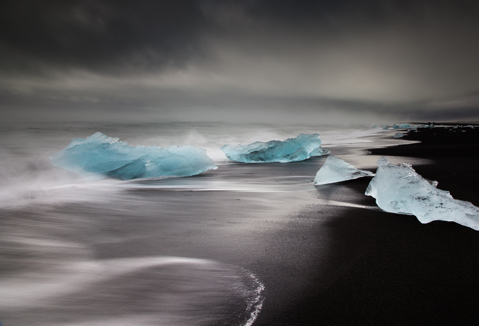
Jokulsarlon, Iceland.

Beware, icebergs can bite back… [Click to enlarge!]

One of the most visited spots along Iceland’s southern coast is the glacial lagoon of Jökulsárlón. Indeed, even at almost 400km from Reykjavik, there is a steady stream of tourists making the arduous coach trip out here and back in a single day which usually ends up as 9 hours in a coach and two to three hours at the lagoon. But despite what little time they get to spend around the lagoon they invariably leave impressed at what they have witnessed.

As mentioned Jökulsárlón is a lake that has formed at the base of Vatnajökull – Europe’s largest glacier – and more specifically at the base of Breiðamerkurjökull, an outlet glacier. There are many complex processes linking these three entities but in essence Vatnajökull is highland ice cap where erosion, glacial motion, snow fall and gravity result in the edges of the ice cap spilling downhill forming what are known as outlet glaciers or glacial tongues. Eventually the outlet glacier meets warm air, ground, or both and collapse under their own immense weight into icebergs – a process referred to as calving.  But words and the science behind them are definitely nothing compared to the sight itself.

I can understand why Jökulsárlón is so popular – thousands of icebergs at the foot of an awe-inspiring glacier – I would have been awestruck too had I not been to Antarctica. Alas however, I have been and so, as impressive as the lagoon is, it left me a little, well, cold.

One of the interesting things about Jökulsárlón is that it vents out via a narrow estuary on to the very top of the North Atlantic and because of this there is a natural tide that pulls the icebergs out to sea. Get there early in the morning after low tide and you’ll be greeted with a sea full of icebergs. It is not a time to go for a swim – some of the larger icebergs can weigh upwards of a 100 tonnes but the power of the North Atlantic tosses them around as if they weighed nothing. The incoming tide also pushes some of the icebergs back onto the beach, grounding them on the black sand. It is truly stunning: A landscape of only black, blue and white. Alas, if you are taking a coach trip out of the capital, you won’t get to see this marvel of nature – as the waves beat rhythmically against the beach and the temperature rises, the mighty icebergs melt and by evening only small lumps remain, the largest the size of a pet dog.

I found myself on Jökulsárlón beach several times trying to do justice to what nature had designed. As can be seen from this image – and the rest in the gallery – the best angles are side on to the sea shooting along the beach. All well and good and I had even bought Wellington boots for this very purpose, which were 1100 miles away back in the UK as I couldn’t get everything into the suitcase! So I ended up playing chicken with the Atlantic: Set up the tripod just out of reach of the waves and begin the task of trying to capture the right shape of wave on the beach at the right time (which is tricky with multi-second exposures), all the while keeping an eye open on the waves coming in to the side of me. Of course, just as soon as I would get in to the swing of things, a rogue wave would come hurtling in and it would be a mad dash out of its path, often having to leave the camera behind perched on the tripod and hoping that there would be camera to return to. Over the course of my visits I discovered a list of handy tips, the hard way.

First, don’t set up the tripod with a thigh-high iceberg right behind you and between you and safety as, when an incoming wave means it time to make a dash for it, the iceberg is somewhat less bothered. You learn a lot about momentum, high centre of gravity, pivot points and just how big a bruise a iceberg can make by crashing full speed into one.

Second, just because you find a nice, solid feeling iceberg you can stand on to raise yourself above the level of the incoming wave, don’t get smug. Given a big enough wave that solid feeling iceberg suddenly becomes far less solid and the thing about ice is that it isn’t exactly a high friction surface.

Third, no matter how far up on the beach you leave your camera backpack out of harm’s way, it won’t be enough. The tide is coming in and you’re engrossed in trying to capture the perfect moment. You end up relying on the goodwill of others to either shout a warning that your backpack is about to get a good wash, or to move it for you.

Fourth, no matter how much you rinse the sand off your tripod after a session you’ll still take half the beach home with you. By the end of the trip my lovely carbon fibre Feisol was making alarming grating noises. Luckily John over at Feisol’s UK distributor was brilliant and had the tripod serviced and back in my hands within a week.

But the biggest thing I learned on my days to the beach was that, despite the bruises and the soaking wet feet, I was having more fun than I’d had in years.

Oh, and not to leave my wellingtons at home again…


Posted in Frame by Frame Tagged , , |

My (Second) Top Five of 2014: The Plane

Today I’m halfway into my alternative top five from this year and is one of the harder-to-find places along the southern coast.

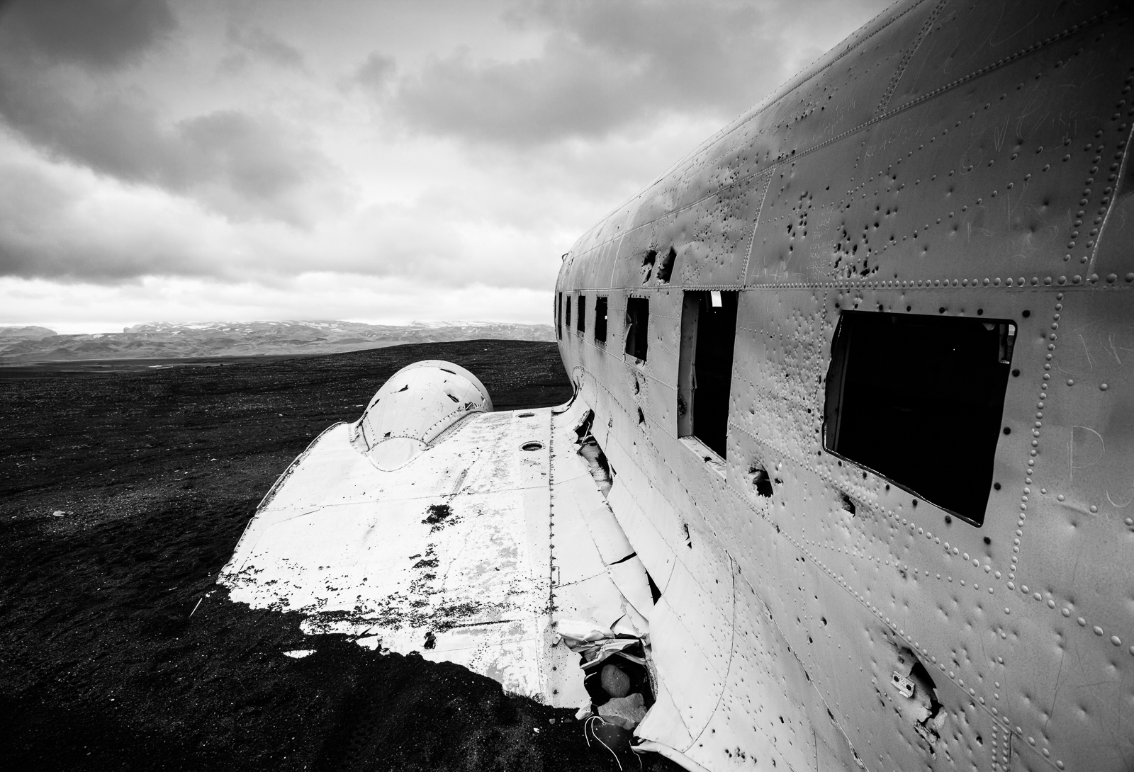
Faith can be an important quality when trying to get the shot...

Faith can be an important quality when trying to get the shot… [Click to enlarge!]

Whilst accounts of the exact date and route – and even the cause – vary some believe the original report in the Icelandic newspaper bear the closest resemblance of the truth. On 21st November 1973 whilst returning from Höfn a US Navy Super Douglas DC-3 was forced to make an emergency landing when heavy icing set in over the Mýrdalssandur sand flats. The plane was able to stay aloft long enough to send out a mayday before eventually eventually coming to rest on Sólheimasandur Beach along Iceland’s southern coast and about 170km from Reykjavik. The crew of seven survived  – surprisingly with no injuries – and were rescued in very short order. The US Navy made plans to recover the craft but these never came to fruition whether due to the weather or the cost. And so forty years on the aircraft still sits on the beach as a silent reminder that Iceland’s  unpredictable weather should not be underestimated.

Finding the wreck requires a combination of planning, keen eyesight and faith. It is not on any map and nor is it signposted and so if you do want to see the wreck for yourself, planning is the order of the day. I had discovered the GPS coordinates of the site and so could accurately locate it on Google Maps. In fact once you know where to look you can actually see an indistinct dark outline of the plane if you zoom right in on the map. But, locating the plane on Google Maps merely tells you were the plane is and, as the old saying goes, it is not the destination that is important, but rather how you get there.

I continued trawling the Internet and found a few descriptions on the route people have taken although distilling the most descriptive of these to its essence effectively left me with “after a long but slight incline on Route 1, turn through a white gate after a green field”. Not exactly confidence building. Still more time was then spent using Google Streetview back and forth along sections of Route 1 and then I found a likely candidate albeit the gate was not white and the field wasn’t particularly green.

So it was facing this gate that I found myself one morning debating if I really wanted to take the hire vehicle off on to the black beach with no actual path to follow and simply drive toward the sea.  Getting lost was not really the issue; getting stuck was. But fortune favours the brave and so off I went.

It was an odd experience. The beach is wide and long and essentially looks as flat as a pancake. Visibility was good but as I continued to drive the landscape didn’t really change much. Planes are quite big and this one was a shiny, silvery lump of metal on an otherwise black background. So where was it? And that is where the faith was required. The beach may look flat, but is wasn’t and  just after what must have been the third thought of giving up, I crested a mound and there it was!

I visited the plane twice, each time for over an hour. In that time three other visitors made the journey out to see the plane. Maybe more did but their faith failed them.

But that is OK; it was nice to be alone with a little bit of history…


Posted in Uncategorized

My (Second) Top Five of 2014: The Falls

Today I’m looking at the second of the alternative top five images from my travels in 2014. These are alternative only in that I’ve already posted about my top five and I like these for completely different reasons.


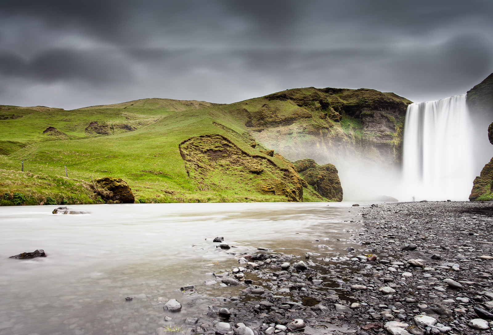
One reason to avoid coach tours: When they've left you have the whole place to yourself...

One reason to avoid coach tours: When they’ve left you have the whole place to yourself… [click to enlarge!]

Iceland conjured up a lot of different emotions as I travelled across the island. Awe is probably the one that most often came up and that is pretty unsurprising given the landscapes to marvel at. Inquisitiveness is probably the next: Why are those mountains all those different colours at once? Why is that beach so black? Why does it rain every five minutes?

But, and it may be something that I shouldn’t publicly admit, but I did begin to feel a sense of the blasé setting in at some point. Yes, as impressive as Iceland is I did eventually inwardly exclaim “Not another waterfall!” That’s OK though, there are a lot of them.

To simplify Iceland’s geography down to its absolute basics, there is a central snow-capped glacial highland region surrounded by lowlands. As winter gives way to spring the glaciers begin the long thaw and water flows in the one direction gravity permits: down. The result is hundreds of waterfalls – literally hundreds – of every conceivable size and shape and even those visitors travelling on a time budget will see at least a few waterfalls if they head out of Reykjavik along Route 1.

One of the most popular of these along the south western coast is Skogafoss. It is popular for a variety of reasons but here’s two. First it is, relatively speaking, close to Reykjavik so even those on a city weekend break can take an organised day trip out to see it. At approximately 200km from the capital you’ll see –and stop at – other sites along the way giving you a full and rewarding day out.

The second reason for its popularity is that it is truly impressive. At 60 metres high its sheer power has a palpable physical effect on you. I visited Skogafoss a couple of times and can attest to how it affects your senses. It is loud. It is big. It is wet and cold. There are no safety barriers preventing you from walking right up to the water pool at its base – although let me know if you try. I got to about 30 metres before the force of the falling water pushed through the waterproofs I was wearing – ones which survived Antarctica – and drenched me to the core. Yes, you don’t just visit Skogafoss, you experience it.

This image captures another aspect of the country I became aware of. Like the majority of the sights in Iceland the falls are free and publicly accessible and if you are prepared to spend a little longer or arrive a little earlier, you’ll spend a lot of time alone with nature. The coach parties beat a rhythmic drum. They arrive, people spill out and get their photographs before the cold gets too much and they get back on board the coach. Maybe a few intrepid tourists take the pathway to the top, but usually not. The coach then disappears leaving about twenty minutes before the next one arrives.

And this image reminds me of all those in-between moments…

Posted in Frame by Frame Tagged |

My (Second) Top Five of 2014: The Expedition

Maybe it is age or maybe just being too pre-occupied with other things right now but my grand plan to reveal my top five images of 2014 hit a bit of a snag yesterday when I suddenly realised that I’ve already posted about them over the past few months! I could of course just run through them again, but where is the fun in that. So I’m going to try again and this post about my second top five. Technically that would make them part of my top ten, but – and this is hard to explain – they are not images six to ten. They are a top five of their own in my mind. So, with that cleared up…

Brattafonn, Iceland.

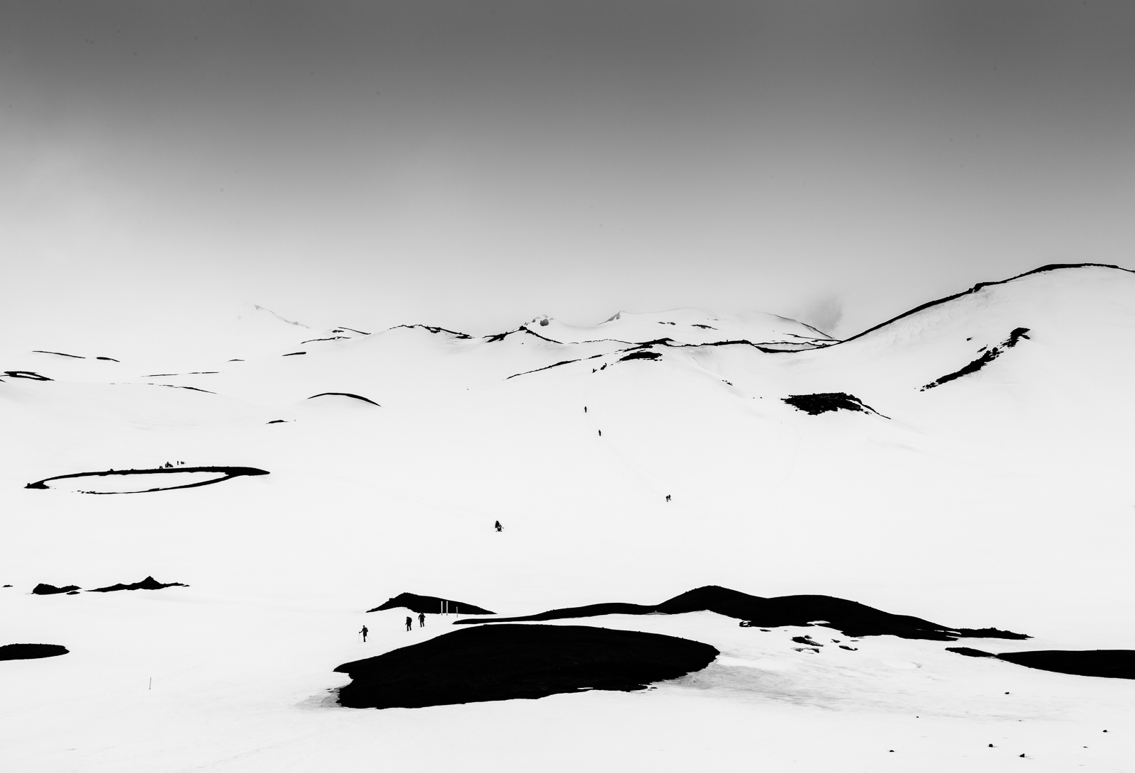
Fimmvörðuháls is not a place that has global recognition, but it could have been a very different story…


Back in 2010 Iceland, which hitherto the World at large had only modest interest in, suddenly found itself a bit of a media darling. The fact the you know exactly why is proof of that, but just in case you have forgotten, it was the year that a rather unimpressive volcano had a minor eruption and – only due to a freak sequence of events – did it have global implications. Yes, Eyjafjallajökull become the household word that no-one mentioned, although only because no-one could pronounce it. At some point an inspired American presenter referred to it as E-15 (‘E’ followed by an unfathomable combination of 15 characters) and the name stuck. So it was rather obvious that, on the travels along the southern coast, I wasn’t not going to see it if I could.

The thing that most people do not know – and I only knew as I researched it – is that there were three eruptions at Eyjafjallajökull in 2010 each with a few weeks of each other. The first took place slightly off centre at the mountain pass of Fimmvörðuháls and was fairly uneventful – even referred to as a ‘tourist eruption’ by the guides – due to the fact that you could pretty much stand around and watch the eruption. It was the second eruption that caused the chaos. You still can’t get to the site of the second eruption, the area being not only officially out-of-bounds, but also because it is geologically unstable and hence not worth the risk. But the site of the first eruption is a different story.

It may have been a ‘tourist eruption, but the ground still steams as the hot ground hot evaporates off the snow. We were hiking up to Magni, one of the two new craters that had been formed and this is the view that greeted us upon out arrival. It is not particularly high up – only 1200 metres or so, but the mountain pass of Fimmvörðuháls sits between two glacial caps and the surrounding peaks cause weather fronts to back up as they struggle to climb over the high ground. The pass is also part of the popular three (or four) day hike between Skógar to the south and Þórsmörk (Thorsmork) to the north. The weather was closing in again rapidly and we were just getting ready to head back down when  a group of intrepid hikers were making their way along the path en route to  Þórsmörk.

This image really sums up one of the aspects of my photographs I most like: It is spartan. I am not keen on ‘busy’ images, I like negative space and how a few details can convey a feeling or a mood. The old adage is that a picture can convey a thousand words, but often you only need a few to make a point. It is this aspect of my work I am keen to develope.

I do envy that they got to stay and experience the power and beauty of nature whilst we had to return down the mountain.

Posted in Frame by Frame Tagged , , |

My Top Five of 2014: Dog Walking a Man

As I’m not going to be around over the Christmas period, I thought I’d share the five images taken this year that I am most happy of.

The idea came to me whilst on a train home at the end of a 61 hour work week: I was fighting not to fall asleep and so began going through some photographs on my iPad in an effort to stay awake. It worked as I found myself flicking back and forth between images trying to decide which I liked more.

I thought I’d share my choice of top five over the course of the week. I hope you enjoy them.

Tel Aviv – June 2014         


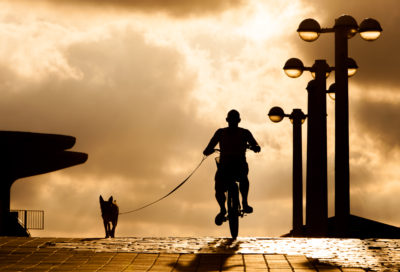
Is the dog keeping up with the man, or the man with the dog? I'll never know for sure but the question keeps making me smile...

Is the dog keeping up with the man, or the man with the dog? I’ll never know for sure but the question keeps making me smile…

This image was taken in Tel Aviv in early June. I was on a training course at the headquarters of one of our vendors. The days were long and we didn’t finish before 6PM each evening which, considering that sunset was just before 8PM, meant heading straight to the local push bike rental station and a mad dash across central Tel Aviv to the beach in the hope of a hour of photography.

If you ever visit Tel Aviv – and you should as it is a great city – the beach is a must: A long golden ribbon of sand stretching from the wall of Old Jaffa to the chic bars and restaurant by the harbour. What I loved about it most was the rhythm – the palpable thrum – of humanity that could be found along its length. The old, the young and the in-between. The athletic, the office worker, the card sharks, the musicians, the friends and the lovers. Everyone was making use of the beach and, as I have described it before, for me it was the heart of the city.

One of the nice things is the beach is also west-facing, so if you like the whole ‘sun setting over the sea’ thing then you’re in luck. But I was after something a little more – well to be honest I don’t know what I really wanted, but something that summed up Tel Aviv. And there was only one thing: Youthfulness. Not of body, but of spirit.

I found a great spot up near the harbour and it seemed that it was a popular path to get down to the beach. It had this great reflection of light coming off the cobbled stones so I set up an waited for the right moment but it became obvious that I may have chosen the wrong spot as there was a near constant flow of people either heading to, or coming back from, the beach. The resulting images were a mass of ill-defined silhouettes with no focus and no real story. Still I waited and people became curious as to why I was sitting in the middle of a path, camera on tripod and not actually taking photographs. So conversations ensued luck was wished. Then it happened.

A young couple appeared over the crest of the path carrying surfboards. It was what I had been waiting for – the essence of Tel Aviv in my mind. There were very few people around and I had a clear definition of them in silhouette (I love shooting people in silhouette). They knew I was photographing them and so we got talking and they liked the image so email addresses were exchanged.

I stuck around a bit longer and I was just thinking of moving on as the light was fading when these two appeared over the crest. It made me smile even as I pressed the shutter. And it made me smile again yesterday after a long and tiring week.

Posted in Frame by Frame Tagged , , |

Ethiopia: Dreaming of a White (and Black and Red) Christmas

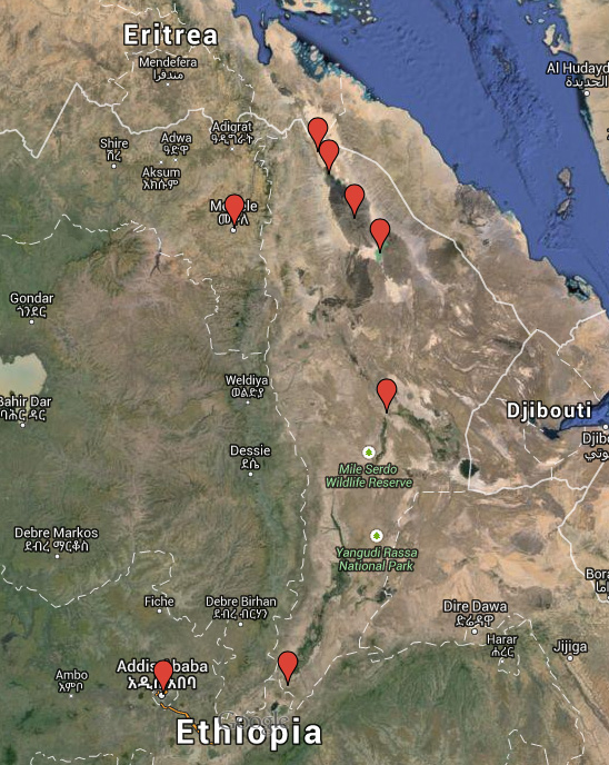
Well, with just twelve days until I leave for Ethiopia and after spending the bulk of yesterday picking and ordering the last of the clothing and equipment, most of the shopping is now complete. All that remains is the medical kit, a plastic funnel for transferring water between containers, some coloured pens and pencils and a few inflatable globes. So with all of that now done I have finally started thinking about the thing that made me want to travel to the remote Danakil Depression in the first place: Landscape photography. 

Starting in Addis Ababa we’ll head east to Awash National Park before heading north and entering “No Man’s Land”

Starting in Addis Ababa we’ll head east to Awash National Park before heading north and entering “No Man’s Land”

It is going to be a packed two weeks as we travel northwards from the capital of Addis Ababa up to the very top of the country and then back again along a loosely counter-clockwise route. As we travel everything will change around us: the landscape, the climate, the wildlife, the people, even the predominant religion will alter as we descend from Addis Ababa at an altitude of 2300 meters to Dallol with an altitude of -130 meters, one of the lowest points on the Earth’s surface.

For me the highlights of the expedition are the three days spent at the Erta Ale shield volcano and the time spent at Dallol. There are many descriptions of Dallol but Wikipedia probably best describes it:

Dallol features an extreme version of hot desert climate (Köppen climate classification BWh) typical of the Danakil Desert. Dallol is the hottest place year-round on the planet and currently holds the record high average temperature for an inhabited location on Earth, where an average annual temperature of 34.5 °C (94.1 °F) was recorded between the years 1960 and 1966. The annual average high temperature is 41 °C (105 °F) and the hottest month has an average high of 46.7 °C (116.1 °F). Dallol is also one of the most remote places on Earth. In addition to be extremely hot, the climate of the lowlands of the Danakil Depression is also extremely dry and hyper-arid in terms of annual average rainy days as only a few days record measurable precipitation. The hot desert climate of Dallol is particular due to the proximity with the equator, the very low seasonality impact, the constance of the heat and the lack of efficient nighttime cooling.

For someone who is as fond of cold weather climates as I am, it will be interesting to see how well I cope with such opposite conditions. The temperature will be further exacerbated by the heat coming off the lava lake at Erte Ale whose surface temperature is a mere 1200 °C

Whilst we spend three days at Erta Ale it is, for all intents and purposes, a single environment. At an altitude of 600 metres there is little else other than the lava lake itself and the black balsaltic lava ground. Getting a good series of photographs here is likely to be as much luck as skill as we will be at the mercy of just how active the volcano is at the time, but I have a series of photographs in my head that I want to try and capture in the limited colour palette of volcanic black and lava red.

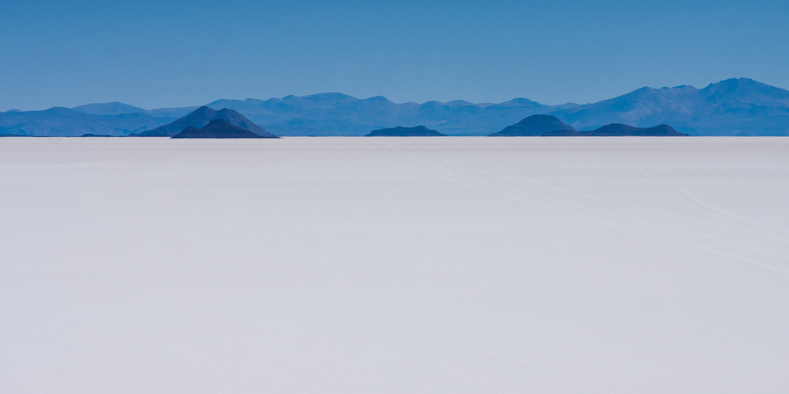
Once we descend from Erta Ale and head towards Dallol the pace will pick up dramatically and photography is going to be more of a challenge as the area offers several different landscapes with only approximately two days to capture something decent. One of the big landscapes is a salt flat much like the Salar de Uyuni in Bolivia although much smaller at only approximately 200 square kilometres. Here I’ll hopefully have a number of opportunities – from the wide vistas of the salt flats themselves to the Afar miners who extract the salt with picks, to the camel trains that take the salt to market. I may even get a chance to try my hand at salt mining in what can only be described as intensely harsh conditions.

Salar de Uyuni, Bolivia.

The Salar de Uyuni salt flat in Bolivia. A similar white Christmas awaits me in Ethiopia.

The volcanic area of Dallol is a sight that still causes me wonder at just how such a place can exist. It is a landscape that would look at home in an old science fiction movie where they have pumped the colours to the maximum and day-glo blues, greens, pinks and yellows all mix together. Lighting here will be a key factor – it has to be right first time as there will be no chance for a revisit.

Another thing that I want to try whilst in the Afar region, and particularly the Danakil Depression itself, is astrophotography. It is not a style of photography I have any experience of and involves its own set of rules and techniques that I know very little about. But the one thing that every astrophotography web site and blog I have visited agree upon is that astrophotography works best when there is no light pollution to obscure the incredibly faint light from distant stars.


Yellow is light pollution and blue is darkness: Jazan on the top border is typical of towns and cities. In the northwest of Ethiopia we’ll have no problems with light. The only light sources are from lava.

Yellow is light pollution and blue is darkness: Jazan on the top border is typical of towns and cities. In the northeast of Ethiopia we’ll have no problems with light. The only light sources are from lava.

Looking at the above image from blue-marble.de – a web site that shows satellite imagery of light pollution across the planet – it is easy to see why the one thing I can guarantee is that – in what Wikipedia and National Geographic call one of the most remote places on Earth – light pollution will not be a problem.

So I have given myself a crash course in astrophotography which in turn has led to having to learn the basics of how to locate and identify the constellations and navigation by the stars. I am hopelessly under-prepared but there is not much I can do now other than make use of the location and hope that what little I have learned will help me produce something I like. Unfortunately however, whilst I would love to take a photograph showing the Milky Way galaxy in the night sky, I believe I’ll be there at the wrong time of year. On the plus side however, to capture some really rich star field images, even the moon can be a problem and most recommendations suggest shooting on nights leading up to and immediately after a new moon. As I start the expedition on the 21st December – the day of the new moon, I’ll have ideal conditions to shoot the night sky – assuming it is not cloudy, that is.

Posted in Destinations, Trip Planning Tagged , , , , |