Tag Archives: Erta Ale

The Danakil Depression: Trip Review Part 5

Today’s post is the fifth and final part of my review of the photographic expedition to the Danakil Depression. Towards the end I talk about my thoughts on what worked and what did not but let’s start by looking at days 10 through 13: The Tigray Highlands. One confusing fact to bear in mind: As we had gained a day by making an early ascent at Erta Ale, our day 10 may well be your day 11. It is hard to know if your trip will also ascend early – I cannot see why not as we weren’t rushing – and so I’ll stick to our itinerary.

Oh, you may also want to see part 1 (travel & Awash National Park), part 2 (Logia & Lake Afdera), part 3 (Erta Ale) and part 4 (Dalol).

Day 10       

Today will be your last sunrise in the Danakil Depression and the stark beauty of the barren landscape. After breakfast and once the 4WD vehicles are packed, you’ll say goodbye to the military and police escorts as they’ll no longer be needed. It also marks the return to tarmac roads courtesy of a foreign mining operation that is has set up outside Hamed Ale. Whilst making the journey smoother, it does serve as a reminder that this once remote and untouched land is no longer quite so remote, or untouched. Given that the Afar people here derive their income from two sources – the salt mining caravan trade and tourism – it is difficult to see how the new-found accessibility will be a good thing for the local ppoulation. It makes the transport required for commercial mining far, far easier which has two critical effects: (1) Make the traditional method of mining little more than a side-show and (2) it will complete the process of killing the wonderful Dalol geysers.

Shortly after leaving Hamed Ale you’ll stop to look at a geologic curiosity – fossils of coral and other marine life. In what is most definitely a dry and arid wilderness this gives a fascinating insight into the land upon which you are now standing. If I understood correctly the coral that you see is three million years old, although there have been many incursions of the Red sea both before and since. It also lends more evidence as to why the salt flats are here: Geologic activity causes the land wall separating the Danakil Depression from the Red Sea to sink, the sea rushes in and then the same geologic activity causes the land wall to rise, stranding an inland sea that evaporates leaving marine life and salt. Repeat the process over a few tens of millions of years and, well, you just spent a few days seeing the result.

A lump of three million year-old coral - one among many just found lying around the landscape. [Click to enlarge!]

A lump of three million year-old coral – one among many just found lying around the landscape. [Click to enlarge!]

You’ll then set off again and begin the climb into the Tigray Highlands. Aside from a couple of short stops there isn’t a lot to do. You’ll stop at Berhale, the terminus of the camel train that you saw at the salt flats. Whilst the isn’t a lot in the way of landscape here, a couple of things did strike me. First you’re beginning to see the life of the salt industry from birth to death and if story-telling photography is your interest, this is a wonderful opportunity, not least as it may be gone in a few years time. Second, you’re leaving the nomadic Afar behind as the makeshift tent-like structures are replaced with brick and concrete buildings.

At the end of the two-day camel caravan is Berhale, a town whose growth is due to the traditional salt industry. Here the salt is loaded onto trucks for country-wide distribution. [Click to enlarge!]

At the end of the two-day camel caravan is Berhale, a town whose growth is due to the traditional salt industry. Here the salt is loaded onto trucks for country-wide distribution. [Click to enlarge!]

Concrete and stone buildings replace the nomadic Afar's tent-like structures. [Click to enlarge!]

Concrete and stone buildings replace the nomadic Afar’s tent-like structures. [Click to enlarge!]

Chances are that you’ll stop at Berhale for lunch which for us was somewhat bittersweet as we said goodbye to the marvellous cook Muscara. Over that past few days we had all experienced living well outside our comfort zone but the good food (and good coffee!) definitely took the edge off the discomfort.

After lunch you’ll continue the ascent heading toward your destination, Wukro. Again there are a few stops to look at some more geologic curiosities – more marine fossils albeit this time at 2,000 metres up in the mountains – and you do begin to get a sense of how high you’ve climbed throughout the day.

The iPhone 6 made taking panoramic shots so easy that I never used the panoramic head on my tripod. [Click to enlarge!]

The iPhone 6 made taking panoramic shots so easy that I never used the panoramic head on my tripod. [Click to enlarge!]

Whilst there is a stark contrast between the dry and barren landscape at Dalol and green and farmed landscape of Tigray, the people are an equally stark contrast. As we approached Wukro, a place that can best be described as a large town, we saw an increase in activity: land being farmed, livestock being herded and children going to school. There were definite signs of a recognisable, familiar societal structure and as we arrived in Wukro we could see schools, hospitals, shops and hotels appear. Also in evidence were signs of electricity and sanitation infrastructures. In short, the “roughing it” phase of the trip was over – a fact made all the more real by finally arriving at our hotel.

The rest of the afternoon was spent as free time. For many of us the time was spent re-acquainting ourselves with all the luxuries that a bathroom offers and having the first proper wash in a week! I managed to gain access to the roof – not so hard as I only had to ask – and set up the solar panel. Whilst I had started the journey with a camera battery charger that could work off either mains electricity or solar panel, the rather cheap construction had seen it fail at Erta Ale. I had also forgotten to bring a mains charger for my MacBook Air and so was reliant on the battery pack that came with the solar kit to keep my laptop alive so I could begin key-wording photographs.

After dinner, most of us headed off to bed – after several days of pre-dawn mornings and variable sleeping conditions, the thought of a linen-covered bed was too enticing to ignore.


Day 11

After the first non-dawn start in over a week and a leisurely breakfast you’ll be off out into the Tigray highlands. At an altitude of 2,400 metres the difference in temperature is obvious and during the day you’ll not have to endure anything above 30°C which means you’ll not have to worry about taking the electrolytes any more. Also gone are the wide panoramic vistas, replaced with an undulating hill-scape.

One of the oldest of the Tigray rock-hewn churches is Abrahat Atsebah. [Click to enlarge!]

One of the oldest of the Tigray rock-hewn churches is Abrahat Atsebah. [Click to enlarge!]

One of the most visited sights in the area – and one you’ll almost definitely see – are the centuries-old rock churches, so called as they are quite literally caved into the mountain side. Unlike the Muslim Danakil region, Tigray is predominantly orthodox Christian. Those interested in architectural photography will have fun trying to capture the essence of the churches and if people are more your interest then there is plenty of opportunity for portrait/candid work.

A priest at the Wukro Cherkos rock church. [Click to enlarge!]

A priest at one of the Tigray rock churches. [Click to enlarge!]

After the church we went for a drive. For those into portrait work one of the nice things about Tigray over Danakil is that there are always people out-and-about tending to some task. As we drove we stopped a couple of times as the mood took us. One stop was to look for some geologic curiosity – more fossils – although most of us were more interested in the farmer coming up the road with cattle and donkeys. We were spotted by some school children and so there was lots of activity and posing for photos. Further on we stopped to watch some farmers thrashing hay although I was distracted by feeling increasingly ill. Next we stopped at a town although, by this point, I was really feeling awful (the cause later tracked down to a combination of high altitude and alcohol!) and so had to return to the hotel early.

The signs of agriculture can be seen everywhere in Tigray. [Click to enlarge!]

The signs of agriculture can be seen everywhere in Tigray. [Click to enlarge!]

It is hard not to take portraits when there are so many eager volunteers! [Click to enlarge!]

It is hard not to take portraits when there are so many eager volunteers! [Click to enlarge!]

Talking to the others later on, there was a general feeling that more could have been done with the day – a feeling I shared at the time. The reality is that it was still a four or five hour day and more had been planned – another rock church – but we were ahead of schedule by a day so I’m guessing that some of the activities had to be moved to give us something to do on the spare day. Thinking of it that way you can’t really blame the organisers – I would imagine that under normal circumstances it would be hard to organise outings for a group of people at short notice – and we had not been in normal circumstances.

But if you do find yourself at a loose end then a couple of the group paid one of the drivers a little extra to head back out to go and see more of the area. The expedition lead apparently wasn’t too impressed once he found out, but Tigray is far safer than Danakil – not needing a military escort was evidence of that – and it kept (the paying) clients happy. I would certainly have gone had I not been ill and so suggest that, if you do find yourself bored – and Wukro doesn’t have a lot to offer – it could be worth trying to organise a side-trip.


Day 12

Due to the earlier change in schedule today turned out to be a spare day for us – if your expedition keeps to schedule than everything we did yesterday and today will be condensed into a single, busy day for you.

After a very leisurely start we headed out to the second of the rock churches, Wukro Cherkos. Whilst it was interesting I was more interested in trying to cover some portrait work – something I tried in Israel – so I stayed outside for most of it trying to capture some candids.

Waiting. And watching. [Click to enlarge!]

Waiting. And watching. [Click to enlarge!]

After the church we returned to Wukro to visit the local market. It was good fun and certainly gives plenty of opportunity to take portrait/candid shots as well as pick up some souvenirs. You’ll also see the final stage of the salt industry you saw started in Danakil as most of the stalls are selling spices and, of course, salt.

A stall at the Wukro market selling spices and, of course, salt. [Click to enlarge!]

A stall at the Wukro market selling spices and, of course, salt. [Click to enlarge!]

After the market you’ll make the relatively short journey to Me’kele – Tigray’s capital city – in time for lunch. To all intents the expedition is now over and you’re going to be left to your own devices for the remainder of the time. I did struggle to get anything worthwhile (photographically) out of the afternoon as there’s not a landscape in sight, but if you’re interested in portrait or urban work the you’ll have busy afternoon.

The markings of an Orthodox Christain women. [Click to enlarge!]

The markings of an Orthodox Christain women. [Click to enlarge!]

Day 13

In the morning you’ll take a domestic flight back to the capital Addis (by now you’ll have dropped the Ababa part) and back to the hotel you started from almost two weeks earlier. As everyone’s international flight leave at different times you’ll also be saying a lot of goodbyes.

Depending upon when you leave – mine was a 2AM flight the following morning – and you’re tolerance for boredom you likely be out in the capital for at least part of the afternoon. As a city there is plenty of opportunity for portrait and urban shots.


=-=-=-=


So, that is it: An overview of the only expedition to the Danakil Depression that concentrates on photography and currently the only one that spends a significant time at the Erta Ale volcano. At approx. £5,000 including flights it is certainly not cheap, and conditions for the most part are basic to say the least, so the most important question is: Do I recommend it?

The short answer is: It depends.

Before I give my views it is worth pointing out the expedition type is described by VolcanoDiscovery (the organisers) as “active volcanoes, photography, adventure” with a character that is “long, bumpy 4×4 transfers, possibly extremely hot temperatures in the desert, intense exposure to sand, salt and dust, very basic sleeping and washing conditions while outside established towns”. This, in my mind, is an accurate description of what I experienced.

Whether I recommend this trip depends on one important element: You.

Over the previous four parts of the review I have described the accommodation and the sanitary facilities at each stage of the trip and, if you haven’t already done so, I strongly urge you read these as, for some of you, it will be enough to persuade you that you’ll have a horrible time. For half the trip there are no toilets, no washing basins, no soap and certainly no showers. For most people it will be the sanitary conditions that dissuade them. The sleeping conditions are also, for half the trip basic – sleeping in rock huts on volcanic ash covered ground, for example. Even when in hotels bear in mind that this is Africa. For me, the rooms were great – clean and comfortable – but I know people who would have been shocked.

Most people who embark on a expedition like this are going to be outside of their comfort zone and so more stressed than usual. You’ll need to take a sense of purpose with you. I didn’t travel because I was half-way curious about volcanoes; I travelled because I really, really wanted to get some landscape shots of this stunning place. Others travelled because that’s what they do – travel to volcanoes around the World. Having a strong purpose for going overrode the discomfort. A sense of humour helps too: We had a great group of people who all seemed to focus on the positive aspects and were willing to make the most of the situation they were in. People like that make a big difference.

So, to summarise:

Reasons to consider this trip:

  • Excellent landscape photography.
  • You have a (more than passing) interest in volcanism or plate geology.

Reason to not consider this trip:

  • Wildlife, urban or architectural photography.
  • Portrait photography – as there are better opportunities elsewhere.
  • You simply want to see a volcano.
  • You struggle under adverse conditions.
  • You like comfort.

The highlight of the expedition, by far is the time spent at the Erta Ale volcano and lava lake. I thought Antarctica was stunning and could not be surpassed for raw, ethereal, beauty, but standing at the edge of a lake of boiling lava is an event I will carry with me for ever.

After the lava lake the next most impressive location is Dalol which is, from what we were told, in the process of disappearing due to the underground volcanic fissures that drive the geothermal activity being damaged by a potash mining operation in the area. As striking as Dalol hot springs are they are not a compelling ‘headline’ destination in their own right (at least in their current state), although there is an argument that the fact that they, and the local salt mining using traditional methods, are both under threat from extinction make them worth seeing as soon as possible.

In my opinion, the other sights we saw are ‘add-ons’, convenient sights along the way. It would have been nice to have more time at Lake Afdera, simply to get some varied landscape shots, but again, it is a stopping point en route to the main attraction.

The weakest part of the trip for me was the time spent in Tigray. Some of this may be due to the fact that we had just spent several days looking at some stunning landscapes, but still, I just didn’t find it engaging.

Aside from the locations it is worth mentioning some other aspects of the trip’s organisation.

What worked:

  • Small group.
  • Geologist guide.
  • Good drivers.
  • Good cook.

What didn’t work:

  • No generator.
  • Time spent in Tigray.
  • Lack of mineral export licenses (but you may be lucky and sneak some pieces through upon exit).

What’s essential to take:

  • Good hiking boots.
  • Electrolytes – water alone will be dangerous.
  • More camera batteries/cards than you think you’ll need.
  • Mosquito Repellent.
  • Toilet tissue/wet wipes/alcohol-based sanitiser.
  • Gas mask.
  • Wide-angle lens – 17mm on a full-frame body is perfect.


All of the trips I undertake get rated in an essentially simple fashion: Knowing what I now after returning, and assuming that nothing could be changed, would I spend the same money again to go a second time? Erta Ale alone makes the answer ‘yes’. Is that a recommendation?


Posted in Destinations Also tagged , , , , , , |

The Danakil Depression: Trip Review Part 3

Today post is the third of five continuing the Danakil Depression trip review (from the perspective of a photographer) and talking about the part of the expedition that was of most interest to me: Visiting the Erta Ale volcano and lava lake. Lots of pictures and some video (although please forgive the constant howl of the wind). You may also be interested in part 1 and part 2 of the review.

Days 5 – 6

As both days were spent in a very similar vein – at the lake – I won’t bother with a day-by-day breakdown.

You’ll be very well rewarded for making pre-dawn starts. It does help if there are like-minded people on the trip – and I was lucky to have a shooting partner on mine – but I suspect that being this close of a volcano means that wild horses wouldn’t keep you away!

Probably my favourite shot of the lake. [Click to enlarge!] (17mm, 1/10sec @ f/9.5, ISO 100, stacked ND grads)

Probably my favourite shot of the lake. [Click to enlarge!]
(17mm, 1/10sec @ f/9.5, ISO 100, stacked ND grads)

During the daytime, the sky is a rather non-descript light blue which doesn’t really make for interesting shots. Dawn however is a different story and purple will be the dominant colour. You’ll still need to use filters as, even in the pale dawn light, the sky is several stops of light above the foreground and you may even want to trying stacking a couple of ND grads. As with most dawn shoots you’ll only have a couple of minutes in the ‘sweet spot’, but luckily you have two dawns to try and capture the moment.

As you arrived late at night your first dawn is also the first time you’ll get to see the landscape around the lava lake and there are a couple of close-by high vantage points – a good one can be seen in the above photo on the right, the wide angle of the image making it appear more distant than it is. The lake is roughly ovoid and is approximately 65 metres in diameter making a wide angle lens – 17mm on a full frame body – pretty much ideal.

From the nearby hill you get a good view of the landscape around the lava lake. [Click to enlarge!] (35mm, 1/2sec @f/8, ISO 100)

From the nearby hill you get a good view of the landscape around the lava lake. [Click to enlarge!]
(35mm, 1/2sec @f/8, ISO 100)


The lake you see is the top of magma column 47 kilometres tall and is in a constant state of flux as the convection currents within the magma column bring molten rock to the surface and the centimetres-thick crust gets swallowed back below the surface. Whilst you are now standing right next to an erupting volcano, the geology of the region means that there isn’t a capped magma chamber and therefore there isn’t a significant amount of pressure build-up. The result of this is that Erta Ale spends much of its time gently simmering away with constantly changing patterns of orange moving across its surface. But it does go though cycles of increased activity and on the second day we were there the lake had entered some kind of prolonged activity whereby periods of simmering were followed by the ‘fountaining’ of lava resulting in spectacular shots. We did try and work out an interval between the fountains, but soon gave up just happy that there were several of them per hour. So it is worth being persistent and visiting as much as you can which I’m sure that you will, but I mention this as not only did one couple leave after the first day (presumably because they had seen enough and become bored) but one of the guys interested in photography and geology also returned to the base camp after the same day stating that “it won’t get any better than this”.

Much of your time at the lake will be spent watching and waiting and so keeping the gas mask to hand and having at least two litres of waters is important as, not only is the sun pounding down upon you from above, the heat coming off the lake’s surface is intense.

The lake surface is a constantly moving mass of boiling, molten rock. [Click to enlarge!] (85mm, 1/750sec @ f/4.5. ISO 100)

The lake surface is a constantly moving mass of boiling, molten rock. [Click to enlarge!]
(85mm, 1/750sec @ f/4.5. ISO 100)

Erta Ale can have moments of breath-taking wonder... [Click to enlarge!]

Erta Ale can have moments of breath-taking wonder… [Click to enlarge!]


Even when the lake is just simmering away, there are little bursts of activity as gas in the magma upwell escapes and I and the others spent a lot of time during the daylight hours attempting to capture the interesting shapes. The problem is that you really can’t predict where or when the gas will escape and as the event can last for as little as a second – often less – you have to keep alert. I found having two cameras really handy, a full-frame body with a 17-40mm lens and a cropped body with a 100-400mm lens, as that way I could quickly zoom in capture details when gas was escaping whilst keeping the 17-40mm set up for more usual landscape shots. The 100-400mm lens was overkill and 200mm would have be more than enough.

Your biggest issue will be the heat haze produced by 1200°C lava. Don't underestimate how many shots it will ruin... [Click to enlarge!]

Your biggest issue will be the heat haze produced by 1200°C lava. Don’t underestimate how many shots it will ruin… [Click to enlarge!]

One of the things that you’ll need to be aware of is that the heat from the surface is so intense that your biggest problem will be the heat haze. During the end-of day review after the first day at the lake I was very dismayed to find that the majority of the shots appeared out-of-focus. Indeed I thought that the auto-focus system was damaged. In fact of the 1000+ shots I took of the lake over the time there only around 80 of them are sharp enough to use. I was talking to one of the other people after the trip and she has had worse luck than me. You’re not going to be able to do anything about this in post production and so avoid disappointment I can only suggest three things:

First, shoot lots! I took over 1000 shots and I ran out of memory cards, having to resort to my emergency 4GB ones and borrowing a card of someone. The rule is simple: take enough shots and some are bound to be usable. I’m not suggesting a blind ‘photograph the hell out of it’ approach, but even with the composition set up, the heat haze will be the wild card. Shoot the same scene enough and, as the wind changes direction – even for a moment – the heat haze will shift allowing usable shots to be taken.

Second – and really an extension to the bit above about changing wind direction – I think shooting into the wind likely resulted in more heat haze and hence more unusable shots. Of course, the composition will determine which direction you shoot for landscape work but if capturing close-up abstract shots of the orange against the black crust, moving around the lake’s edge may help a bit.

Third, you’ve got three nights and two days up here and then you’ll be gone so make every minute count. One of the benefits this expedition has over the others I could find (certainly in 2014) is that you have access to the lake in various lighting conditions – night time, day time, dawn and dusk. The other trips only give you a single night – great for abstracts, not so good for landscapes.

When night falls the two-colour nature of the landscape takes over. [Click to enlarge!] (55mm, 1/15sec @ f/4.5, ISO 200)

When night falls the two-colour nature of the landscape takes over. [Click to enlarge!]
(55mm, 1/15sec @ f/4.5, ISO 200)

The guy who thought that day one was the best it would get (and so left) was, of course, wrong and missed some stunning shots as the second day saw the lake fountaining lava. Most of the group didn’t bother getting up pre-dawn to head over to the lake to see the sun rise above the caldera wall, again missing not only some stunning photography, but one the best spectacles nature has on offer. It may seem rather presumptuous of me to suggest that you would do anything other than make good use of the time but the combination of dirt, dust, heat, no sanitation, mice in the huts and lack of proper sleep can make anyone’s resolve weaken. Also, if you’re travelling as a couple or group, there may be other pressures too. But you’ll likely never be back here again so it is worth making use of the time.

The expedition doesn’t really provide a schedule of events for these two days which is ideal for photographers but perhaps less so for non-photographers. Saying that there are other things to see, the most notable of which is a hornito – or lava dome – in the nearby second crater. For our visit the hornito was simply steaming away although it also has periods of fountaining activity that can be impressive. At an altitude of 600 metres you’ll have some panoramic vistas too. But I suspect that the lava lake will be your focus.

Although quietly steaming away when we visited, the hornito is known to fountain lava too. [Click to enlarge!] (105mm, 1/250sec @ f/4.5, ISO 100)

Although quietly steaming away when we visited, the hornito is known to fountain lava too. [Click to enlarge!]
(105mm, 1/250sec @ f/4.5, ISO 100)

On the last evening there was a bit of a commotion when one of the military spotters thought that they saw some activity in the DMZ. At the time we were standing atop the hightest point next to the lava lake (see the dawn photo at the top of the article) and so were pretty exposed. Although unlikely to have been anything the military escort we had decided it would be better to descend and by the time we had out gear together and began to descend we passed three of the guards in sniping positions. It was a sobering reminder of where we were and just how close to the border.

OK, so this was a staged shot for a bit of fun - and he loved my sunglasses. But seeing three of the military in position for real on the second day at the lake was a sobering experience and a reminder that this is still a hotly contested area. [Click to enlarge!]

OK, so this was a staged shot for a bit of fun – and he loved my sunglasses. But seeing three of the military in position for real on the second day at the lake was a sobering experience and a reminder that this is still a hotly contested area. [Click to enlarge!]

We were still allowed to remain at the lava lake so it wasn’t the end of shooting (photographic, that it) and for the next couple of hours we busied ourselves making sure the we had captured everything we were after.

Four of us on the trip as close to an eruption as we'll every want to be! [Click to enlarge!] 50mm, 2 sec @ f/4, ISO 400

Four of us on the trip and as close to an eruption as we’ll ever want to be! [Click to enlarge!]
50mm, 2sec @ f/4, ISO 400

That evening we also had a reminder of how lucky we were to be on this expedition instead of one of the shorter four/five day ones as around 10PM a large group of around 25 people turned up and headed out to the lake. They were there for a couple of hours and then gone before we awoke at 5AM the next day. They missed so much of the beauty and spectacle of this amazing place.

Two Afar military guards stand on watch as night falls. [Click to enlarge!] (47mm, 1/15sec @ f/8, ISO 100)

Two Afar military guards stand on watch as night falls. [Click to enlarge!]
(47mm, 1/15sec @ f/8, ISO 100)

So you want to see a volcano?

Well, who wouldn’t. But after visiting the Bolivian Altiplano in 2010 and Iceland in mid 2014, both of which are overflowing with volcanoes, why did I – and why may you – want to visit Erta Ale? After all, it is not exactly the most convenient volcano to visit.

The answer for me was simple although perhaps hard to explain but in essence I want to see landscapes that show the scale and power of nature on a vast and unbelievable scale. And, of the elemental forces of nature, the volcano best represents just how immense and powerful nature can be. But to really appreciate the majesty of a volcano I wanted to see an eruption, I wanted to see lava flowing and I wanted to have the experience of being as close to this process as I could get whilst having a reasonable chance of surviving. The problem is that volcanoes don’t really erupt on demand and so trying to plan a trip to one isn’t an easy task.  But it can be done.

Erta Ale has the distinction of being one of only six known persistent lava lakes on the planet and although not the biggest (that would be Mount Nyiragongo the Democratic Republic of the Congo – or DRC), it is the oldest having been in permanent motion since 1906. For me, the key part here is persistent.

Staring into the abyss. [Click to enlarge!] 105mm, 1/500sec @ f/8, ISO 100

Staring into the abyss. [Click to enlarge!]
105mm, 1/500sec @ f/8, ISO 100

It might not be the largest of the lakes but at 60-70 metres in diameter you’ll certainly be impressed. Also, despite the apparent choice of lava lakes to visit your options are constrained. As of the end of 2014 Mount Nyiragongo, within the Virunga National Park, is still closed after a recent civil war; Mount Erubus in Antarctica is off limits to most; Kilauea in Hawaii has succumbed to health and safety worries and is definitely more a tourist attraction than a wonder of nature; and Ambrym in Vanuatu, whilst certainly very active, is not only fairly remote but the lake’s surface is about 500 metres below the crater rim making it a ‘view from afar’ experience for most people. The sixth and newest lava lake, Lake Nyamuragira, is also in the DRC and part of the same volcanic chain as Nyiragongo. But it is not yet fully persistent and very small.

So, if you want to have as much guarantee as possible that you’ll see an active volcano ‘doing its thing’ then Erta Ale is really your only option. But you better be quick. Small-scale tourism to the area has been increasing year after year despite the uncomfortable conditions and high cost. However with the construction of a road to Dalol now complete one of the main obstacles for mass tourism – access to the area – has been removed. Erta Ale may still require effort to get to, but it is no longer, as National Geographic have described it, one of the most remote places on Earth.

This may be great for the local economy but as more tourists arrive, the safety aspects of an unprotected hole full of molten rock will obviously become a concern and I can see safety barriers being erected. And that it not really something that will enhance any landscape photograph.

The lava lake at dawn is surrounded by a fragile lava landscape with its own unique beauty. [Click to enlarge!] (20mm, 1/15sec @ f/8, ISO 100)

The lava lake at dawn is surrounded by a fragile lava landscape with its own unique beauty. [Click to enlarge!]
(20mm, 1/15sec @ f/8, ISO 100)

You can spend hours watching the lake's surface constantly shifting, separating and reforming. It is almost hypnotic, or that could just be the gas! [Click to enlarge!] (35mm, 1/10sec @ f/5.6, ISO 100)

You can spend hours watching the lake’s surface constantly shifting, separating and reforming. It is almost hypnotic, or that could just be the gas! [Click to enlarge!]
(35mm, 1/10sec @ f/5.6, ISO 100)

Posted in Destinations Also tagged , , , , |

The Danakil Depression: Trip Review Part 2

Today’s post continues the review of the 13 day expedition to the Danakil Depression in northern Ethiopia. If you’ve missed it, part one can be found here.

Before talking about the third day it is probably a good time to mention an aspect of the trip that, if you travel alone, you have no control over: The people you travel with. Travel with the right people and the problems that arise can even be fun. Conversely travelling with people who aren’t enjoying themselves can really ruin the experience.

Being a solo traveller I am used to being dumped pretty much wherever there is space for me and I’m generally OK with that. Most of the people I meet travel as couples or in groups and so obviously they want to stay together which leaves spaces here and there that solo travellers then fill. So, perhaps because we were native English speakers, I ended up with an American couple, who even by day two were showing signs of perhaps realising the conditions that they had expected and the conditions they were experiencing were somewhat different. After a day in the 4WD with them being short with each other, followed by awkward silences, I asked to be moved to another vehicle. I can’t criticise them for being bothered about the sanitary conditions – if that is what the issue was – the conditions were getting worse, and they did manage to stay on the trip for a few days more, when the sanitary conditions became as bad as they can get. But I didn’t want my trip ruined by a bad atmosphere. They problem is that when you ask to be moved like that, you’ll likely cause offence.

Anyway, back to day three…


Day 3

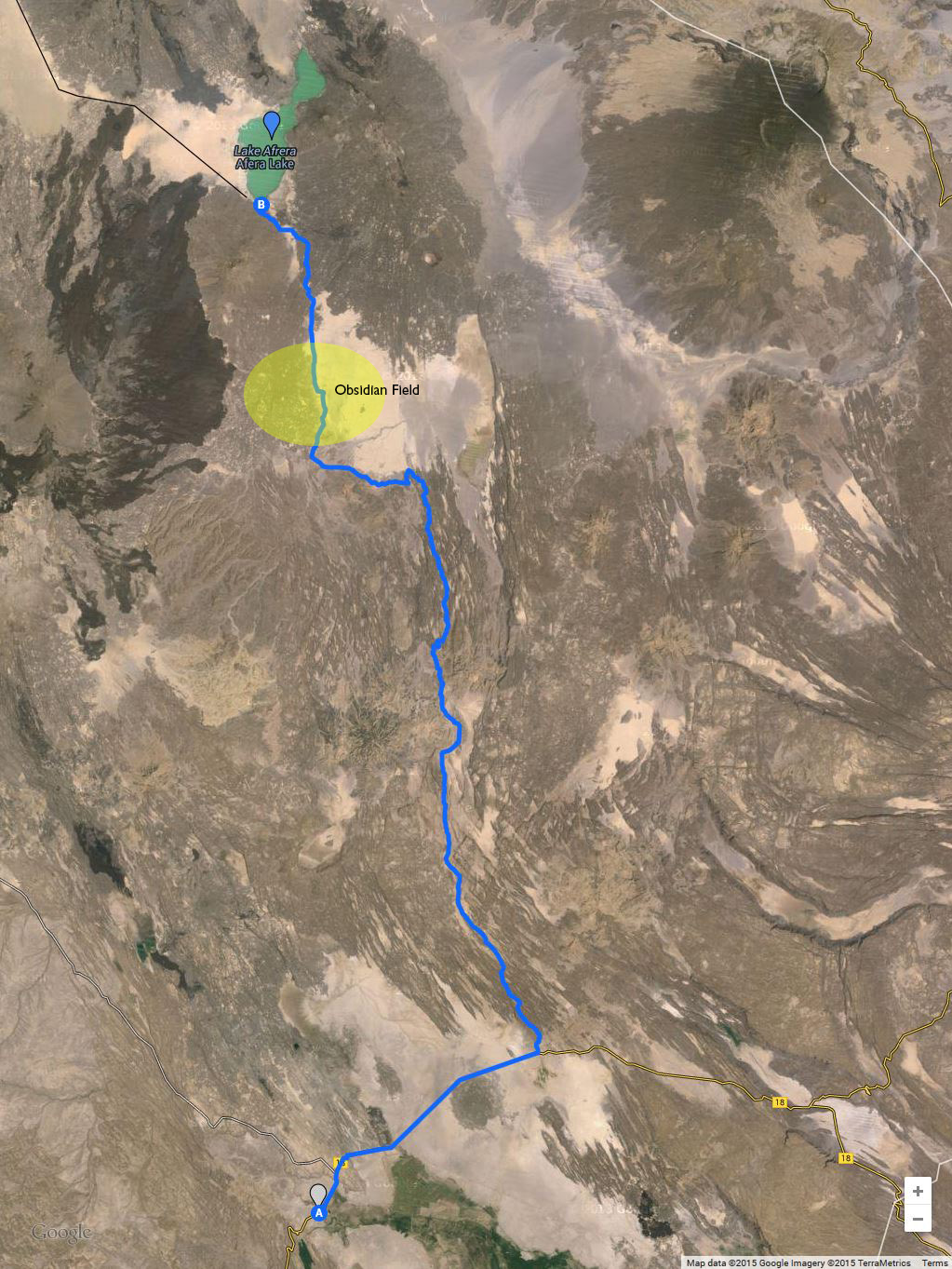
Day 3: Logia to Lake Afdera

Day 3: Logia to Lake Afdera

A new event occurred after breakfast. Enku – our guide – made a point of getting us to all take rehydration salts. Over the past couple of days we have been slowly descending from Addis at about 2,500 metres altitude to Logia at 900 metres. But today will see us descend even further and the relatively cool temperatures – somewhere between 25°C and 30°C will increase as we descend. In retrospect this is one of the most critical things to remember on this trip – keeping hydrated is very important and water will not be enough, you will need rehydration salts. You’ll likely be given the ones we were which, whilst I didn’t mind the taste too much, others were less keen on. In any event buy your own before travelling as you’ll really need to keep taking them until you return to the highlands on day 10.

Today you’ll pass through Logia and soon after turn off highway 2 and head north to Lake Afdera (as local maps refer to it), a journey of 200km. This has only recently become a modern tarmac road – another sign of Chinese investment. The most immediate change is that the huge number of transport trucks drops sharply.

Once of route 2, the roads are much quieter, so much so that whilst lying down to take this shot some of the others were in the middle of the road dancing to the radio... [Click to enlarge!]

Once off route 2, the roads are much quieter, so much so that whilst lying down to take this shot some of the others were in the middle of the road dancing to the radio… [Click to enlarge!]

You will still see a few as Lake Afdera is the base of a commercial salt mine, but there is nowhere near the volume that you have just experienced over the past two days. One of the highlights for me was that shortly after lunch we stopped at an obsidian field. I’ve indicated its approximate location on the map but it’s worth checking that you stop there as I suspect that we only did as the trip we were on had an emphasis on volcanism and geology. I found it impossibly difficult to photograph and do it justice but it shimmered as the inky black lumps of obsidian – many as big as your forearm – caught the sunlight. Just be aware that you do need a mineral export license to take some home as a souvenir and they are quite thorough in scanning your bags at the airport. Even so, I managed to sneak a few pieces through. If this is important to you however, insist on having an export license before you travel as you can’t get one at the airport.

Again we arrived close to the end of the day. Leaving earlier (at the time we had planned) would have made a difference as it would have given us time to scout out locations for sunset. As it was we had to rush around to find something. Here there are large man-made salt fields where saline water is left to evaporate and catching the sunset in these would likely be an interesting composition, but you may be short on time to find one – a composition that is. The shoreline by the lake may be more interesting although standing on the shore facing the lake puts you looking east and so the sun unfortunately sets behind you, but on the plus side that does mean sunrise will be good. There are a couple of jetties out into the lake so silhouettes are an option.

Tonight we exchanged rooms for tents on the banks of the lake which was wonderfully picturesque but had its own challenges not least of all it meant that you will see, hear and probably feel mosquitoes. Mosquito repellent is a must. The second challenge is that, you are now below sea level and, at an elevation of -102 metres, you will have gone from the relatively temperate climate at Logia to a hot and humid one. There are natural hot springs close by and you can take a refreshing dip in them to cleanse yourself, but as soon as you get back out you’ll feel the heat again. Mixed groups need not worry; there are conveniently two hot springs and so there’ll be a ‘his’ and ‘hers’. To be honest it is worth taking a dip even if you do get all sweaty again immediately afterwards. If you’ve never bathed in naturally heated water it is an experience to keep with you – it is not just hot water but rich in minerals too. The men may also be sharing the hot spring with local salt workers and due to my timing I ended up sharing it with the Muslim workers who were cleansing themselves for evening prayers. Doing this will likely make you feel less like a tourist. It will also introduce you to the wonders of the volcanic nature of the Danakil region. In the movies volcanoes bring destruction and chaos, however they also bring life and fertile lands.

After a long day in the 4WD you'll be in time for sunset. [Click to enlarge!]

After a long day in the 4WD you’ll be in time for sunset. [Click to enlarge!]

The third challenge, and this is the one that most people struggle with, is that the concept of a toilet – in fact any sanitation – no longer exists. The camp did have a hole in the ground made private by sheets of corrugated iron, but there was a gut-wrenching smell emanating from it. So when we asked about what to do about toilets, and the reply was a hand wave gesturing into the jet-black night, we all just accepted it. Now I am not going to delve into the details but before you spend around $6000 (by the time you include flights etc.) to come on this kind of expedition, you owe it to yourself to fully understand what you are letting yourself in for and whether you are prepared to cope.

You’re going to need a head torch as both hands need to be free. The torch will serve a double duty in both allowing you to see where you are going and what you are about to stand in (remember that your little group is not the only one who needs to answer the call of nature – there will be others too). It will also act to warn others who may inadvertently approach on a similar mission to you that you are already ‘on site’. You’ll also have to become used to the squatting position – not a natural position for many Westeners – and so finding something to prop yourself against may be useful. Make sure that you bring toilet tissue, moist wipes and some kind of anti-bacterial hand lotion as there will be nowhere to buy these. And, perhaps the biggest challenge is the mental one; accept that for most of man’s history this is how the ‘act’ was done. Also, console yourself that no matter how discomforting you may find this, if you limit yourself to once per day, you will only have to do it five more times.

And just to reiterate the point: If the above description of going for ‘a poo’ in nature is at all horrible to you, remember that you are paying a lot for the privilege. The good news is that everyone else you’re with will be having the same feelings as you.

But, finally you are truly away from civilisation. Here, nature rules supreme.

The accommodation may get more basic on day three but you can't fault the view! [Click to enlarge!]

The accommodation may get more basic on day three but you can’t fault the view! [Click to enlarge!]

Day 4

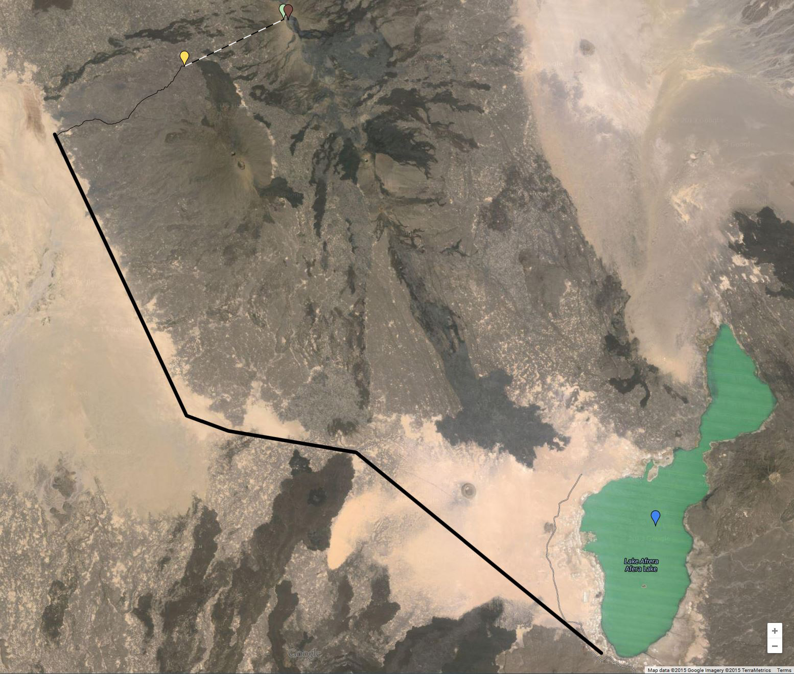
Day 4: Lake Afdera to Erta Ale base camp

Day 4: Lake Afdera to Erta Ale base camp

Today is the first day where I found a dawn start really worthwhile. As mentioned the sun rises on the opposite bank of Lake Afdera to which the tents were set up and it was literally a case of get out of the tent and enjoy the sunrise. Some people love sunrise photography so do not, but I did like the abstracts that could be created by not including any manmade feature, such as the jetty. Long exposures work well as the lake will have ripples upon in – despite being dawn the land is already heating up and so a wind is developing.

Sunrise at the lake offers a few frantic minutes of great opportunities... [Click to Enlarge!]

Sunrise at the lake offers a few frantic minutes of great opportunities… [Click to Enlarge!]

After breakfast we begin to find to why understand why Enku insisted on the rehydration salts. By 9AM the temperature was already at around 30°C and the sun was just beginning to take a hold on the land. At -102 metres you’re in a basin and the heat was being captured in the same way water fills a bucket. The breeze, such that there was one was beginning to feel like a hairdryer. Today you’ll pick up the Afar police and military escort that you need for the next segment of the trip. It is not going to be a speedy process and so, like us, you’ll probably want to walk up to the local town, a place whose sole existence is due to the salt mining and wait in the local bar out of the sun. How long you’ll have to wait is in the hands of the military but by midmorning we had all become bored of waiting and despite the heat when out from the cover of the bar we walked around the chronically poor town, some of us more than once. If you’re interested in candid or portrait photography you’ll have plenty of opportunity here and despite there being an increasing number of foreigners passing through each year, you’ll definitely draw curious attention – nothing to cause concern but people will ask for money. Luckily all the paperwork is completed and we’re ready to go.

Today also marks the day where you swap the tarmac roads for dirt tracks. Up until now the roads have been really very well maintained. From talking to the drivers this may simply be because many of them are relatively new: The road from Lake Afdera to the main Ethiopia-Djibouti route 2 is still shown as a compacted rock road on many maps. It is a comfortable road to drive along, but it isn’t universally loved as many see it as a reminder of the continued Chinese investment in Ethiopia – something everyone I spoke to seemed to be concerned about.

You will feel the heat and for us joy was found in the simple pleasure of having the 4WD windows open when moving whenever we could although as the day progressed this became increasingly difficult. The track we were following to get to the base camp at Erta Ale was becoming less a rocky gravel track and more volcanic ash with the result that the car in front was creating vast clouds of fine volcanic ash. So windows were closed and we relied on the air conditioning to provide some semblance of cooling.

After a while you turn off the relatively flat ash desert and onto the lava escarpment of Erta Ale itself. The lava lake is approximately 60-70 metres in diameter but the volcano itself is around 30km at its base. It is here that you learn why mankind invented the 4WD. I think it is safe to say the shooting from the vehicle with the aim of keeping horizons straight at this point is futile, but good luck.


From what I gather trips up to the summit of Erta Ale all follow the same basic process. You arrive late afternoon as the sun is beginning to lose its strength and swap the 4WD vehicles for camels. In our case, perhaps because we had 13 days worth of possessions with us, we began the process of dividing or items into what we needed to take up to the lave lake and what we could leave behind at the base camp. The ascent involves a 7km trek and a climb of approximately 500 metres, which isn’t really that arduous but even in late afternoon the heat is still above 30°C and most of us weren’t used to such temperatures. As a result the ascent is usually made after dark although this does have its own reward in that you get to make the trek in pitch black across ash plains, razor sharp lava inclines and, well I really don’t know what else as it was pitch black.


It was all very Blair Witch. We did make occasional stops for water and to let people catch up and when we did we turned off the head torches. It was phenomenal: An eerie, windless silence under a billion pin pricks of light. When nature puts on a show, she really does it in style. Again, a bit of time invested in learning how to spot the north star and night sky photography would be rewarded here.

The night-time climb to get to the summit base camp may have been an experience, but it was nothing compared to our first sight of the volcano... [Click to enlarge]

The night-time climb to get to the summit base camp may have been an experience, but it was nothing compared to our first sight of the volcano… [Click to enlarge]

It was about 11PM when we got to the top and despite being oddly tired the fact that we were a few hundred metres away from a volcano banished all thoughts of resting – for many of us at least – and anyway, the camels hadn’t arrived with our stuff. This is another tip: If you decide that you are going to have the camels carry your camera back pack – which we all did – make sure that you have your tripod and a fairly wide angle lens with you so you can get set up as soon as you arrive. The above shot was taken from the summit camp which is up on the caldera wall, but that’s not going to be enough to keep you happy for the evening and you’re going to want to head out and get closer.

There’s a simple rule at Erta Ale: All visits out to the volcano’s lake must be accompanied by (at least) one of the Afar military. This is mainly for your protection, although at least for the first night, it also shows you the way. It also means that, should an accident happen, there is someone who can go for help. Speaking of accidents there are several risks that you need to be aware of.

First, between you and the lake is approximately 300 metres of lava field which looks, forgive the pun, rock-solid. It is not. Erta Ale is a very gassy volcano and so the resulting lava is surprisingly light and very brittle. As you walk over the lava you hear this somewhat disconcerting crunching sound. Over the next couple of days there will at least one incident where you’ll put your foot through the lava and you’ll be glad of wearing a good, strong, walking boots when you do; to protect against sprains and nasty cuts.

Second, this is an active volcano and despite its apparently calm appearance it is a bubbling lake of molten rock. If you are lucky you’ll get to see some Strombolian eruptions – the classic fountain of lava – but whilst beautiful they come with the risk of lava bombs. You only have to read my recent post on my selfie to see this.

Third, whilst the gassy nature of Erta Ale can give some photogenic eruptions, the gas is mix of poisonous gasses, predominately hydrogen sulphide. Short exposure can be handled by holding your breath, but for any real photographic work you’ll need a gas mask. Yes, you will look silly and yes it makes breathing harder, but when you see others have to abandon their shots you’ll be grateful for that mask.

The final point worth mentioning is really an extension of the first one. This is not a tourist attraction, it is an active volcano. There are no safety barriers, no warning signs to indicate danger and – again, forgive the pun – in the heat of the moment it is easy to get too close to the edge. Don’t. The edge is very unstable. Over the years there have been few deaths due to the edge collapsing. Again, this is a benefit of a properly organised expedition – a knowledgeable guide who will keep you safe.

So off we headed into the inky darkness. There is no real way that I can explain the experience of meeting your first volcano and would probably make it sound rather underwhelming if I tried, but I think my best description so far has been that it was like the sound of nature ripping apart very slowly – an odd mixture of a deep bass with a kind of fizzing high-pitched sound. It had a similar creaking sound as an iceberg make as it thaws – nature under extreme stress – albeit the noise was octaves lower. It is a disquieting sound that leaves you feeling that you are in the wrong place.

The remainder of evening – we were they until about 1:30AM – was spent getting used to being this close to a volcano. I think it is a good idea; the photography is limited to capturing abstracts of the bright orange lava against the black centimetres-thick cooling surface, but for me the biggest thing I got from the evening was to get ‘being awestruck’ out of the way.

Anyway, at some point you will have to return to the camp so make sure you get some sleep – you have to be back at the lake before dawn at around 6AM!

Posted in Destinations Also tagged , , , , |

Up Close & Personal With the Erta Ale Volcano


It’s beginning to get chilly here in the UK and so the annual panic over snow is about to start. With that in mind I thought it would be nice to post an image that embodied warmth.

I’m in the middle of writing up the third part of the review (days 4 through 6) of the trip to Ethiopia – the days where we were at the Erta Ale lava lake – and so I’m not going into details today but it is essentially it is a hole 47 kilometres deep and full of molten lava. The level of the lava can rise or fall a few metres but not enough to make a difference to the temperature when you stand close of the rim, which is hot. Very hot. The fun starts when there’s gas in the upwell as it turns the usually gently bubbling, boiling rock surface into something even more spectacular: A Stombolian eruption.

There’s a convenient, but easily climbable peak not too far back from the lake and this gives a great downward view of not only the lake but the whole caldera. This was the third and last day that we were at the lake before heading further north to Dalol and nature had been kind by putting on frequent displays of Stombolian eruptions, lasting up to two minutes at a time. After spending much of the day at ground level trying to capture video and time lapses of the activity, I and one of the other photographers on the trip decided to head up here to gain a different perspective. I was up here with the intent of setting up a panoramic shot but when looking down one of the eruptions started.

This was very much an opportunistic shot. I didn’t have time to frame the shot nor to zoom in so the resulting image captured the moment, but not ideally. In fact I initially dismissed the image as unusable in the forthcoming gallery, but then realised that whilst it may not make it into the final 25 images it still tells a story and gives a great idea of just how ‘up close and personal’ you can get with a volcano.

There has been a significant amount of cropping of the original image – enough that this wouldn’t print well at A3+. Other that that I have only made clarity and vibrance adjustments.

Oh, definitely click the image to enlarge!

Erta Ale can have moments of breath-taking wonder... [Click to enlarge!]

Erta Ale can have moments of breath-taking wonder… [Click to enlarge!]

Posted in Frame by Frame Also tagged , , , |

The Danakil Depression: Trip Review Part 1

Back in the middle of last year, once I had begun take the idea of going to Ethiopia seriously I started to read around on what options I had. I knew that I wanted to see the Erta Ale volcano and the bizarre landscape at Dallol – both conveniently close to each other in the Danakil Depression – but, other than that, I was open to suggestions.

There were many options for four and five day trips that covered the Danakil region but I just knew that, from a photographic standpoint, these were going to be too rushed. There was one trip I found that was 13 days in length and, more importantly, billed as a photographic expedition, but I could find very little independent review on this. To be honest, there wasn’t really too much more describing the shorter trips either.

One of the main reasons that I was more keen than usual to read the experiences of other travellers was that the Danakil region is listed by the UK government as being an area to which you should not travel for any reason, a fact that makes it very difficult to get any form of travel insurance from a UK company. I did ask for advice on one of the photography forums explaining that I couldn’t find much about these trips on the web to which the replies were generally unhelpful stating “that should tell me something”. So in the end my trip was really a result of a bit of a leap of faith. Because of my inability to find anything useful to help me know what to expect – both as photographer and simply as a curious traveller – I have decided to describe the trip I took – in general and its usefulness to photographers – in the hope that, if you too are thinking of going, I can answer some of your questions.

Before continuing I just want to clear up a few of so-called “facts” that you’ll see mentioned time and again as you read various web sites:

  1. “The Danakil Depression is the hottest place on the planet.” No, it is not. It currently has the title of ‘place with the highest average temperature’ which is not the same thing. In fact the measurements upon which this record is based were taken at the (now) ghost town of Dalol (often written Dallol) back in the 1960s. It does get hot of course, but when I was there in December the temperature really only reaches the early 40’s centigrade. The thing that you’ll notice is that even once the sun goes down, the temperature remains in the high 20’s throughout the night. Keep covered up and drink plenty of water mixed with rehydration salts.
  2. “It is a seriously dangerous region for tourists.” At the most northerly point of where you’ll travel you’ll be very close – about 8km – from the highly disputed border with Eritrea. The short story is that Ethiopia tried to annex Eritrea in the 1960’s which lead to the 30 year Eritrean War of Independence that Eritrea finally ‘won’ in 1991. Since then relations have been cool, but with the exception of a couple of clashes – the  1998 – 2000 Ethiopian/Eritrean War being the most notable – the border is generally stable.
  3. “There is a risk from terrorism.” Well, yes. But there is in most major western cities too. What this refers to is the 2012 attack at Erta Ale that killed five tourists, injured two and kidnapped four (later released). The attack was carried out by the Afar Revolutionary Democratic Unity Front, the Afar being the nomadic tribes that live in the Danakil region. There was also a kidnap in 2007  with an attempted one in 2008. So yes, there is a risk that you have to consider. However, the Ethiopian government, and perhaps more importantly, the Afar themselves, understand just how much money tourism brings in to the region and they have moved a long way to providing security for guests. Both Erta Ale and Dalol have military bases and you have military and police escorts from when you enter the region until when you leave.
  4. “The Afar are known to castrate foreigners”. Oh please. Yes, back in the 1930s there was custom that, as a rite of passage into manhood, a boy had to castrate a member of a neighbouring tribe. But that over 80 years ago. Women had barely been given the right to vote in the UK at that point, we’ve had World War 2, nearly had World War 3 and the word ‘minging’ regrettably has entered the Oxford English dictionary. A lot has changed since the 1930s and the Afar have too. So, don’t worry; you’re going to leave Ethiopia with all the bits you arrived with.

The reason I want to highlight – and rebuff – these oft made comments is that they can cause people to not travel to one of the most stunning places on Earth. It is OK if you decide not to travel, but it is important to do it based on facts.


Trip Options

Most of the shorter trips start and end in the Tigray capital town of Mek’ele. This has the benefit of being significantly closer to the Danakil Depression – and where you really want to be – but it does mean that international visitors will need to factor in time to get from the international airport in Addis Ababa to Mek’ele – this most likely being via an internal flight. At around US $600 the shorter trips are a lot cheaper but, from a photography perspective, pretty much pointless. Whilst some will likely disagree, the whole point for me was to spend time at the lava lake at Erta Ale and walk away with images I was happy with. Looking at the itineraries of all the four-to-five day trips I could find and they all had the same basic approach: Begin the three-hour ascent to the lava lake in the early evening, head over to the lava lake and then descend in the early morning. So all you get is a few hours in the dark at the lava lake. For this reason alone, I would not recommend them, but there are other reasons I’ll cover in the later posts looking at days 4 to 6.

At the time of looking at my options there were really only two other choice available. The first would have been to arrange a custom tour, but given the complex geography, harsh climate and political instability (both with neighbouring Eritrea and within the Afar clans themselves) this would have resulted in a serious financial outlay. The second option was the 13-day trip offered by the German company Volcano Discovery. As it turns out the actual trip is handled by Addis-based Origins Ethiopia and it is they that provided the vehicles and drivers, the cook, and the guide as well as organising the police and military escorts required in parts of the Danakil Depression. You will pay a lot more than $600 – it was $4700 in 2014 – but if you are travelling with the aim of landscape photography, or even just to understand the region a bit more then the shorter trips are really going to leave you disappointed. That said, I am not saying that the trip I took was perfect and I’ll cover the strengths and weaknesses (for me) in a later blog entry.

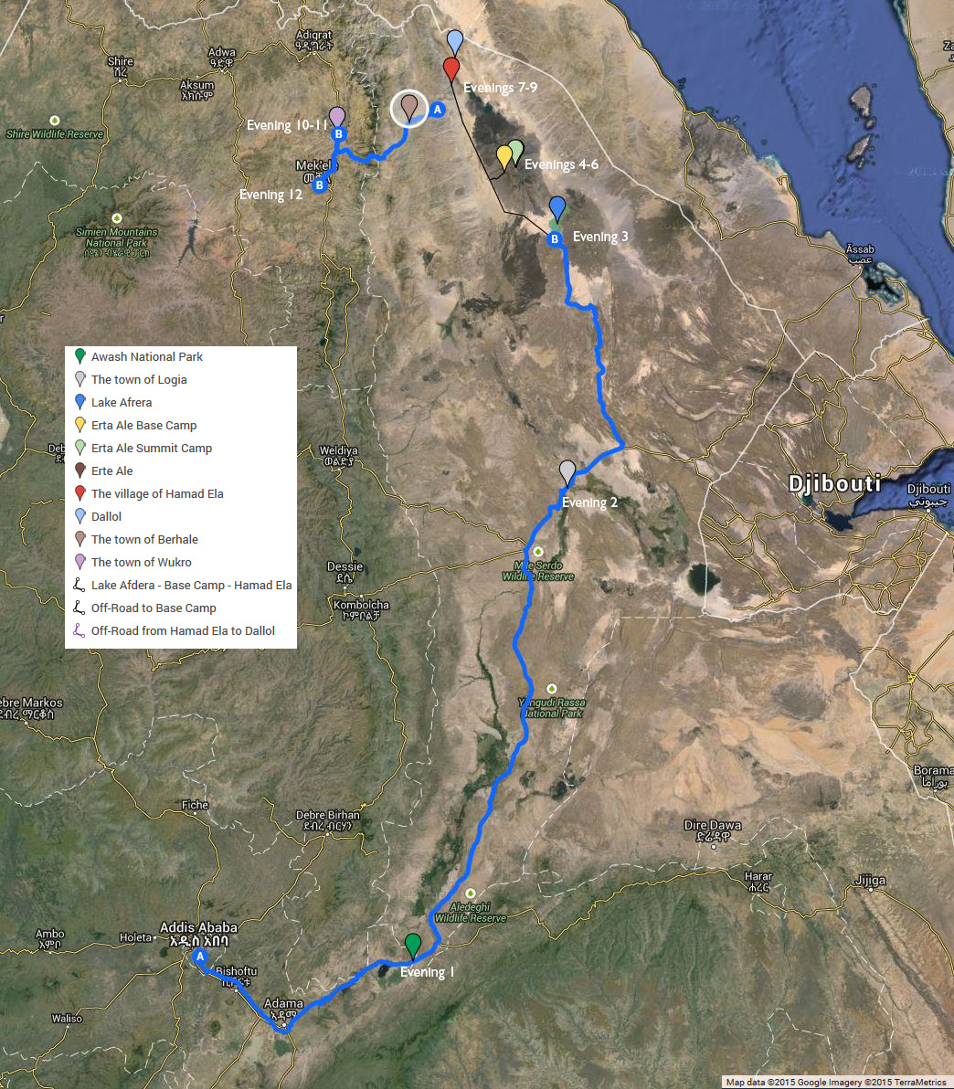
An overview of the route taken on the 13 trip.

An overview of the route taken on the 13 day trip. The lines in blue show the sections where you’re mostly sitting in the 4WD vehicles. The real fun happens between evenings 3 and 9…

Despite the trip being advertised as a 13 day tour of the Danakil Depression you are not going to be spend 13 days behind the camera. This is in no way a criticism of the tour’s itinerary but it does reflect the fact that it is a big country and it takes time to get from one location to the next, especially as Erta Ale and Dallol have been described by National Geographic as being in one of the most remote places on Earth. In the end you will have about five days of solid landscape photography time, quite a few 30 minute blocks when you stop at some of the other points of interest (such as the rock churches in Tigray) and lots of quick five minute stops. You’ll probably be shooting a lot from a moving vehicle too.

One of the many short stops you'll make over the next 13 days. The trip is all about volcanoes and geology and with a trained geologist for a guide you'll certainly learn about geology... [Click to enlarge!]

One of the many short stops you’ll make over the next 13 days. The trip is all about volcanoes and geology and with a trained geologist for a guide you’ll certainly learn about geology… [Click to enlarge!]

I’ll divide the review into several parts over the next couple of weeks simply because the overall thing is quite large. I’ve written this is referring to “you” an awful lot so I better explain why. Simply I am working on the basis that, if you do decide to travel to the region, you’ll bypass the shorter trips and opt for the longer one – of which Volcano Discover/Origins Ethiopia seem to be the only one who really focus on Erta Ale. As this is an expedition they have run a number of times now it is pretty much a set schedule and the trip I had will most likely be the one you have. I do refer to “I” every so often – usually to voice some personal feeling, or simply because I forgot to say “you”!


Day 1

The first day's travel was along route 4 to Awash National Park covering a stretch of approximately 200km... [Click to enlarge!]

The first day’s travel was along route 4 to Awash National Park covering a stretch of approximately 200km… [Click to enlarge!]

Depending upon how you organise your international flights you’ll likely arrive early morning on a red-eye flight. The international airport is surprisingly close to the heart of Addis and so this gives you a couple of hours to have breakfast at the hotel, freshen up and, in my case, transfer everything I needed from a suitcase to a backpack before the expedition officially begins. You spend the rest of the day driving the 200km to Awash National Park where the first night is spent. How much photography you get done is largely dependent upon your interests – and your ability to shoot from a moving vehicle. There are stops, of course, for lunch and a couple of volcanic craters, but it could be difficult to get a decent composition from them given the short time you stop at them. As there are few stops I did end up shooting from the 4WD as it made its way across the landscape but I’m not a “shoot from the hip” photographer. One of the other guys produced some great shots this way so you may be lucky and is something I would definitely practise before you arrive as you will pass some interesting sights. Perhaps of more interest would be the frequent road-side villages that have developed that you see as you drive. You will only get to see these villages today and tomorrow as they are a result of being on the main route  (routes 4, 18 and 2) between Addis and the port cities in neighbouring Djibouti and so there’s a lot -and I mean a LOT – of transportation along the route.

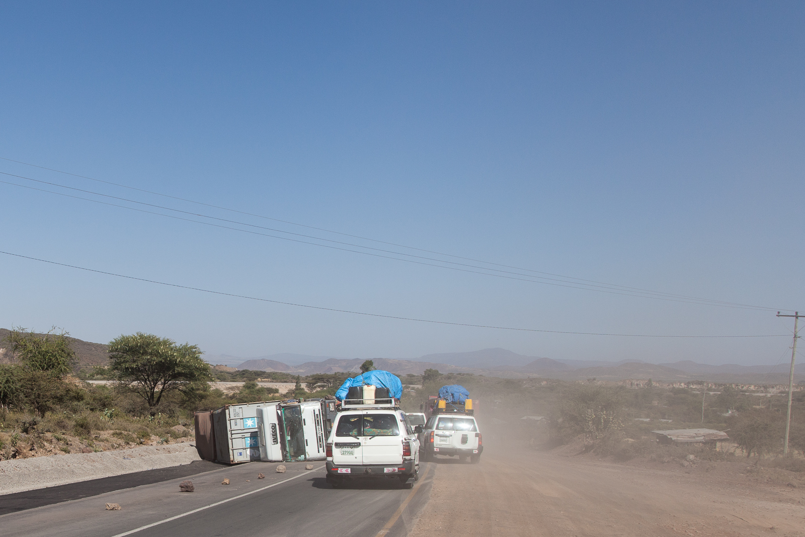
On the first day of driving we saw in the region of 20 overturned trucks. [Click to enlarge]

On the first day of driving we saw in the region of 20 overturned trucks. [Click to enlarge!]

And another one...

And another one… [Click to enlarge!]

Speaking of the transportation another thing you’ll see is a lot of accidents. It is hard to give an exact figure – simply as we didn’t start counting until after we had seen the first few – but a good guesstimate would be around 20. That is 20 articulated lorries – some with the 40 foot freight containers on them. As grim as it sounds, one of the first we saw still had blood dripping out of the crushed cabin. It is a long road from Djibouti to Addis and there are no maximum hours for driving.

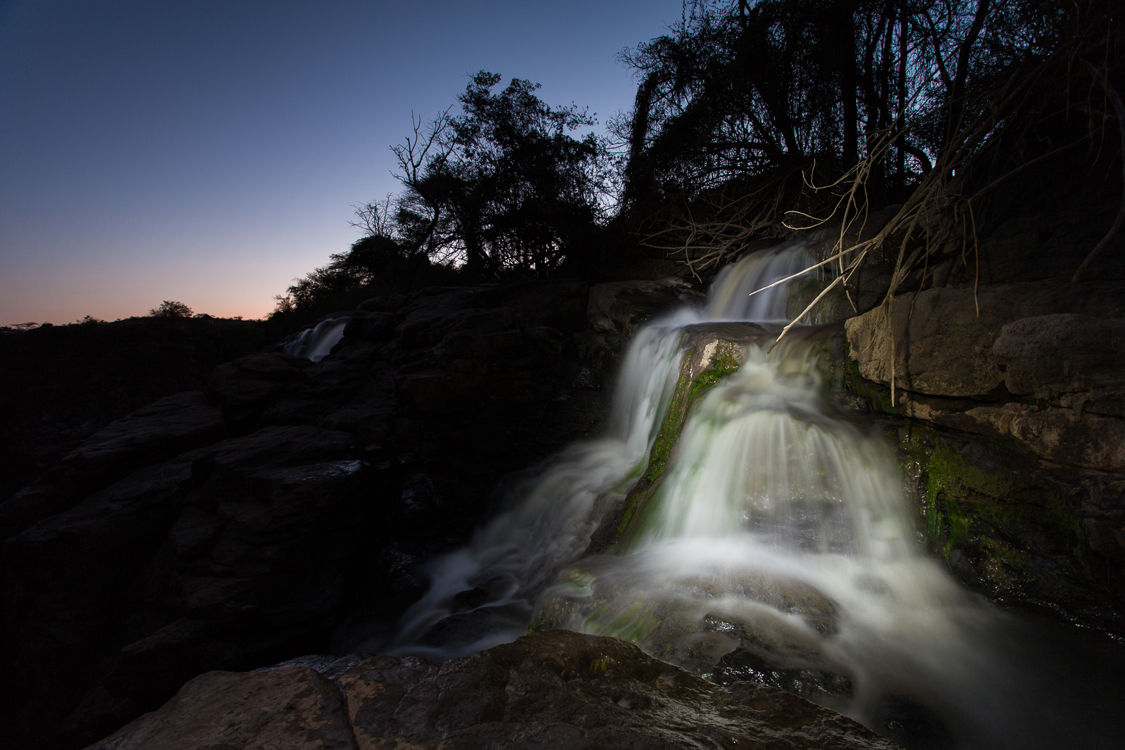
At the lodge in the national park there may be some time before darkness completely takes hold to make the easy three minute trek to the Awash waterfalls. The waterfall is certainly worth taking the time photograph – what will be against you is the fact that you arrive late in the afternoon. The light likely will not be ideal, but you can get creative with some light painting.

_MG_9738
The light was fading even as we arrived, but a handy torch always comes in useful! [Click to enlarge]

The evening was spent in comfort. The food was good and the beds comfortable. Mosquitoes are a problem here – you are close to water after all – and so make sure you are protected. You will also get to bathe properly as the huts have a toilet and shower, albeit the water is not that warm and has a distinct odour to it. Still enjoy it a few days from now you’ll give anything for a cold, odd-smelling shower. The other thing you will get to experience, which for a town-dweller like myself was breath-taking – is the night sky. Before coming to Ethiopia, read up on how to photograph the night sky – you won’t regret it!


Day 2

Day two is more time in the 4WD vehicles covering distance... [Click to enlarge!]

Day two is more time in the 4WD vehicles covering distance… [Click to enlarge!]

The day starts reasonably late at about 7AM with breakfast although you may be up about an hour earlier if you’re hoping to find a good angle for sunrise. There is an argument that a dawn start at Awash is worthwhile but the most impressive sight there is the waterfall which is largely cast in deep shadow even after sunrise due to the high cliff face immediately opposite.

If you're looking to get some quality wildlife photography this may not be the trip for you. We spent a couple of hours in Awash national Park and saw relatively few animals... [Click to enlarge!]

If you’re looking to get some quality wildlife photography this may not be the trip for you. We spent a couple of hours in Awash National Park and saw relatively few animals… [Click to enlarge!]

You also get to experience the very flexible notion of time that will be the norm for the rest of the trip – the 8AM start is more like 9AM before everyone is ready and the 4WDs area packed. The day starts with a couple of hours in the national park itself day although – and please remember that I am not interested in wildlife photography – it is not that spectacular.

The remainder of the day is spent driving a further 360km north to Logia – what is possibly best described as a truck-stop town. Again there are a few token stops and you may be able to get a good composition from them. You’ll likely stop for lunch in one of the many road-side town that you have been passing through since starting yesterday and it is really you’re first opportunity to see how rural Ethiopians live up close.

Today you'll get to stop in one of the road-side towns that have grown around the busy transport link between Addis and Djibouti [Click to enlarge!]

Today you’ll get to stop in one of the road-side towns that have grown around the busy transport link between Addis and Djibouti [Click to enlarge!]

One of the things you will also begin to notice is the panoramic vistas. This is a big country with big stretches of nothingness – it is a land of unbroken horizons.

The second day begins to show just how empty Ethiopia can be... {Click to enlarge!]

The second day begins to show just how empty Ethiopia can be… [Click to enlarge!]

Again the accommodation was fine – a basic hotel, but clean and there was a toilet, shower (again cool) and electricity. Now would be a good time to make sure that all your batteries are charged as from here on in, with the exception of the cigarette lighters, there is no electricity and with everyone wanting to charge phones and cameras, there’s guaranteed to be a queue. Or you could do what I did and take a solar charger.

Here we were also introduced to the cook Muscara who would be preparing us food for the next few days and had just prepared dinner. There is a saying that ‘an army marches upon it’s stomach’. How true this is I do not know, but I do know that a person can forgive a lot of discomfort when they are happily fed. At the end of the trip when we were all discussing what we had experienced, we all agreed that the high quality of food made a lot of what we had been through bearable. Whilst this may seem a little melodramatic, it is worth remembering that at this point we are still in relative civilisation.

Speaking of which enjoy the sleep you get tonight as it will be your last in civilisation for a while…


Posted in Destinations, Travel, Uncategorized Also tagged , , , , , , |