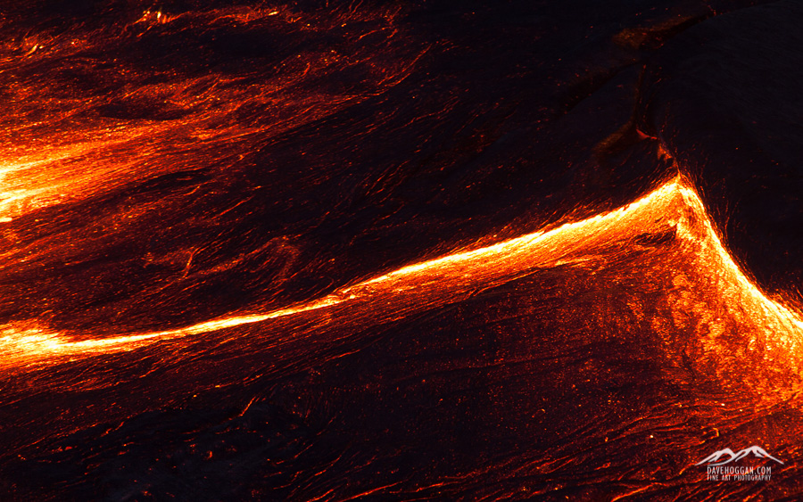
The ever-changing surface of the lava lake at Erta Ale guarantees that you’ll never take the same shot twice. But be warned; staring at the lake’s surface can become almost hypnotic.
It has been very quiet around here for a few weeks simply because work has been insanely busy. I’m an IT security professional by day and right now I’m currently managing two projects that are well underway and all my time is split between them with the thousand different technical and operational queries that clients raise during the deployment phase. All my other work therefore has to fit into the gaps and the evenings.
Of course there is always a benefit to being so busy and one is that I have been working on one client’s site or another over the past few weekends and the travel fund has slowly been growing! So, despite feeling a little weary right now I do have something to look forward to: the next photography trip!
As mentioned in a previous post, Siberia is planned for 2017. The photographer running that – Alexey Trofimov – has suggested dates around the end of February and so whilst I’m really excited about working alongside him I need something a bit sooner.
The next option is to return to Iceland. I have an image in my head that I can’t get rid of and so I can see a week or two spent driving along the southern coast. Iceland is an easy trip; one I really do not have to think about but again, I want to go late in the year, when it is colder – perhaps November or early December. Again, I can’t wait.
So, the current plan is 18 days travelling through Java on a volcano hunt. The people who organised the trip to Ethiopia, Volcano Discovery, have a photographer-centric trip in September and over the past few weeks I’ve been talking to them about adding a custom extension. If all goes well I should be climbing Krakatoa in just under 80 days!
After the heat of Java’s volcanoes Iceland will be a nice halfway-house before the -25°C expected in Siberia.


![A lump of three million year-old coral - one among many just found lying around the landscape. [Click to enlarge!]](http://davehoggan.com/wp-content/uploads/2015/02/MG_2209.jpg)
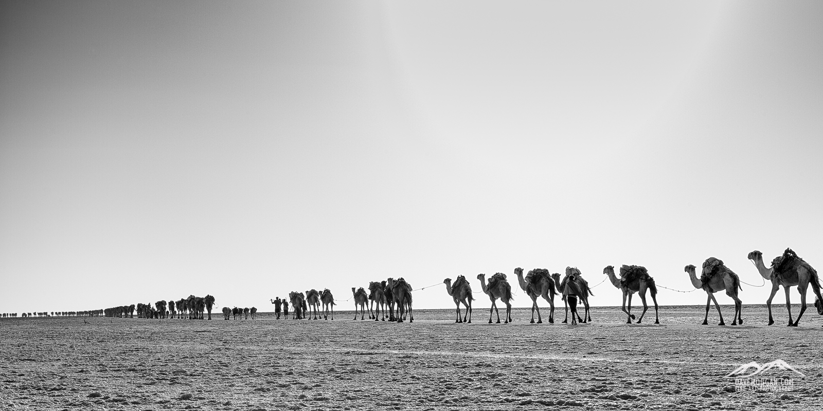
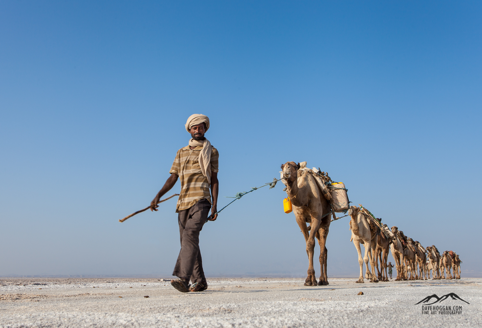
![At the end of the two-day camel caravan is Berhale, a town whose growth is due to the traditional salt industry. Here the salt is loaded onto trucks for country-wide distribution. [Click to enlarge!]](http://davehoggan.com/wp-content/uploads/2015/02/MG_2232.jpg)
![Concrete and stone buildings replace the nomadic Afar's tent-like structures. [Click to enlarge!]](http://davehoggan.com/wp-content/uploads/2015/02/MG_2228.jpg)
![The iPhone 6 made taking panoramic shots so easy that I never used the panoramic head on my tripod. [Click to enlarge!]](http://davehoggan.com/wp-content/uploads/2015/02/IMG_0228.jpg)
![One of the oldest of the Tigray rock-hewn churches is Abrahat Atsebah. [Click to enlarge!]](http://davehoggan.com/wp-content/uploads/2015/02/MG_2343.jpg)
![A priest at the Wukro Cherkos rock church. [Click to enlarge!]](http://davehoggan.com/wp-content/uploads/2015/02/MG_1418.jpg)
![The signs of agriculture can be seen everywhere in Tigray. [Click to enlarge!]](http://davehoggan.com/wp-content/uploads/2015/02/MG_2309.jpg)
![It is hard not to take portraits when there are so many eager volunteers! [Click to enlarge!]](http://davehoggan.com/wp-content/uploads/2015/02/MG_2323.jpg)
![Waiting. And watching. [Click to enlarge!]](http://davehoggan.com/wp-content/uploads/2015/02/MG_1415.jpg)
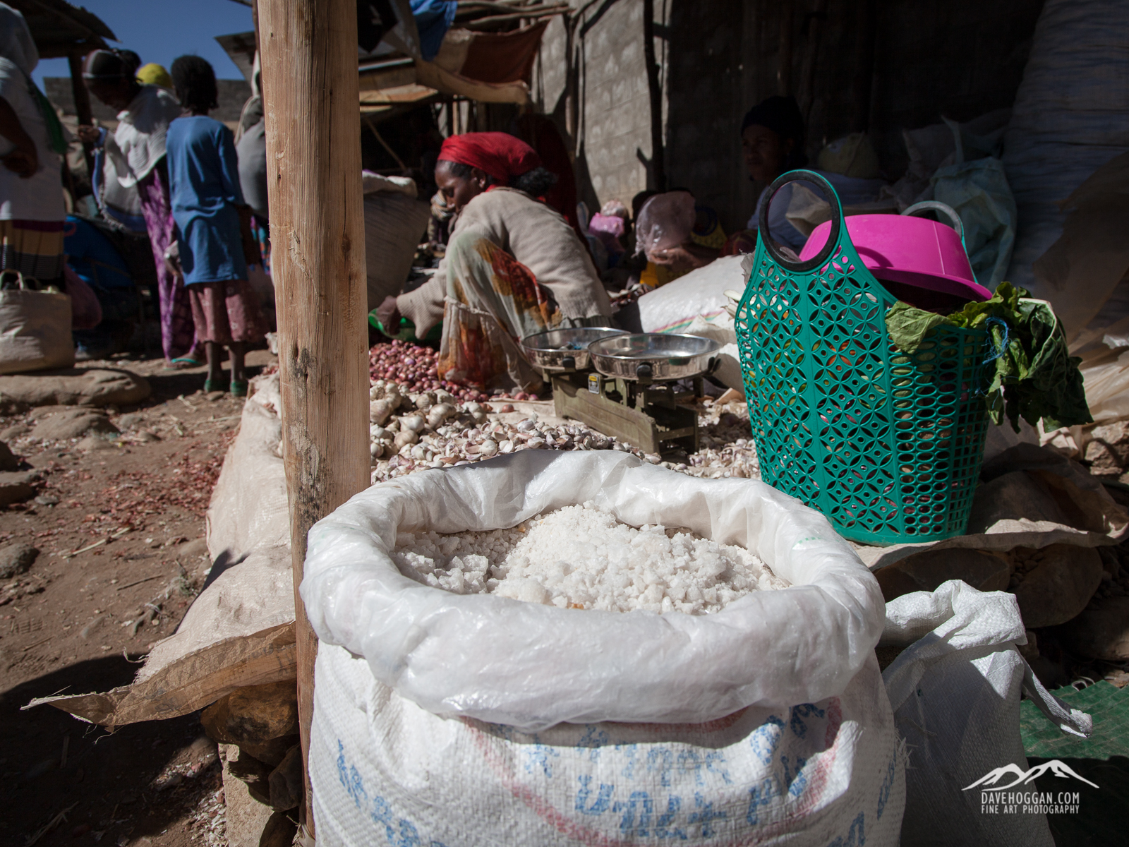
![A stall at the Wukro market selling spices and, of course, salt. [Click to enlarge!]](http://davehoggan.com/wp-content/uploads/2015/02/MG_2381.jpg)
![The markings of an Orthodox Christain women. [Click to enlarge!]](http://davehoggan.com/wp-content/uploads/2015/02/MG_2380.jpg)

![Dawn approaches as we descend from Erta Ale. [Click to enlarge!]](http://davehoggan.com/wp-content/uploads/2015/02/MG_1593_cs.jpg)
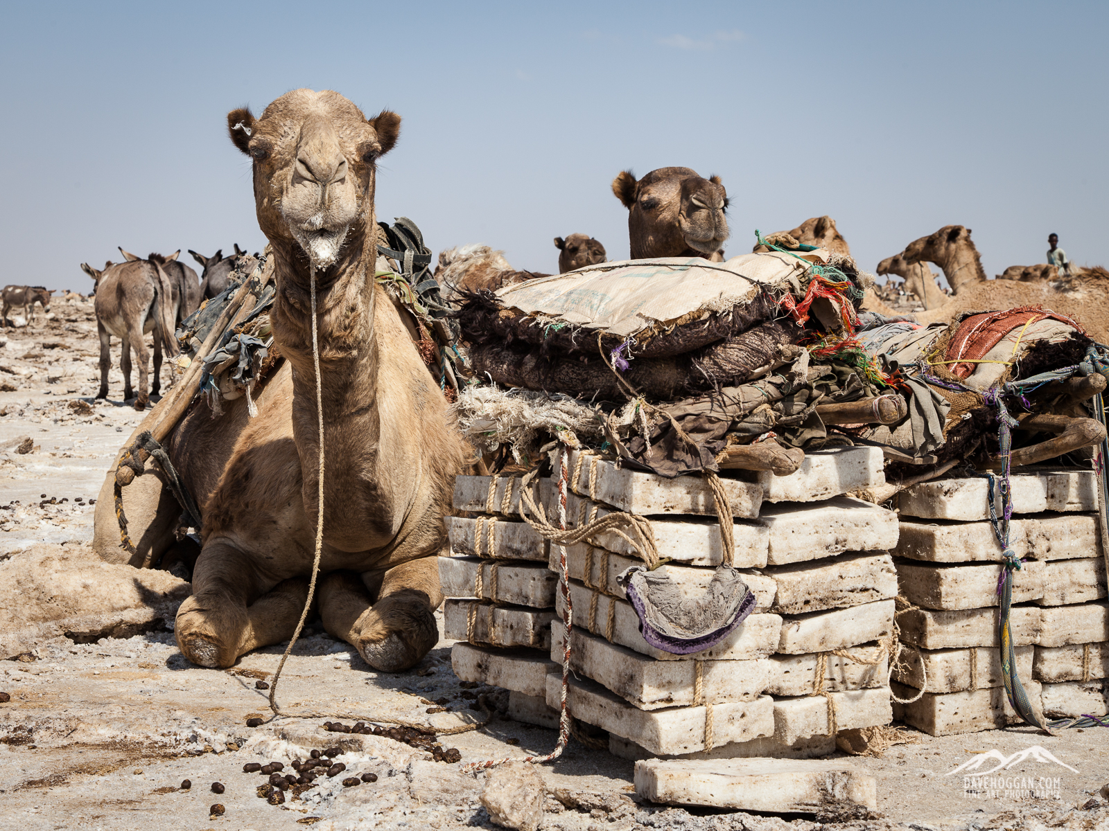
![Camels are a critical part of the Afar way-of-life and so get treated with love and care. [Click to enlarge!]](http://davehoggan.com/wp-content/uploads/2015/02/MG_1610.jpg)
![The sun literally bakes the ground. [Click to enlarge!]](http://davehoggan.com/wp-content/uploads/2015/02/MG_1652.jpg)
![Ash, as far as the eye can see [Click to enlarge!]](http://davehoggan.com/wp-content/uploads/2015/02/MG_1675.jpg)
![Luxury is relative. After four days without a toilet the sanitary facilities at Hamed Ale were a step up. Toilet is on the left; bucket-shower on the right. [Click to enlarge!]](http://davehoggan.com/wp-content/uploads/2015/02/MG_2208.jpg)
![En route from the salt plains to Berhale [Click to enlarge!]](http://davehoggan.com/wp-content/uploads/2015/02/MG_1731.jpg)
![Our temporary home at Hamed Ale and a testament to the fact that travelling with the right people makes everything fun! [Click to enlarge!]](http://davehoggan.com/wp-content/uploads/2015/02/IMG_0224.jpg)
![Dallol was once described by National Geographic as being one of the most remote places on Earth. [Click to enlarge!]](http://davehoggan.com/wp-content/uploads/2015/02/MG_2018.jpg)
![A bizarre landscape that is sadly now but a shadow of what it once was. [Click to enlarge!]](http://davehoggan.com/wp-content/uploads/2015/02/MG_1987.jpg)
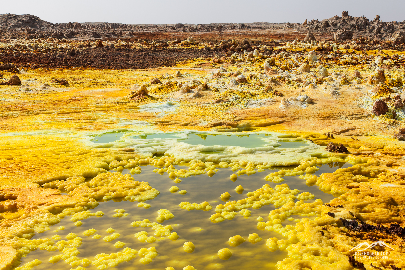
![This is what the stunning, other-worldly landscape of Dallol is becoming due to potash mining. [Click to enlarge!]](http://davehoggan.com/wp-content/uploads/2015/02/MG_2014.jpg)
![The area was once a riot of vivid yellows, green, blues and white. buy nearby potash mining has had a devastating effect. [Click to enlarge!]](http://davehoggan.com/wp-content/uploads/2015/02/IMG_0215.jpg)
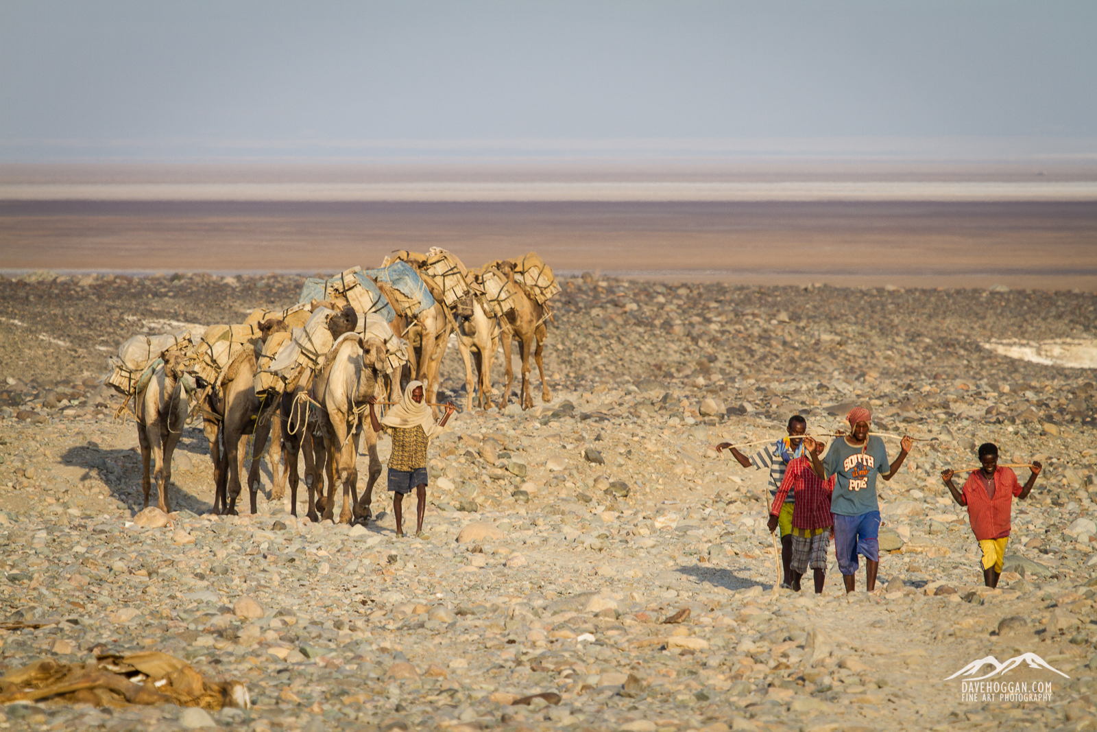
![The daily camel train heading out to the salt flats to pick up their cargo of white gold. [Click to enlarge!]](http://davehoggan.com/wp-content/uploads/2015/02/MG_2036.jpg)
![Cliffs of salt dominate the landscape and provide some excellent landscape to work with. [Click to enlarge!]](http://davehoggan.com/wp-content/uploads/2015/02/MG_2090.jpg)
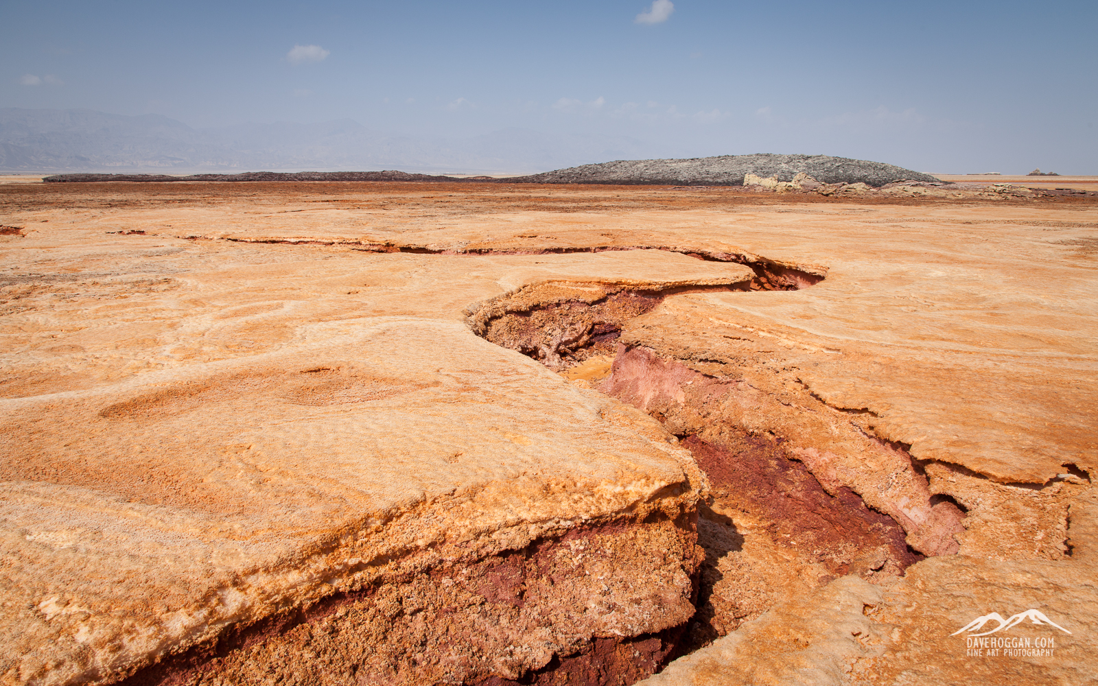
![More evidence of the destruction of a continent. This fault has only appeared in the last year and mirrors the 6500km fault that is pushing eastern Africa away from the rest of the continent. [Click to enlarge!]](http://davehoggan.com/wp-content/uploads/2015/02/MG_2108.jpg)
![Getting ready to load the camel for the two-day journey back to Berhale. [Click to enlarge!]](http://davehoggan.com/wp-content/uploads/2015/02/MG_2189.jpg)
![Descending from Erta Ale. [Click to enlarge!]](http://davehoggan.com/wp-content/uploads/2015/02/MG_1583.jpg)
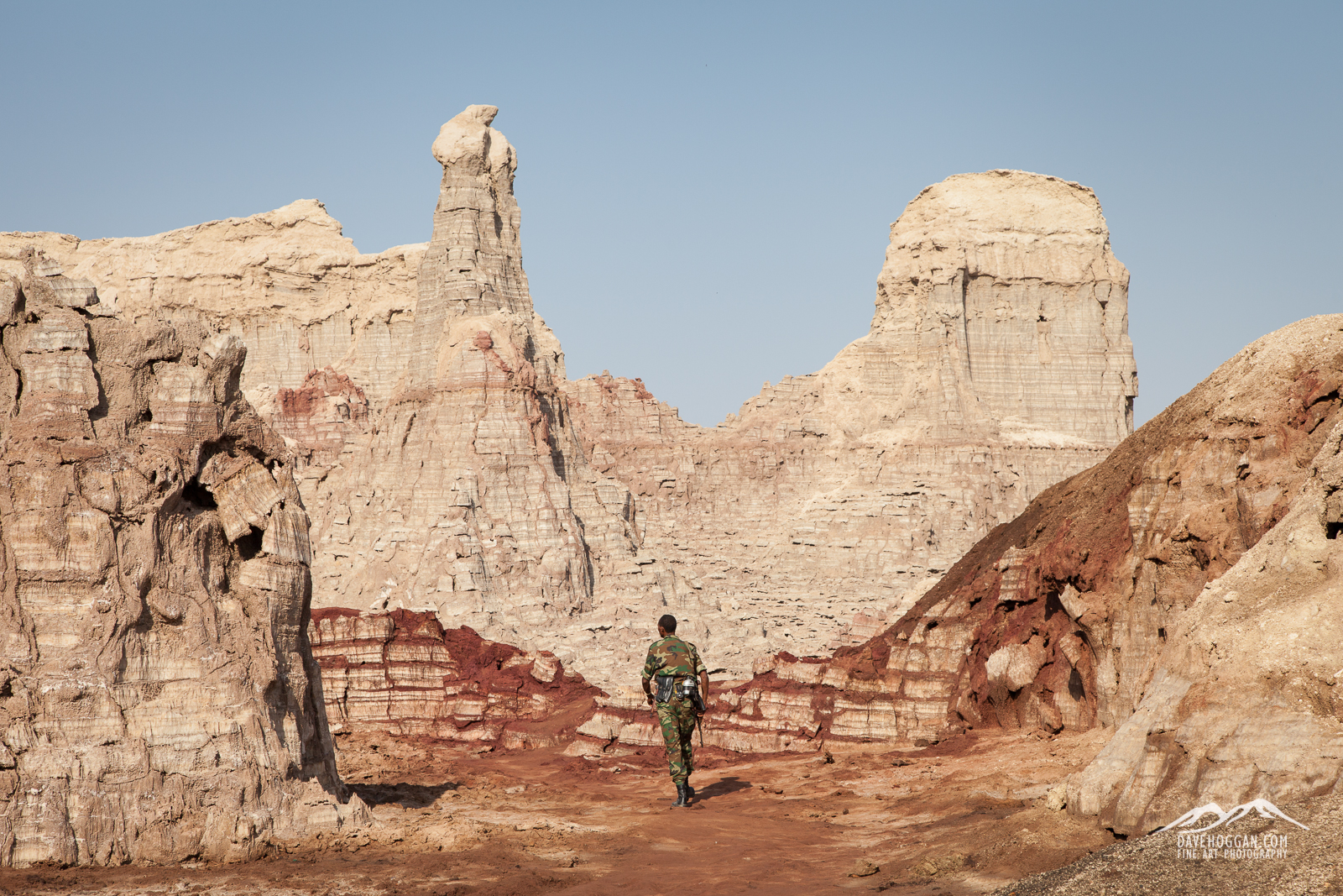
![An Afar military guard watches the only road in to the area. [Click to enlarge!]](http://davehoggan.com/wp-content/uploads/2015/02/MG_1635.jpg)
![Life survives in even the harshest environment. [Click to enlarge!]](http://davehoggan.com/wp-content/uploads/2015/02/MG_1651.jpg)
![Dunes of volcanic ash [Click to enlarge!]](http://davehoggan.com/wp-content/uploads/2015/02/MG_1678.jpg)
![Years of use has produced a polished salt track across the land. [Click to enlarge!]](http://davehoggan.com/wp-content/uploads/2015/02/MG_1819.jpg)

![Probably my favourite shot of the lake. [Click to enlarge!] (17mm, 1/10sec @ f/9.5, ISO 100, stacked ND grads)](http://davehoggan.com/wp-content/uploads/2015/02/MG_1331_cs.jpg)
![From the nearby hill you get a good view of the landscape around the lava lake. [Click to enlarge!] (35mm, 1/2sec @f/8, ISO 100)](http://davehoggan.com/wp-content/uploads/2015/02/MG_1473.jpg)
![The lake surface is a constantly moving mass of boiling, molten rock. [Click to enlarge!] (85mm, 1/750sec @ f/4.5. ISO 100)](http://davehoggan.com/wp-content/uploads/2015/02/MG_1383.jpg)
![Erta Ale can have moments of breath-taking wonder... [Click to enlarge!]](http://davehoggan.com/wp-content/uploads/2015/01/MG_15011.jpg)
![Your biggest issue will be the heat haze produced by 1200°C lava. Don't underestimate how many shots it will ruin... [Click to enlarge!]](http://davehoggan.com/wp-content/uploads/2015/02/Example-of-Heat-Haze-1600.jpg)
![When night falls the two-colour nature of the landscape takes over. [Click to enlarge!] (55mm, 1/15sec @ f/4.5, ISO 200)](http://davehoggan.com/wp-content/uploads/2015/02/MG_1290.jpg)
![Although quietly steaming away when we visited, the hornito is known to fountain lava too. [Click to enlarge!] (105mm, 1/250sec @ f/4.5, ISO 100)](http://davehoggan.com/wp-content/uploads/2015/02/MG_0646-2.jpg)
![OK, so this was a staged shot for a bit of fun - and he loved my sunglasses. But seeing three of the military in position for real on the second day at the lake was a sobering experience and a reminder that this is still a hotly contested area. [Click to enlarge!]](http://davehoggan.com/wp-content/uploads/2015/02/MG_0687-2.jpg)
![Four of us on the trip as close to an eruption as we'll every want to be! [Click to enlarge!] 50mm, 2 sec @ f/4, ISO 400](http://davehoggan.com/wp-content/uploads/2015/02/MG_1540.jpg)
![Two Afar military guards stand on watch as night falls. [Click to enlarge!] (47mm, 1/15sec @ f/8, ISO 100)](http://davehoggan.com/wp-content/uploads/2015/02/MG_0775.jpg)
![Staring into the abyss. [Click to enlarge!] 105mm, 1/500sec @ f/8, ISO 100](http://davehoggan.com/wp-content/uploads/2015/02/MG_0631.jpg)
![The lava lake at dawn is surrounded by a fragile lava landscape with its own unique beauty. [Click to enlarge!] (20mm, 1/15sec @ f/8, ISO 100)](http://davehoggan.com/wp-content/uploads/2015/02/MG_0713.jpg)
![You can spend hours watching the lake's surface constantly shifting, separating and reforming. It is almost hypnotic, or that could just be the gas! [Click to enlarge!] (35mm, 1/10sec @ f/5.6, ISO 100)](http://davehoggan.com/wp-content/uploads/2015/02/MG_1181.jpg)

![Tree stump in Lake Afdera, northern Ethiopia. [Click to enlarge!]](http://davehoggan.com/wp-content/uploads/2015/02/MG_0957.jpg)
![Tree stump in Lake Afdera, northern Ethiopia in the natural dawn light . [Click to enlarge!]](http://davehoggan.com/wp-content/uploads/2015/02/MG_0955-2.jpg)
![The original shot of the tree stump [Click to enlarge!]](http://davehoggan.com/wp-content/uploads/2015/02/MG_0948.jpg)

![Once of route 2, the roads are much quieter, so much so that whilst lying down to take this shot some of the others were in the middle of the road dancing to the radio... [Click to enlarge!]](http://davehoggan.com/wp-content/uploads/2015/01/MG_0010.jpg)
![After a long day in the 4WD you'll be in time for sunset. [Click to enlarge!]](http://davehoggan.com/wp-content/uploads/2015/01/MG_0090.jpg)
![The accommodation may get more basic on day three but you can't fault the view! [Click to enlarge!]](http://davehoggan.com/wp-content/uploads/2015/01/MG_0107.jpg)
![Sunrise at the lake offers a few frantic minutes of great opportunities... [Click to Enlarge!]](http://davehoggan.com/wp-content/uploads/2015/01/MG_0122.jpg)
![The night-time climb to get to the summit base camp may have been an experience, but it was nothing compared to our first sight of the volcano... [Click to enlarge]](http://davehoggan.com/wp-content/uploads/2015/01/MG_0296.jpg)


![One of the many short stops you'll make over the next 13 days. The trip is all about volcanoes and geology and with a trained geologist for a guide you'll certainly learn about geology... [Click to enlarge!]](http://davehoggan.com/wp-content/uploads/2015/01/MG_9702.jpg)
![The first day's travel was along route 4 to Awash National Park covering a stretch of approximately 200km... [Click to enlarge!]](http://davehoggan.com/wp-content/uploads/2015/01/Day-1-Route.jpg)
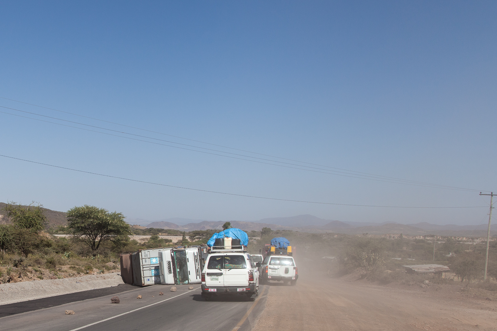
![On the first day of driving we saw in the region of 20 overturned trucks. [Click to enlarge]](http://davehoggan.com/wp-content/uploads/2015/01/MG_9700.jpg)
![Day two is more time in the 4WD vehicles covering distance... [Click to enlarge!]](http://davehoggan.com/wp-content/uploads/2015/01/Day-2-Route.jpg)
![If you're looking to get some quality wildlife photography this may not be the trip for you. We spent a couple of hours in Awash national Park and saw relatively few animals... [Click to enlarge!]](http://davehoggan.com/wp-content/uploads/2015/01/MG_0816.jpg)
![Today you'll get to stop in one of the road-side towns that have grown around the busy transport link between Addis and Djibouti [Click to enlarge!]](http://davehoggan.com/wp-content/uploads/2015/01/MG_0878.jpg)
![The second day begins to show just how empty Ethiopia can be... {Click to enlarge!]](http://davehoggan.com/wp-content/uploads/2015/01/IMG_0102.jpg)

![The kit I took to Ethiopia consisting of the panel (top), the red cable connecting the panel and V72 battery, the black cable to connect the V72 to the camera charger and the white/black cable to connect to my MacBook Air. The car charger (bottom) also came in useful. The camera charger is not shown as it did not survive... [Click to enlarge]](http://davehoggan.com/wp-content/uploads/2015/01/IMG_0173.jpg)
![Although not part of the provided system the magnetic mount really made a huge difference - and one I recommend Voltaic Systems consider adding... [Click to enlarge]](http://davehoggan.com/wp-content/uploads/2015/01/MG_0190.jpg)
![A close-up of the panel on the 4WD showing the (home-made) silver metal magnetic mounts and the (provided) plastic loops in each corner for cable-tie mounting. The panel happily survived repeated bumps and knocks as well as being covered in dust and volcanic ash... [Click to enlarge]](http://davehoggan.com/wp-content/uploads/2015/01/IMG_0136.jpg)
![Using the ten foot cable I had a lot of flexibility as to where I put the V72 in the 4WD. All I then had to do was wait for the sun to work its magic... [Click to enlarge]](http://davehoggan.com/wp-content/uploads/2015/01/IMG_0130-2.jpg)
![Home at Erta Ale. "A compact, fully air-conditioned, one bedroom apartment backing on to a stunning panoramic landscape." it said in the brochure. It even came with free mice... [Click to enlarge]](http://davehoggan.com/wp-content/uploads/2015/01/IMG_0166.jpg)
![We relied on the Voltaic charger. Several Canons, a Fuji, two iPhones and even the quadracopter were all kept alive by the solar charger... [Click to enlarge]](http://davehoggan.com/wp-content/uploads/2015/01/MG_0701.jpg)
![The provided plastic attachments allowed the panel to be cable-tied to the shack and the cable fed inside via one of the many, many holes. The next nearest source of power was a 4WD somewhere in the distance... [Click to enlarge]](http://davehoggan.com/wp-content/uploads/2015/01/IMG_0162.jpg)
![By day three the lack of camera battery charger would have been catastrophic to the shoot and shots like this would have been missed... [Click to enlarge]](http://davehoggan.com/wp-content/uploads/2015/01/MG_1353.jpg)
