As foreboding as the name ‘Danakil Depression’ perhaps sounds it is nothing more than a case of calling something that it is. First, northeast Ethiopia forms part of the 100,000 square kilometre Danakil Desert measured as being one of the hottest and lowest places on the Earth’s surface. Second, it lies at the junction of three tectonic plates – a triple junction – each drawing apart from its neighbours and leaving a basin, or depression, in the land. Eventually the separation of these tectonic plates will split the horn of Africa off the continent completely and the Danakil Depression will either become part of the Red Sea’s floor, or the bed of a new sea entirely. In approximately 100 million years.
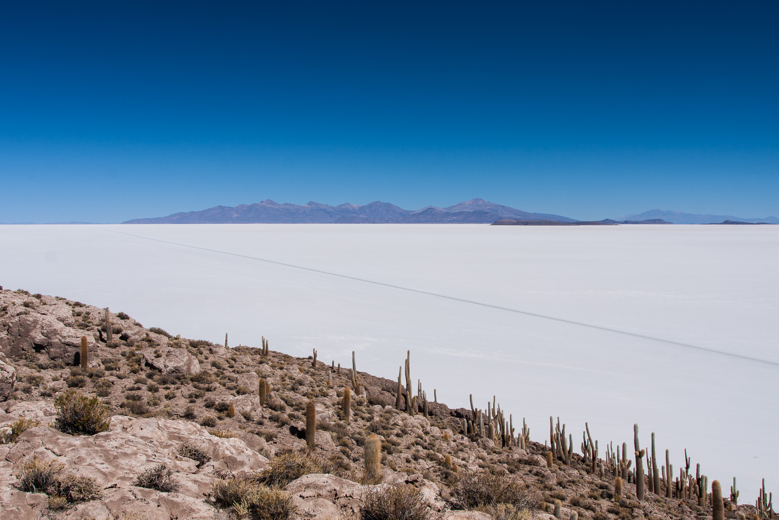
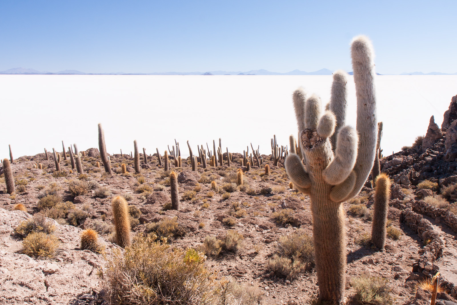
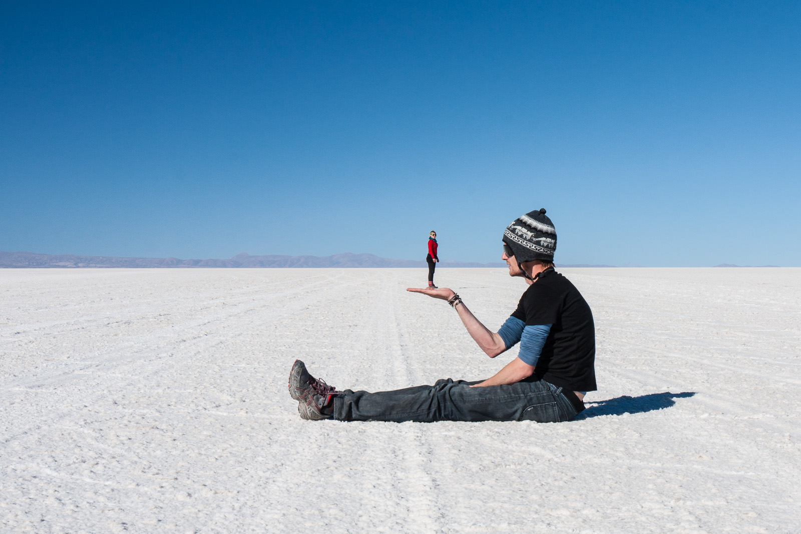
Although the depression, which sits at 130 metres below sea level, is (very) dry land for the moment the region’s volcanic activity has meant that the area has been repeatedly flooded by the Red Sea and then sealed again with the most recent incursion being a mere 30,000 years ago. Each time the waters evaporated thick layers of salt remained and current estimates suggest deposits 800 metres thick in parts of the salt plain. Visually it is not as stunning as the Salar de Uyuni in Bolivia – appearing more of a dirty brown-white against Uyuni’s blazing white expanse – but looks are only one way to measure the worth of something. The Danakil salt plains – part of the region National Geographic has called the ‘cruelest place on Earth’ – prove that man can live anywhere if he has the will. And Ethiopians have the will.
White Gold: A Tradition Spanning the Centuries
For centuries this inhospitable and remote location has been the centre of a booming economy in salt – indeed for a long time salt blocks were the currency. Even today, when currency in measured by the Ethiopian Birr, the salt blocks mined here still have significant importance in a country 4.5 times the area of the United Kingdom. But despite the centuries the process of mining and transporting the salt has remained unchanged.
Thousands of workers spend six hours a day, six days a week, ten months a year working in small teams to mine the salt. The first job is to crack open the surface of the salt plains with pick axes and wooden poles. These large fragments are then shaped into small, rectangular blocks approximately 35cm long and weighting 4kg using only a small, bladed, hand tool. It is gruelling work in the intense heat of the desert often north of 50°C and the workers have little protection against the constant contact with salt.
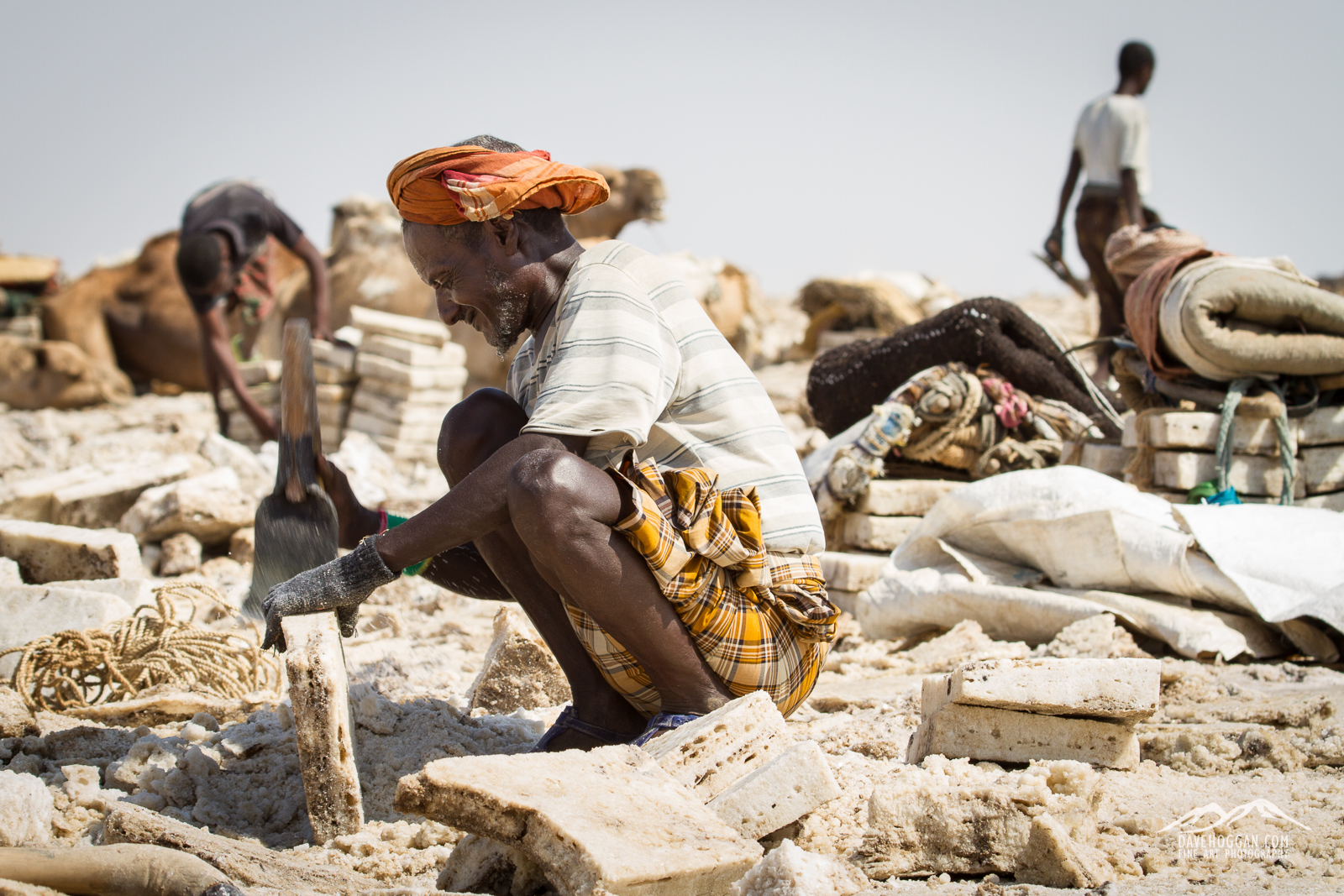
With little to protect them from the heat and salt the workers spend ten months a year crafting the salt blocks.
Whilst I believe that still photography has an impact that is usually – over time – more powerful than video, this is one of those times where video adds a lot.
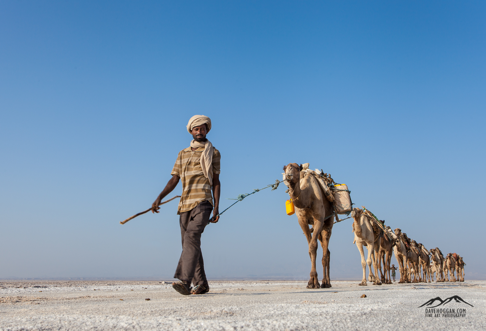
Despite being in the Danakil region of Ethiopia, an area that is home to the Afar people, most of the salt workers are Tigrayans from the highlands to the west who have come for the work. Whilst it was unclear how many Afar salt workers there are – if any – it was clear that they owned and operated the camel caravans with their costs (and profits) coming from the 400% mark-up between how much they pay and subsequently sell the blocks for.
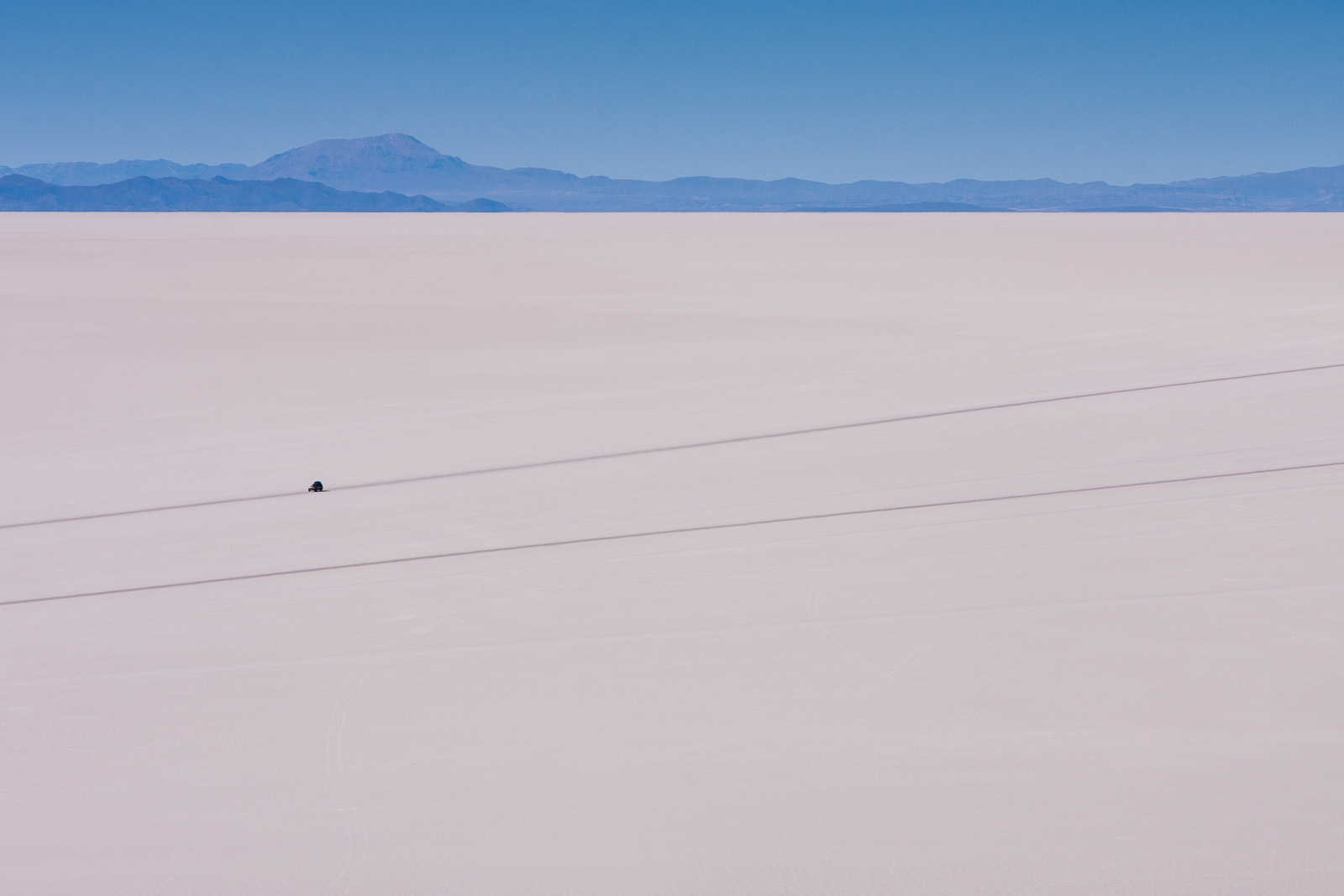
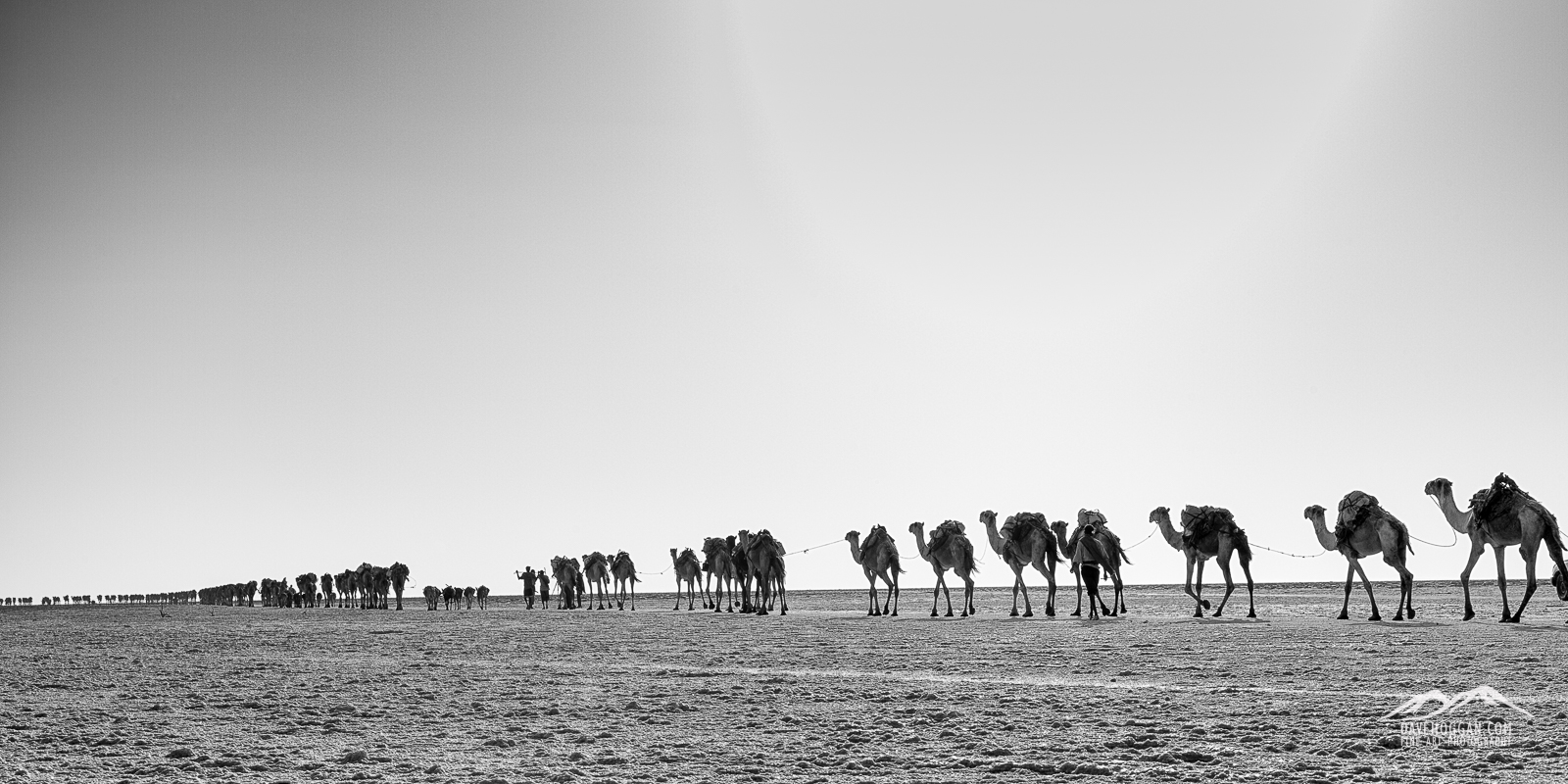
Once cut to size the salt blocks are tied into bundles and loaded on to camels for the two-day journey back to the town of Berhale stopping overnight at the village of Ahmed Ela.
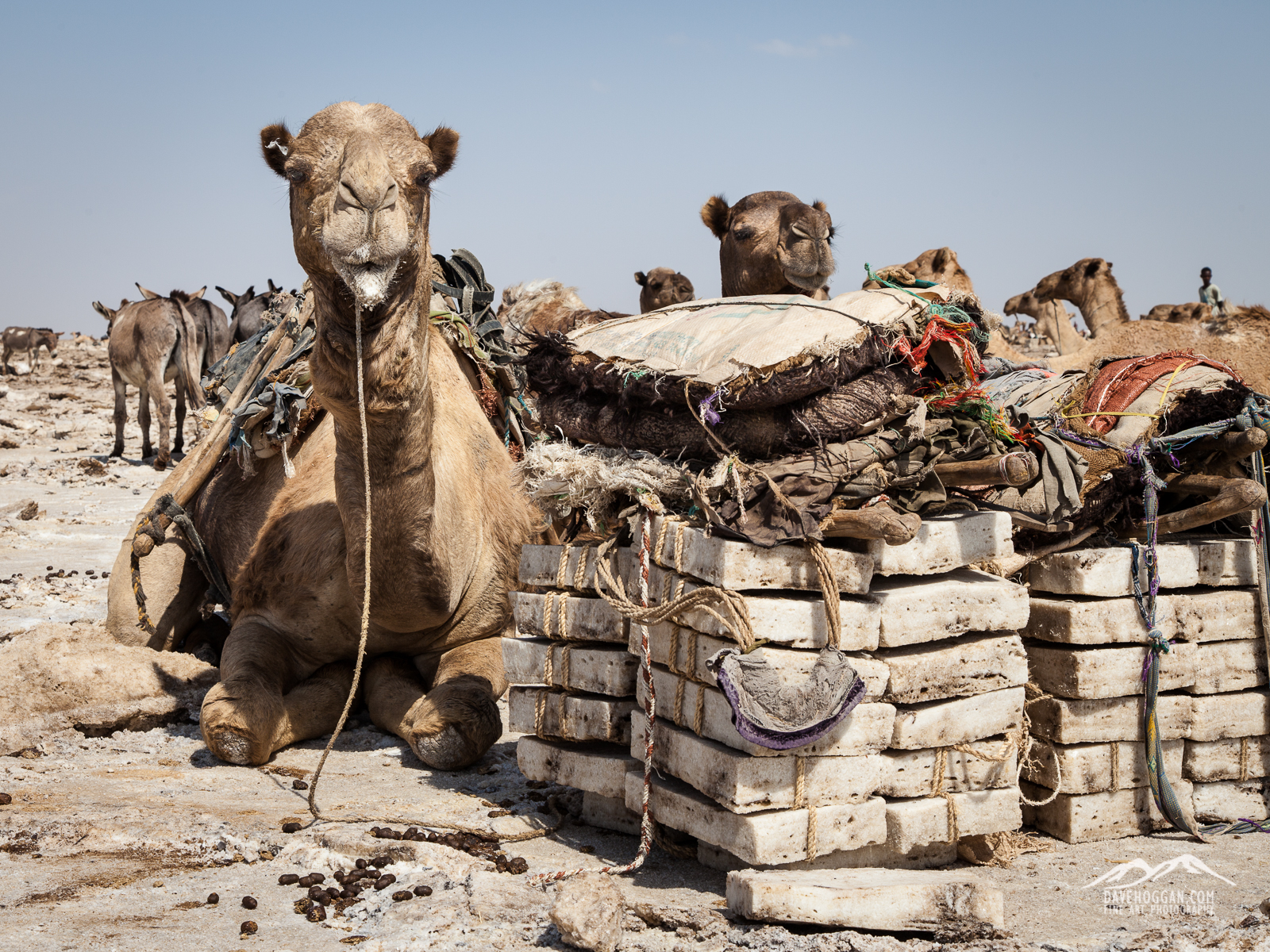
Camels have a well-earned rest whilst the salt blocks are cut, shaped and tied into bundles.
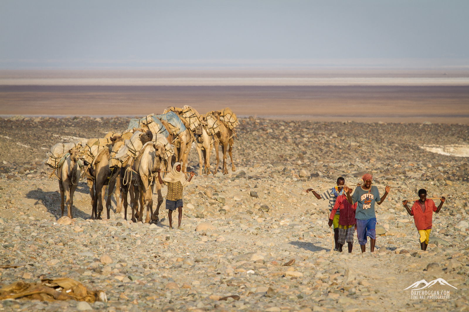
The camel train, now in much smaller groups, arrives at the village of Ahmed Ela for the evening.
Once at Berhale the salt gets loaded onto trucks for distribution across Ethiopia ending up in factories, restaurants, and local markets.
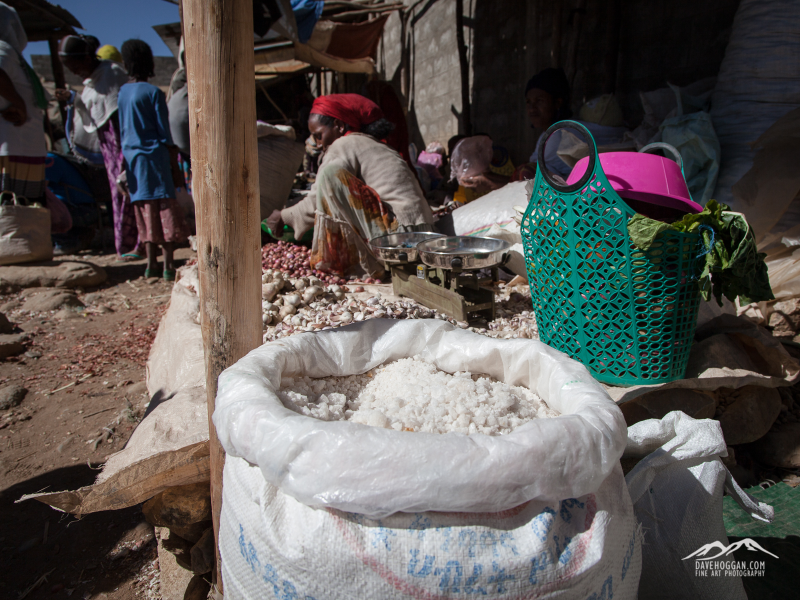
Salt blocks inevitably get broken along the way and these normally end up in markets.
Brown Gold: An Uncertain Future
Inevitable though it may be progress is threatening this centuries-old tradition and many of the Ethiopians I spoke to view the completion of a tarmac road – which by the end of 2014 had reached Ahmed Ela – with uneasy concern. It may seem an odd investment; roads are expensive things to construct and a camel-stop town seems an unlikely destination, and you can perhaps be forgiven for assuming an ulterior motive in its construction. And there is.
Being a geologically active area the area is exceptionally rich in minerals, especially potash which is an excellent fertiliser and one much in demand. Although potash is not scarce, its proximity to the surface in Danakil makes the region an extremely cost effective source – if you can get there. Attempts have been made in the past to mine these minerals on a commercial scale, such as the Canadian mine from the early twentieth century, but the inhospitable climate and remoteness made commercial mining uneconomic. But combine cash-rich foreign investors with an eye on long-term financial returns with modern automated machinery and mining on a large scale becomes possible, and profitable. All you need is the means to get there.
Whilst the road, which as of 2016 is apparently complete – is the first step toward the mining of mineral deposits such as potash- the salt flats are an easy target and many of those who depend upon the traditional process of salt mining (the Afar, the Tigrayan workers, the camel-stop towns and villages) see the dawn of mechanised mining as a clear and present danger. It would be the end of a centuries-old way-of-life and put many people out of work in an area where work is hard to come by.
It would also destroy one of the few remaining wildernesses left on the planet. If that seems melodramatic, here’s a fact for you: Three mining companies have already been granted licenses to mine potash in the Danakil area and one company alone – Yaro International – is gearing up to mine 600,000 tonnes. Per year. Now imagine what that will do to the landscape in the photograph below.
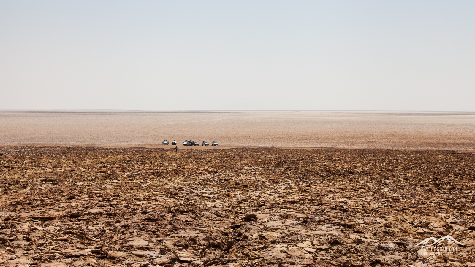
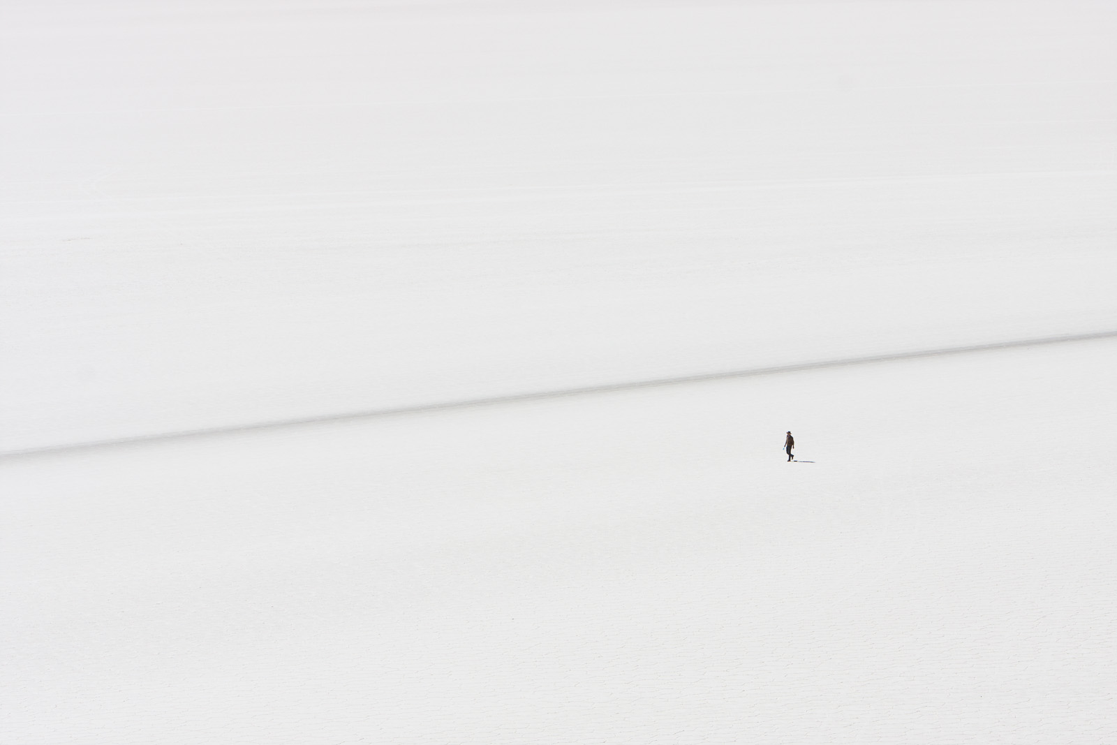
It may look a barren wilderness, but whilst I stood on the rise drinking my third litre of water that morning with the temperature edging close to 50°C and a French tourist collapsed due to heat exhaustion somewhere behind me, it was difficult to believe that a people had not only managed to survive here, but actually built a business that supported them and their families…
Hopefully the mining will be done with care and consideration for the surrounding environment, but here’s some more images of the region at the end of 2014. Just in case…
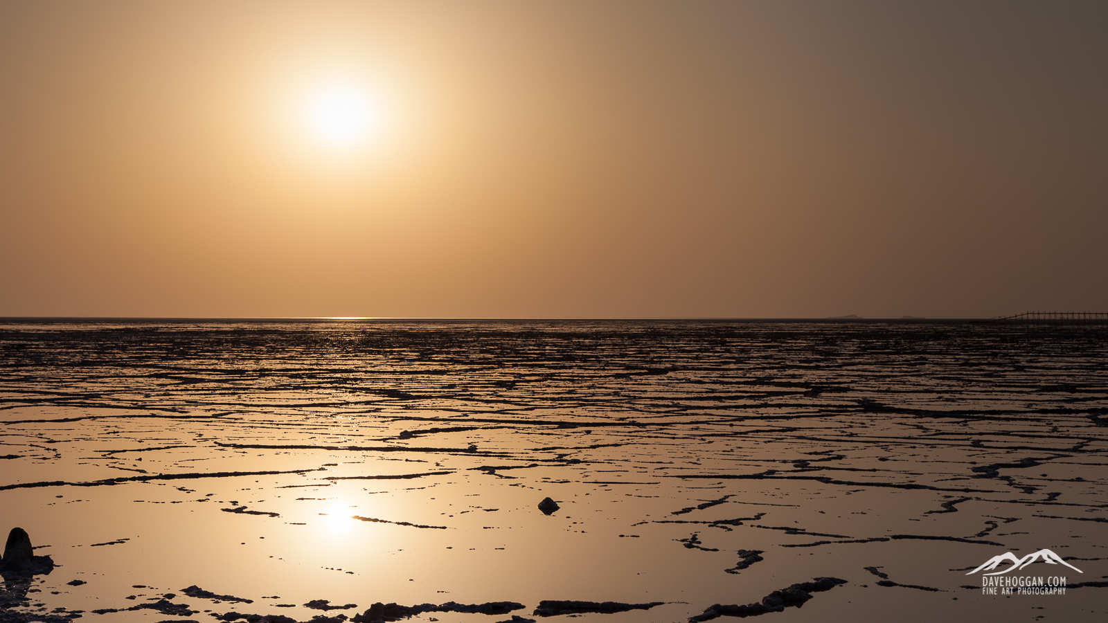
The morning sun slowly rises above the last remaining rainwater that washed down off the Tigray highlands. Deserts are not always dry…
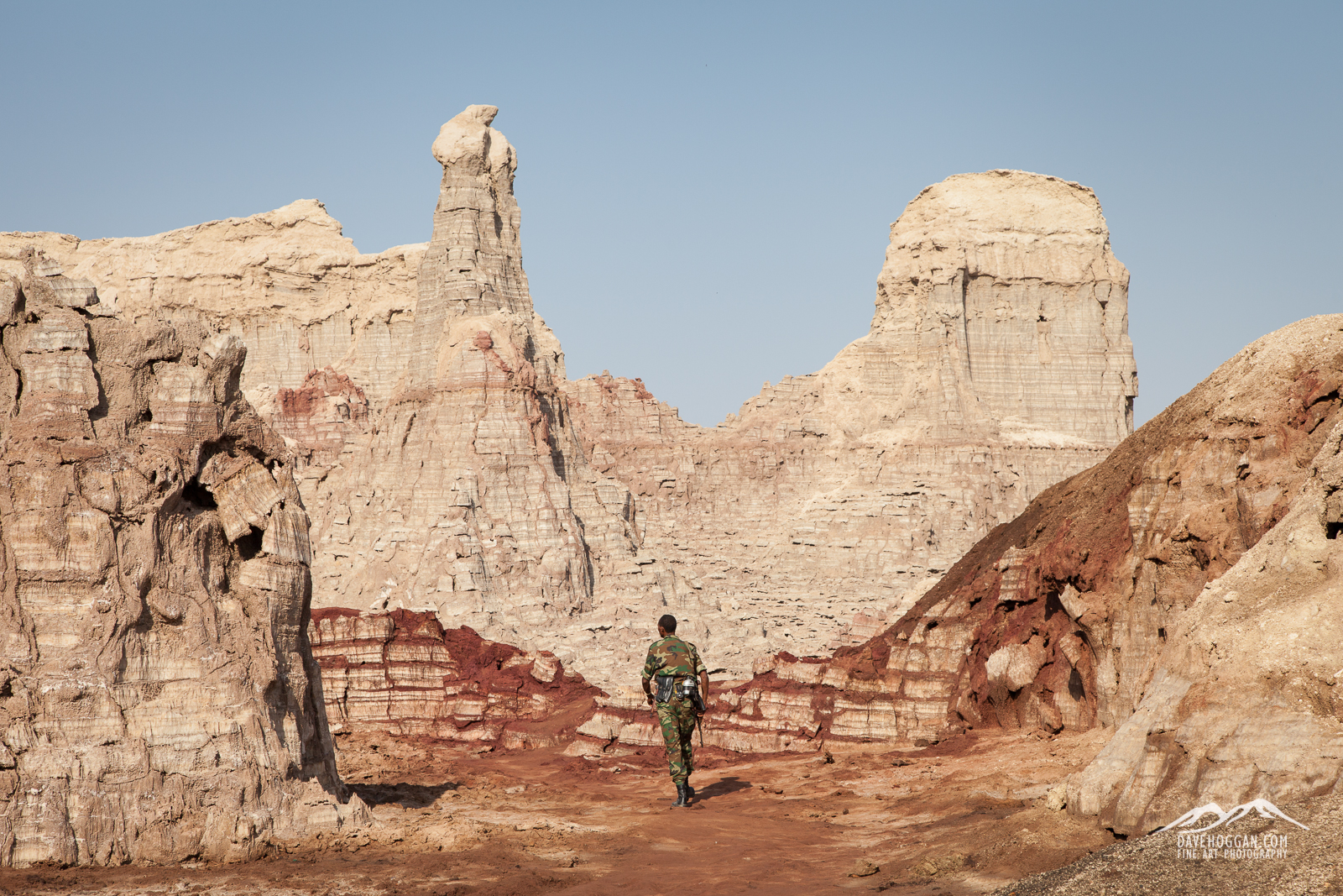
One of our military escort walks ahead to check the valley, unusual in that everything is made of salt. Years of erosion has crafted peaks and gullies.
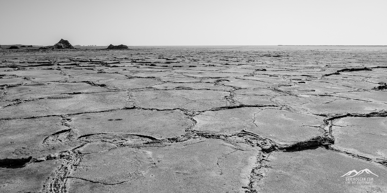
The rainwater seen above dissolves surface salt and as the sun’s heat evaporates the water the salt crystalises out again leaving an oddly geometric pattern.
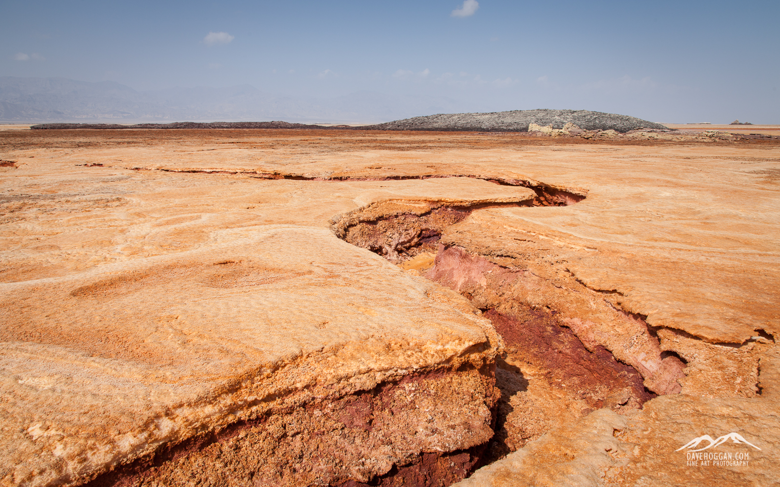
It may be approximately 100 million years until the horn of Africa becomes its own continent, but signs of tectonic activity are always visible in this geologically active area.
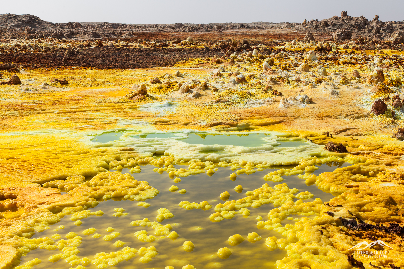
One of the most unique landscapes on the planet is – perhaps soon to be was – Dallol. The rich geologically active environment provides a wealth of minerals, here the yellow of sulphur. This is also its downfall; Danakil holds the World’s largest deposit of potash – an excellent fertiliser.
And perhaps my favourite image from Dallol…


![A lump of three million year-old coral - one among many just found lying around the landscape. [Click to enlarge!]](http://davehoggan.com/wp-content/uploads/2015/02/MG_2209.jpg)
![At the end of the two-day camel caravan is Berhale, a town whose growth is due to the traditional salt industry. Here the salt is loaded onto trucks for country-wide distribution. [Click to enlarge!]](http://davehoggan.com/wp-content/uploads/2015/02/MG_2232.jpg)
![Concrete and stone buildings replace the nomadic Afar's tent-like structures. [Click to enlarge!]](http://davehoggan.com/wp-content/uploads/2015/02/MG_2228.jpg)
![The iPhone 6 made taking panoramic shots so easy that I never used the panoramic head on my tripod. [Click to enlarge!]](http://davehoggan.com/wp-content/uploads/2015/02/IMG_0228.jpg)
![One of the oldest of the Tigray rock-hewn churches is Abrahat Atsebah. [Click to enlarge!]](http://davehoggan.com/wp-content/uploads/2015/02/MG_2343.jpg)
![A priest at the Wukro Cherkos rock church. [Click to enlarge!]](http://davehoggan.com/wp-content/uploads/2015/02/MG_1418.jpg)
![The signs of agriculture can be seen everywhere in Tigray. [Click to enlarge!]](http://davehoggan.com/wp-content/uploads/2015/02/MG_2309.jpg)
![It is hard not to take portraits when there are so many eager volunteers! [Click to enlarge!]](http://davehoggan.com/wp-content/uploads/2015/02/MG_2323.jpg)
![Waiting. And watching. [Click to enlarge!]](http://davehoggan.com/wp-content/uploads/2015/02/MG_1415.jpg)
![A stall at the Wukro market selling spices and, of course, salt. [Click to enlarge!]](http://davehoggan.com/wp-content/uploads/2015/02/MG_2381.jpg)
![The markings of an Orthodox Christain women. [Click to enlarge!]](http://davehoggan.com/wp-content/uploads/2015/02/MG_2380.jpg)

![Dawn approaches as we descend from Erta Ale. [Click to enlarge!]](http://davehoggan.com/wp-content/uploads/2015/02/MG_1593_cs.jpg)
![Camels are a critical part of the Afar way-of-life and so get treated with love and care. [Click to enlarge!]](http://davehoggan.com/wp-content/uploads/2015/02/MG_1610.jpg)
![The sun literally bakes the ground. [Click to enlarge!]](http://davehoggan.com/wp-content/uploads/2015/02/MG_1652.jpg)
![Ash, as far as the eye can see [Click to enlarge!]](http://davehoggan.com/wp-content/uploads/2015/02/MG_1675.jpg)
![Luxury is relative. After four days without a toilet the sanitary facilities at Hamed Ale were a step up. Toilet is on the left; bucket-shower on the right. [Click to enlarge!]](http://davehoggan.com/wp-content/uploads/2015/02/MG_2208.jpg)
![En route from the salt plains to Berhale [Click to enlarge!]](http://davehoggan.com/wp-content/uploads/2015/02/MG_1731.jpg)
![Our temporary home at Hamed Ale and a testament to the fact that travelling with the right people makes everything fun! [Click to enlarge!]](http://davehoggan.com/wp-content/uploads/2015/02/IMG_0224.jpg)
![Dallol was once described by National Geographic as being one of the most remote places on Earth. [Click to enlarge!]](http://davehoggan.com/wp-content/uploads/2015/02/MG_2018.jpg)
![A bizarre landscape that is sadly now but a shadow of what it once was. [Click to enlarge!]](http://davehoggan.com/wp-content/uploads/2015/02/MG_1987.jpg)
![This is what the stunning, other-worldly landscape of Dallol is becoming due to potash mining. [Click to enlarge!]](http://davehoggan.com/wp-content/uploads/2015/02/MG_2014.jpg)
![The area was once a riot of vivid yellows, green, blues and white. buy nearby potash mining has had a devastating effect. [Click to enlarge!]](http://davehoggan.com/wp-content/uploads/2015/02/IMG_0215.jpg)
![The daily camel train heading out to the salt flats to pick up their cargo of white gold. [Click to enlarge!]](http://davehoggan.com/wp-content/uploads/2015/02/MG_2036.jpg)
![Cliffs of salt dominate the landscape and provide some excellent landscape to work with. [Click to enlarge!]](http://davehoggan.com/wp-content/uploads/2015/02/MG_2090.jpg)
![More evidence of the destruction of a continent. This fault has only appeared in the last year and mirrors the 6500km fault that is pushing eastern Africa away from the rest of the continent. [Click to enlarge!]](http://davehoggan.com/wp-content/uploads/2015/02/MG_2108.jpg)
![Getting ready to load the camel for the two-day journey back to Berhale. [Click to enlarge!]](http://davehoggan.com/wp-content/uploads/2015/02/MG_2189.jpg)
![Descending from Erta Ale. [Click to enlarge!]](http://davehoggan.com/wp-content/uploads/2015/02/MG_1583.jpg)
![An Afar military guard watches the only road in to the area. [Click to enlarge!]](http://davehoggan.com/wp-content/uploads/2015/02/MG_1635.jpg)
![Life survives in even the harshest environment. [Click to enlarge!]](http://davehoggan.com/wp-content/uploads/2015/02/MG_1651.jpg)
![Dunes of volcanic ash [Click to enlarge!]](http://davehoggan.com/wp-content/uploads/2015/02/MG_1678.jpg)
![Years of use has produced a polished salt track across the land. [Click to enlarge!]](http://davehoggan.com/wp-content/uploads/2015/02/MG_1819.jpg)