Tag Archives: hiking

Ethiopia: The Danakil Depression

With the Iceland gallery in its final stages of preparation meaning that I no longer have to worry about it, it does free up some much needed time to plan the next trip: The Danakil Depression in Northern Ethiopia. And this trip really does represent my biggest challenge to date.

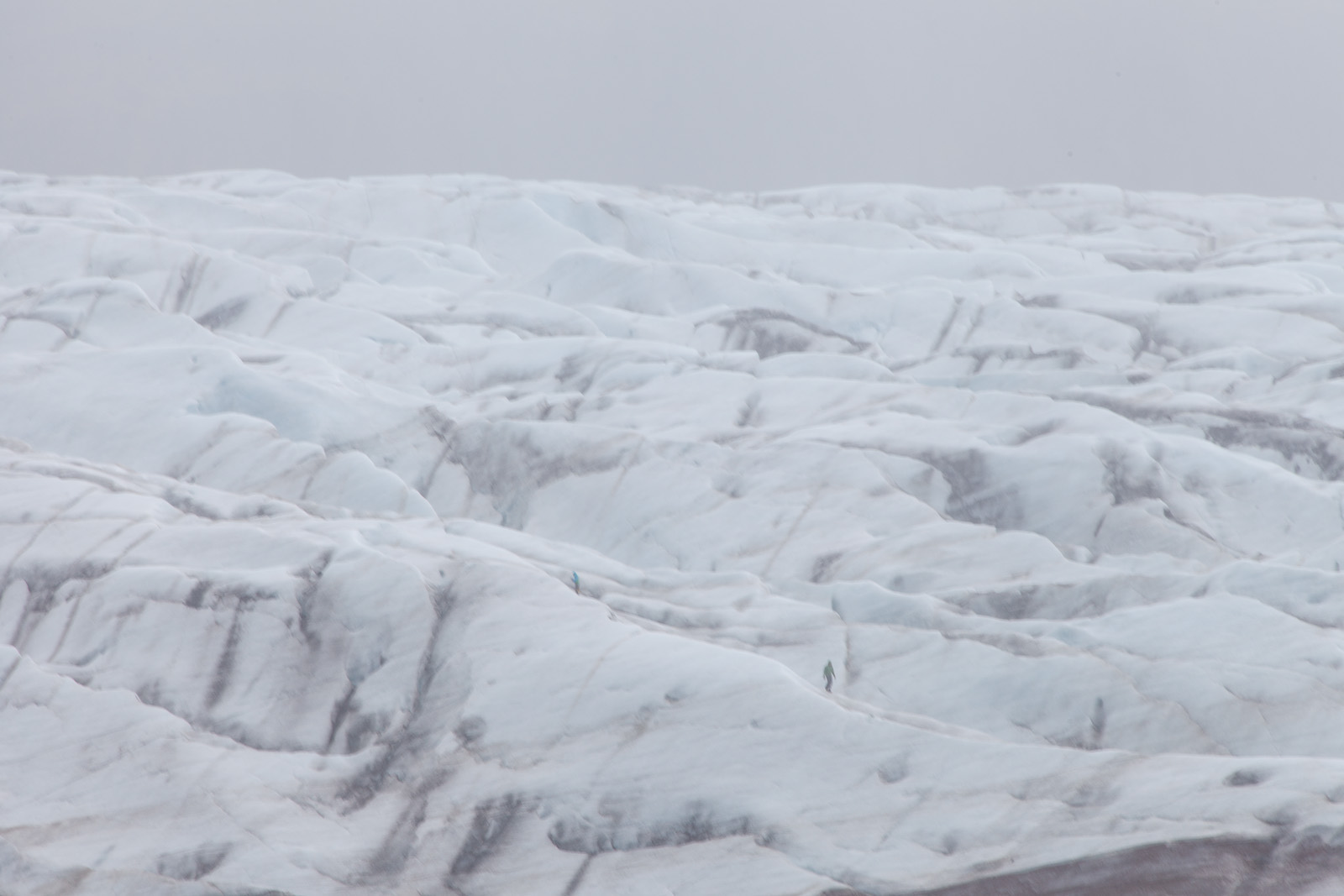
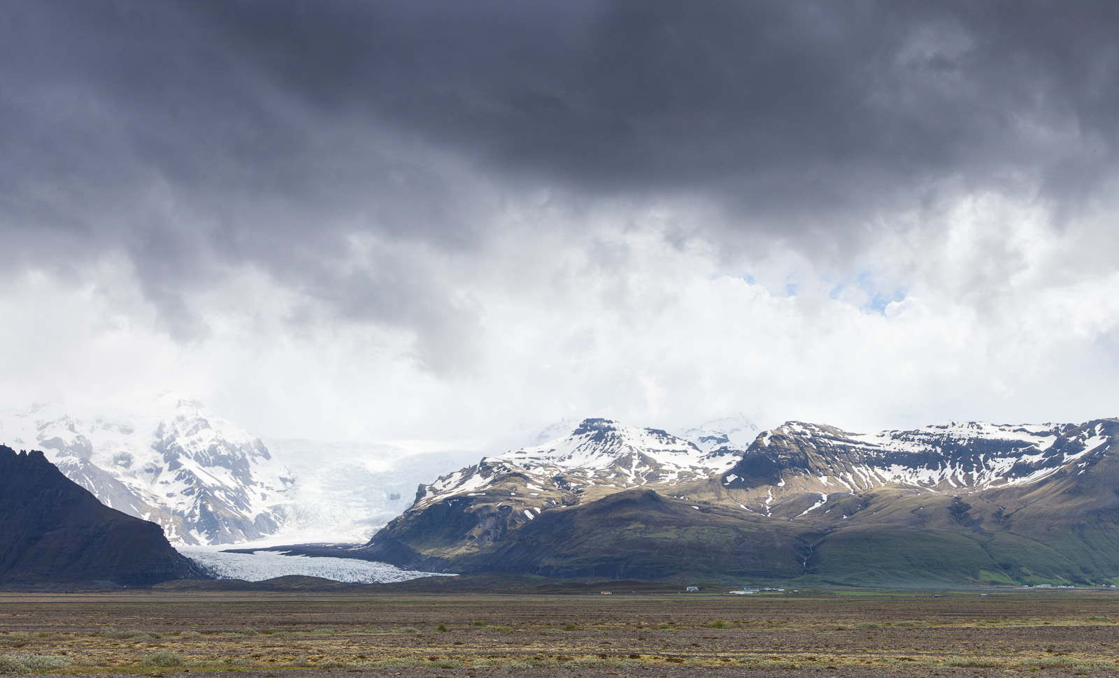
Looking at some of my recent trips (Iceland, Antarctica and the Bolivian Andes being examples in point) and you probably come to the conclusion that I’m a cold weather kind of guy. And I am. So the thought of spending time in a place whose average daily temperature – in Winter – doesn’t drift much below 40 °C doesn’t really make me want to rush and pack my suitcase. To be fair, I’ve survived 40 °C plus temperatures before, in Egypt, but that was insanely low humidity and I spent much of the midday hours under cover. In the Danakil Depression, the lowest point in Africa and the second lowest land point on the planet, the humidity is to put it mildly, horrific.


The Danakil Depression - Dalol on the map - isn't exactly recommended.

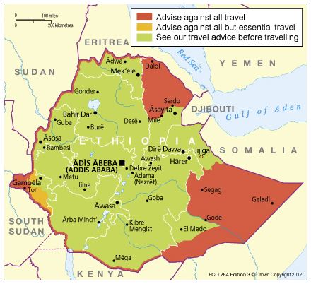
The Danakil Depression – Dalol on the map – isn’t exactly recommended.


The second aspect that would raise an element of concern for most is its location about eight kilometres from the border with Eritrea. A hotly disputed border. The Foreign & Commonwealth Office (or FCO) – the UK’s governmental department responsible for issues travel guidelines and assisting UK nationals around the World via regional embassies – is the go-to site when assessing the safety of travelling to various countries. The travel advice for Danakil is “Advise against all travel”. Digging a little deeper however and, aside from an unfortunate episode in 2012, there have been no real problems in the past few years. That said, however, without FCO approval, no normal travel insurance policy will cover you. So I’ve had to look into specialist insurance.  I don’t know if I should be comforted or concerned that they all include kidnap and torture cover.

The third issue is that the area is the home to the Afar tribe, a nomadic people who live off the land by mining salt from the region’s salt flats and transporting it back to civilisation via  camel train. My experience of African people (in Africa) is that they are a proud race but apparently the Afar take that pride up a few notches. So, I’ve got to read up on Afar (and tribal) societies, lest I do something that offends. Not that I’ll come to any harm, but it could well mark the end of my being allowed in what is their homeland.

But despite all of this it is the fourth point that, for many, would be the most problematic. The Danakil Depression is regarded as one of the most remote and inhospitable places on the planet. It is a barren, unending desert scrubland. There is no running water here, surface lakes being either extremely poisonous or highly acidic. There is no gas or electricity supply, no medical facilities, in fact there are, well, no facilities at all. Including toilets. If you are the least bit conscious about bodily functions then this is not the place for you. It is not so much you go and squat behind a bush – there are no bushes. No, when you need to go it is a case of grab the paper, walk two hundred metres out on the flat expanse and hope no-one heads your way. And, given that, you can safely assume that there are no washing or bathing facilities at all – a highlight of day eight on the expedition I’m taking is that we get to have a makeshift shower in a river.

So, why on earth would anyone want to put themselves through all of this?

The first reason is that the Danakil Depression hosts the second of five known lava lakes on the planet – the first being up a mountain in the Democratic Republic of the Congo and currently inaccessible after recent civil war. It may be deemed the second best, but it is the oldest lake and still hugely impressive.

The second is that the Danakil region itself hosts some of the most insanely coloured and textured landscapes ever. They look like they’re from another world, or a game designers imagination.

And, as a budding landscape photographer, what more could I ask?

Posted in Travel, Trip Planning Also tagged , , , , , |

Svínafellsjökull: Walking on Water

A long time ago I had a couple of bad experiences with organised trips, bad enough to tarnish the experience in fact. After the second I resolved that I would never go on an organised trip again. Never.

The problem is that, if you are interested in travel photography there are only two options: You rely on someone else to plan the trip or do it yourself and because my obstinance on the matter had precluded the former option I have had, over the years, to become quite adept at the latter. To be honest, I’ve even come to actually enjoy the process and wholeheartedly believe in the old axiom: If something is worth doing, do it yourself – or something along those lines…

But there are some things that you can’t, or shouldn’t, attempt alone.

Destinations such as Antarctica firmly fall into the can’t category. Just getting there is a challenge: The Drake Passage is not a body of water that you would want to cross in a fishing boat and nor would you want a fishing boat captain, and specialist vessels and specialist staff require specialist organisations.

As for the shouldn’t category, well, that’s a bigger list. However here’s one example from Iceland.

Of the three organised trips I booked in Iceland the first was a glacier walk on Vatnajökull, Europe’s largest glacier. Walking on glaciers is not only fun, but presents great photographic opportunities too. But walking on a glacier can also be dangerous – after all, you’re essentially walking on a gigantic skating rink, albeit one with man-eating crevasses, soft spots and, of course, gravity-affirming slopes. Walking out onto a glacier when you do not know what you are doing or are ill-equipped usually puts you one step closer to asking your maker – personally – as to why such wonders of nature exist in the first place.

There are several operators who offer glacier hiking but I went with Icelandic Mountain Guides, aka MountainGuides.is, for a couple of reasons. The first was the number of options they offered for glacier hiking. I was on a tight time schedule and having various options available meant that I could plan my limited time effectively whilst still getting the experience into my itinerary. I initially opted for the full-day hike, but ended up taking the half-day for the reasons discussed below. They also included all the safety kit – so I didn’t have to worry about last minute costs or hassle. Probably the thing that ‘sealed the deal’ however, was that they responded quickly to my emails – when I am planning something I want to get it organised quickly and out of the way. I want people to move at my speed.

It was only a few weeks after booking that I saw the BBC documentary “Julia Bradbury’s Icelandic Walk” and Icelandic Mountain Guides were the local guides involved. If they’re good enough for the BBC, they were good enough for me!

Even after paying my money, they were very responsive and, when they had to cancel the full-day trip I had booked as I was the only person, they gave me an option to have a full refund, move to the half-day trip (and refund the difference) or move to another day. They really could not have done much more.


_MG_7484

The day before the start of the season and operators are out checking safety conditions.


So what are the benefits of going on an organised glacier hike?

The first is, quite simply, safety. Certain activities carry a significantly higher risk of serious or fatal injury for those who are badly equipped and  glacier hiking is one of them. I only have to cast my mind back to last winter here in the UK when a bit of ice resulted in the endless news spots showing  people slipping and falling over.  Ice is nice, but there more of it there is, usually the more dangerous it can be. With an organised hike all the necessary safety equipment is provided and all you have to do is use it. Perhaps more importantly, there’s someone watching to make sure you use it properly. Of course, you could walk past a crevasse without using guide ropes and 99 times out of 100 you would be perfectly fine. But that one time out of 100 will really ruin your day.

Going with the experts has a number of benefits. Not falling into a crevasse being one.

Going with the experts has a number of benefits. Not falling into a crevasse being one.

The next benefit it is educational. Do you know what an ablation zone is? Do you know that the ice at the front of the Svínafellsjökull tongue moves at 1.5 metres per year whereas the ice at the rear moves at 50 metres per year? Do you know why? Do you know why crevasses form at different angles? I didn’t. But after a few hours with Árni, our guide, I did, along with a whole bunch of other interesting facts. At some point you’re going to be telling the folks at home about your trip and it is going to be so much more interesting to them if you can explain why the patterns in the ice are the way they are. Yes, you’ll learn that too.

300 year old art: Icelandic glaciers mix pure ice and volcanic ash to create some truly stunning abstract art. It is possible that the catalyst of the French Revolution is in this very photograph…

300 year old art: Icelandic glaciers mix pure ice and volcanic ash to create some truly stunning abstract art. It is possible that the catalyst of the French Revolution is in this very photograph…

The third is that you meet new people. That is always a reward.

So, maybe I am slowly recovering from my earlier experiences with tour operators and that my adamant refusal to consider them in the past is exactly that – in the past. As the saying goes, never say never…


Disclaimer: If this post sounds like a bit of an advert for Icelandic Mountain Guides, I guess it is. One of the problems I’ve always had in planning a trip is finding recommendations for excursion operators that are photographer-friendly. Whilst this trip is not a photographic hike – and I was the only photographer on this particular hike – two things make me recommend it. The first is that I felt like I had plenty of time for photography. Whilst I spent a lot of time shooting on the move, there were plenty of stops. The second is that I was pretty much allowed to move at my own pace – I frequently drifted behind the group to get them in the ‘sense of scale’ shots as well as look around at other things that caught my eye. Other than keeping a watchful eye on me, Árni let me drift behind and catch up as I needed. It was only as I approached something potentially dangerous that he intervened.

Some more shots from the hike…

From a distance you get a real sense of the scale of Vatnajökull - Svinafellsjokull is a relatively small glacial tongue.

From a distance you get a real sense of the scale of Vatnajökull – Svinafellsjokull is a relatively small glacial tongue.


At the foot of the glacial tongue. Up close the black rocks in front of us turned out to be ash-covered ice.

At the foot of the glacial tongue. Up close the black rocks in front of us turned out to be ash-covered ice.


Close to the mountainside friction causes the glacier to twist and buckle.

Close to the mountainside friction causes the glacier to twist and buckle.


Having an experienced guide like Arni meant that I could concentrate on photography safe in the knowledge that I wasn't going to kill myself.

Having an experienced guide like Árni meant that I could concentrate on photography safe in the knowledge that I wasn’t going to kill myself.


If you've never tried hiking on a glacier, you should add it to your list - it is great fun!

If you’ve never tried hiking on a glacier, you should add it to your list – it is great fun!

Posted in Destinations Also tagged , , , , |

Iceland. T minus 21.

Things have been quiet around here the past week or so mainly due to the fact that the majority of the core decisions were made some time ago, leaving me with worryingly little to do. That said, with 21 days to go, it is now time for the customary mad rush to get all the last-minute tasks completed.

That’s not to say I haven’t been continuing to plan the trip. In fact, after my last post about how much planning is required and how it can sometimes seem too much effort, it would appear that I have spent yet more hours on Google. And it has been worth it, but more of that later on.

Months ago I mentioned that Evernote plays a key role in any trip planning I undertake. The browser plug-in that allows you to copy all or part of a web page with a single click, combined with what is likely Windows 7 best feature – the snipping tool – means that I can quickly gather all manner of information for later use. But, as much of a geek that I am, I’ve never been too keen on relying on electronics when out in the field – simply because I am usually quite literally a field. So one of the remaining tasks is to distil all 84 Evernote clippings into a printable document. For me this apparent duplication of effort is usually fairly handy as the process forces me to consider how to group shooting locations, the logistics of getting between them and, if nothing more accurate, then at least a vague idea of the time required at each location. It also allows me to remove some of the more impractical ideas that ended up in Evernote as I get a better idea of the final itinerary.

The other tool I’m relying on now is the Reminder app on my phone, tablet and iCloud. Not because it is a particularly wonderful app, but it is always with me on one device or another and synchronises seamlessly. I’ve had an ‘Iceland 2014’ list for some time, but with three weeks to go it is now that it will really get a beating. Right now there are over a dozen outstanding tasks and more are being added as I think of them – usually in the oddest of places.

One of the larger outstanding decisions – and one that has come about from the continued research – is whether to take an entire day out of my time when based in Vik and go on an organised hike. Usually I would much prefer to go exploring by myself but I had this notion of going to see Eyjafjallajökull, simply known to the rest of the World as E-15* and the volcano that erupted in 2010 causing all the havoc. Like most places in Iceland, you could go yourself, but I’m tight on time and so having someone do all the planning seems like a good option. Google, unsurprisingly, came back with countless options but the quirky humour of the Eskimos Iceland website piqued my interest. A few emails later and the notion of getting to the top of E-15 has been replaced by a more general hike, but one that passes across E-15 and includes some other photogenic landscapes. Of course I have checked and there will be lava fields still warm from the eruption and the requisite steaming ground too. It sounds like a great way to see some hard-to-get-to landscapes. The fact that it is described as ‘challenging’ and ‘requiring the use of ropes and cables’ in some places only makes it more appealing.

The decision really is whether I can afford the time. I only five days based in Vik before heading east along the coast but I’m happy that that gives me a bit of slack just in case Iceland’s notoriously unpredictable weather decides to be playful. Taking a day of that to go hiking leaves me no time to reshoot locations should I need to.

Still, last minute rushing about aside, I’m really very excited!


*E-15  – E with an unpronounceable combination of 15 letters after it!

Posted in Travel, Trip Planning Also tagged , , |