It is a long weekend here in the UK but there’s no rest for the wicked and I’ve been working yesterday and today leaving just Monday for me to cram in all the usual household tasks and start wrapping up the preparation for the trip.
One of the monumental decisions is that I’m not going to be using satnav whilst driving around Iceland. That probably doesn’t seem like a life changing event, but given that I pretty much need satnav to get to the end of my street, the thought of driving across a foreign country for the first time without some reassuring “In two hundred yards turn left.” to guide me may likely end up in some kind of therapy being required.
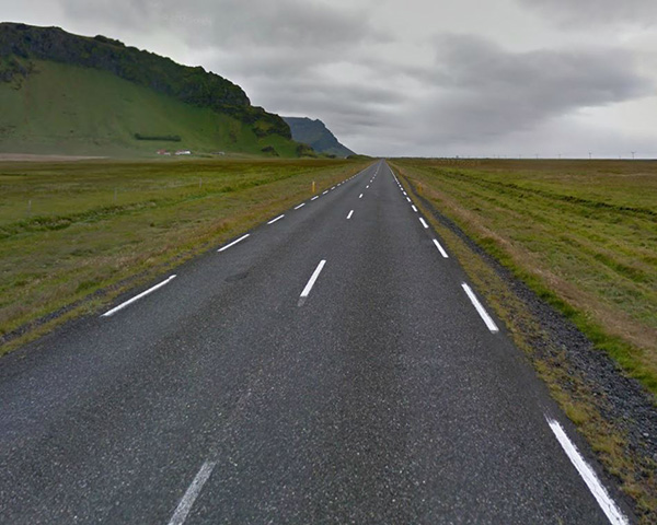
Route 1 is the main ‘getting from A to B’ road. As Google Maps shows it is easy to see why there is no Icelandic translation for ‘rush hour’.
That being said, other than Reykjavik itself, you would struggle to call Iceland’s road network complex. Look at a map and you would be forgiven for thinking that the map designer had decided to include a couple of major roads and not bother with the rest. But no, that is pretty much the road network. Other than the ovoid route 1 that roughly travels the coastline of the island, there are two types of road you’ll find. The first type is similar to route 1 – a tarmac two-lane road – that usually acts as a spur off route 1 whilst the second type are the highland, or ‘F’ roads which are essentially gravel, or compacted crushed rock. As most of us travelling to Iceland will be hiring a car the rule is simple: Unless you have a 4WD it is best to view F roads with caution. Not only will they not be forgiving on the suspension, most hire companies have a hefty penalty for paintwork chips – a risk greatly increased by the loose surface of F roads. Their uneven surface will require higher clearance too, even more so as crossing fords is a common event on these roads. Ever since I killed a BMW 3 series when attempting to pass through a ford here in the UK – and subsequently earned the title ‘U-boat commander’ – I have always been wary of driving through anything deeper than a puddle.
As my trip is confined to the southwestern corner of Iceland, and I’ve no plans to venture significantly inland into the highlands, I only have to concern myself with a dozen or so roads and, where I do have to travel on F roads, it’s really only before they become ‘interesting’. No, as much as I would like to think of this journey as being worthy of Ranulph Fiennes, The driving won’t exactly be something legends are made of.
Still, I know myself and I know my sense of direction. So I am somewhat comforted by the purchase of the Ferdakort 1:250,000 touring maps. I’ve long had a thing about maps (even briefly referring to my study as the ‘Map Room’) and the maps from Ferdakort are really very nice – certainly as good as OS maps here in the UK. But, what I particularly like is that the Ferdakort maps include a few nice touches for those travelling the country.
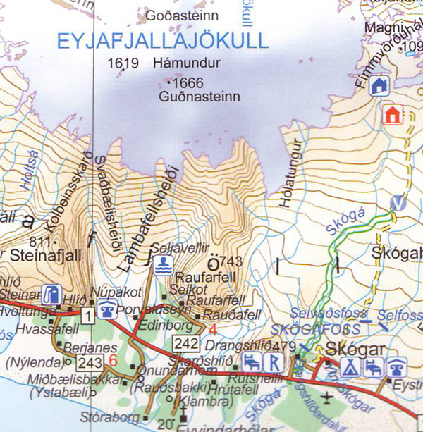
Ferdakort touring maps have some handy extras for visitors to Iceland – the location of petrol stations for one thing.
For a start they include the location of petrol stations which, in a country consisting of sporadic population centres separated by vast tracts of wilderness, is a pretty handy feature. And, as petrol stations usually have a convenience store as well, you also know where to stock up on food. They also include the locations of many hotels and guesthouses – again a nice feature when trying to work out how to get to your accommodation. And F roads are clearly marked as broken lines and where crossing a ford will be required this is clearly shown with a nice big ‘V’.
So, my plan for tomorrow is to take all the points of interest that I have marked on Google Maps and transcribe them on to my lovely Ferdakort maps as accurately as possible. Then I can plan the routes I’ll need to follow and approximate times, which may sound a bit like overkill but remember a lot of the shots will be time-of-day dependent to get the right mood so minimising mistakes in directions will be useful.
But maybe I should take my satnav anyway. Not to use, you understand, but just in case I need to hear a reassuring “Turn left” every so often…

